Devil's Stairsteps
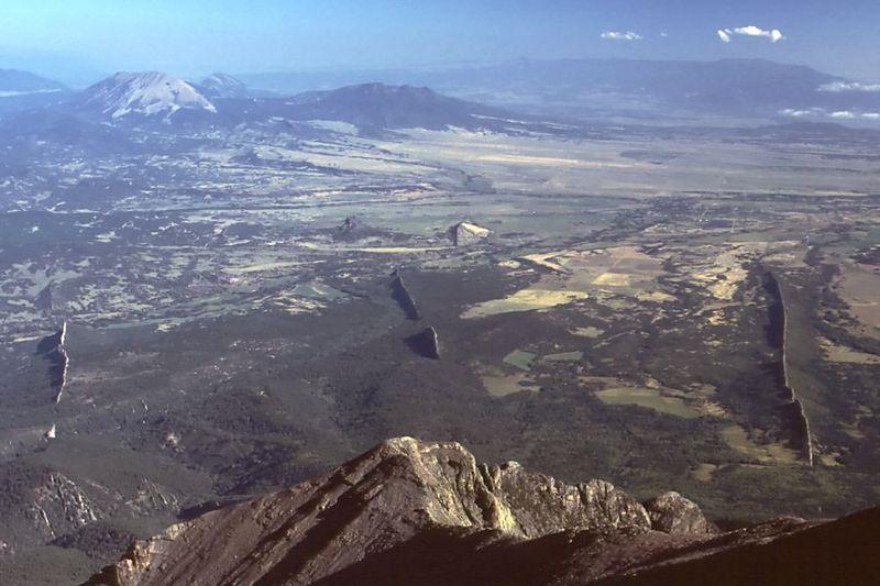
The radial dikes of the Spanish Peaks area are very famous. I remember seeing them in my Geology 101 textbook. They are one of the best examples of their type in the world.
 What are the radial dikes of the Spanish Peaks? I'm glad you asked.
Long ago, this area was buried under hundreds of meters of other rocks. During a period of volcanic activity, magma rose up under the area now occupied by the Spanish Peaks. The area domed up above the magma. Fractures formed in the rocks as a result of the stress. These fractures were filled with various kinds of magma, which slowly cooled and solidified.
The igneous rocks that fill the vertical cracks and joints are called dikes. Those that form horizontal layers are called sills. The smallish intrusions that form the cores of the Spanish Peaks are called stocks. The igneous rocks that make up the nearby buttes -- Gardner, Goemmer, and Huerfano -- are called volcanic plugs.
Over millions of years, the softer overlying rocks eroded away. The dikes are now visible since they do not erode as quickly as the surrounding rock. They form walls of igneous rocks that dramatically criss-cross the landscape.
One set of dikes radiates outward from the West Spanish Peak. Another set radiates from Silver Mountain. The third set, which is the oldest, are roughly parallel instead of radiating. They mostly trend east-west.
This earthcache will take you to one of the sets of dikes that emanate from the West Spanish Peak.
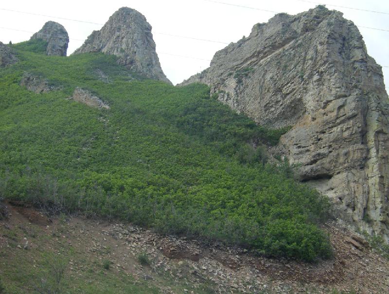
The dikes known as the Devil's Stairsteps are well-displayed where they cross Highway 12. There is an informative interpretive sign at the site.
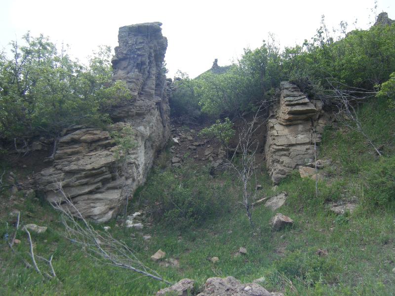 Interestingly, many of the ridges crossing Highway 12 here are not actually dikes. They are hardened parts of the sedimentary Cuchara Formation. The dikes themselves are formed of granodiorite porphyries, lamprophyres, and the like, which in this spot are fairly crumbly. It is estimated that they were emplaced at a very high temperature (1000-1100 C). The heat baked the surrounding sandstone, hardening it and subtly changing its texture and mineralogy. This is called contact metamorphism. This zone is more resistant to weathering than the dike or the surrounding unmetamorphosed sandstone.
Park at the pull-out. Read the sign and look across the road at the rocks.
To log this cache, please send the following in an e-mail. Also, please post a photo of yourself and/or your GPS with the dikes in the background.
1. According to the sign, how long ago were the dikes emplaced?
2. According to the sign, how much material has eroded away?
Optional:
3. How many ridges can you count? Can you see the difference between the hardened sandstone and the crumbly and/or crystal-rich dikes?