
Come on a journey to remember and commemorate
the history and travels of Captain John
Smith!
Over four
hundred years ago, Englishman John Smith and a small crew set out
in an open boat to explore the Chesapeake Bay. Between 1607 and
1609 Smith mapped and documented nearly 3,000 miles of the Bay and
its rivers. Along the way he visited many thriving American Indians
communities and gathered information about this “fruitful and
delightsome land.” In December 2006 the U.S. Congress
designated the routes of Smith’s explorations of the
Chesapeake as a national historic trail—the first national
water trail.
Are you ready to follow in the wake of Captain John Smith? Visit
sites along the National Historic Trail and learn about the native
cultures and the natural environment of the 17th-century Chesapeake
through the Captain John Smith Chesapeake Geotrail. The Trail
provides opportunities for you to experience the Bay through the
routes and places associated with Smith’s explorations.
Caches will be located in museums, refuges, parks, and towns in
Virginia, Maryland and Delaware along the rivers and creeks that
Smith and his crew explored four centuries
ago.
The Captain
John Smith (CJS) Geotrail launched June 4, 2011 with over 40 caches
within Maryland, Virginia and Delaware. A trackable geo coin will
be awarded to the first 400 geocachers, while supplies last, for
locating at least 15 CJS caches. To be eligible for the coin,
geocachers must download a passport from either the CJS Geotrail or Maryland Geocaching Society website.
Geocachers must find and log at least 15 finds, record the code
word from each cache on their passport and post a picture of
themselve at each cache location. After discovering the 15 required
caches, geocachers may have thier passports validated in person or
via mail at the National Park Service, Chesapeake Bay Office
located at 410 Severn Ave, Suite 314, Annapolis, MD 21403. Please
refer to the passport for complete validation instructions.
Participating in the CJS geotrail is fun and we
hope that many people join in. However, it is not a requirement for
logging your find on this cache once you find the container.
You are seeking a traditional hide. The final is a Lock & Lock
stocked with a variety of items. The hike to this cache is about
0.5 mile on level terrain.

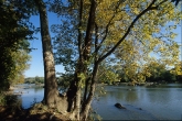
Take a hike, have a picnic, go fishing, rent a jon boat or a kayak
. . . whatever your preference, Riverbend Park offers a serene
Potomac River environment for your pleasure. Hiking trails at
Riverbend Park range from an easy quarter-mile stroll to a 5-mile
stretch that connects to the Potomac Heritage Trail and offers
beautiful views of the river. Several trails, up to 2.5 miles in
length, travel by the river, ponds and upland forest, with
exceptional birding opportunities. One of the most popular routes
runs from the Riverbend Visitors Center to the Great Falls National
Park, located 1.75 miles downstream. A network of small, off-shore
islands is accessible by boat and kayak, available for rent at the
park. The river is calm downriver of the boat ramp, with mild
whitewater upriver.
Trails and picnic grounds are open 7 a.m. to dusk. The Visitors
Center-exhibits, gift shop and snack bar-is open 9 a.m. to 5 p.m.
weekdays and noon to 5 p.m. weekends. December through February,
the hours are 11 a.m. to 4 p.m. daily.
Riverbend Park is part of the renowned Potomac Gorge, a 15-mile
corridor known for its globally significant plant communities and
the diverse wildlife species that are drawn to them. Poised just
above the dramatic and impassable waters of Great Falls, the area
was once a bountiful resource and an important gateway between
coastal and inland American Indian communities. Their earliest
presence at Riverbend dates to at least 12,000 years ago. Because
Riverbend stands on a flood plain, permanent settlements were
unlikely. However, the land probably drew Northern Virginia tribes
like the Nacotchtank and Tauxenent or Dogue, who may have traded
and hunted in the area, gathered stone for tool-making, and
eventually set up camps or farmsteads.
In June and July 1608, Captain John Smith and his crew spent four
weeks on the Potomac River, disembarking many times on the north
and south banks. At Pamacocack, Moyaons, and Nacotchtank, Smith
stopped to be feasted and entertained in these leaders’
towns. His journal has few details about his time on the Potomac
but we do know that he had heard about a special mineral the
Indians used and was determined to find it. After leaving
Nacotchtank on the Maryland side of the Potomac, the crew made
their way a little farther upriver to present day Riverbend Park,
the “Little Falls” where the presence of rocks of
“divers tinctures” gave them hope that there may indeed
be precious metals to be had.
 Thanks to FlyingMoose for helping with
this hide and to the Maryland Geocaching Society for assisting with
this
project!