

Come on a journey to remember and commemorate the history and
travels of Captain John
Smith!
Over four hundred years ago, Englishman John Smith
and a small crew set out in an open boat to explore the Chesapeake
Bay. Between 1607 and 1609 Smith mapped and documented nearly 3,000
miles of the Bay and its rivers. Along the way he visited many
thriving American Indians communities and gathered information
about this “fruitful and delightsome land.” In December
2006 the U.S. Congress designated the routes of Smith’s
explorations of the Chesapeake as a national historic
trail—the first national water
trail.
Are you ready to follow in the wake of Captain John
Smith? Visit sites along the National Historic Trail and learn
about the native cultures and the natural environment of the
17th-century Chesapeake through the Captain John Smith Chesapeake
Geotrail. The Trail provides opportunities for you to experience
the Bay through the routes and places associated with Smith’s
explorations. Caches will be located in museums, refuges, parks,
and towns in Virginia, Maryland and Delaware along the rivers and
creeks that Smith and his crew explored four centuries
ago.
The Captain John Smith (CJS) Geotrail launched June 4, 2011 with
over 40 caches within Maryland, Virginia and Delaware. A trackable
geo coin will be awarded to the first 400 geocachers, while
supplies last, for locating at least 15 CJS caches. To be eligible
for the coin, geocachers must download a passport from either the
CJS Geotrail or Maryland Geocaching Society website.
Geocachers must find and log at least 15 finds, record the code
word from each cache on their passport and post a picture of
themselve at each cache location. After discovering the 15 required
caches, geocachers may have thier passports validated in person or
via mail at the National Park Service, Chesapeake Bay Office
located at 410 Severn Ave, Suite 314, Annapolis, MD 21403. Please
refer to the passport for complete validation instructions.
Participating in the CJS geotrail is fun and we hope that many
people join in. However, it is not a requirement for logging your
find on this cache once you find the container.
You are seeking a traditional hide, located off of the Neck Field
trail. This facility is open dawn to dusk. Please no night caching.
There is a fee of $2.00 weekdays and $3.00 weekends. Please refer
to the facility website for updated information at
www.dcr.virginia.gov/state_parks/bel.shtml
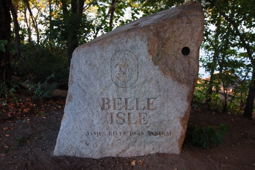
Situated off of the Rappahannock River, Belle Isle State Park
features a variety of activities including boating, canoeing,
hiking, fishing, camping, and picnicking. Throughout the 733-acre
park there are tidal and non-tidal wetlands, marshes and forests.
This diversity in environment supports the wide array of flora and
fauna that sustained the native peoples of the region, and which
visitors can still enjoy today. The many habitats found in the park
provide homes to predator birds, such as blue herons, osprey,
hawks, and bald eagles. White-tailed deer, turkeys, groundhogs,
rabbits, squirrels, moles, reptiles, and amphibians are common too.
Also on park grounds are the the Bel Air Mansion and Guest House.
These structures sit on the site of the Belle Isle plantation that
operated in the 19th century. Visitors can reserve the mansion for
weddings and other functions.
Captain John Smith and his crew would have landed or passed by this
area in mid- to late August 1608, as part of their second
exploratory voyage around the Bay and its rivers. During the first
voyage earlier that summer, the men landed at Stingray point, near
present-day Deltaville at the mouth of the Rappahannock. However,
shortly thereafter, a stingray stung Smith on the wrist, injuring
him so grievously that he feared for his life. Ultimately, Smith
recovered, but the encounter with the stingray [hence the name,
Stingray Point] forced the boat’s return to Jamestown, ending
its explorations – for the time being.
Just a few days after his return to Jamestown on July 21, 1608,
Smith set out again, departing on July 24. After a little under a
month of sailing, the crew arrived back at the mouth of the
Rappahannock on August 14, 1608, ready to explore [in Smith’s
words] an “excellent, pleasant, well inhabited fertile and a
goodly navigable river.” On August 15-16, Smith and his man
spent a few days in and around present-day Belle Isle State Park.
He arrived at Moraughtacund Village, and was treated with great
hospitality by the Werowance or local chief. According to
Smith’s writings, he would return to this same location later
in August, to negotiate a peace with the Rappahannock
tribe.

Thanks to ScoopitUp for helping with this hide and to the
Maryland Geocaching Society for assisting with this
project!