
Springtime is welcome; it has
been a long winter and a heavier than normal blanket of snow will
finally be thrown off and green will return to the land. Just a
trickle, as the spring sun beats down on a crusty topped drift of
snow. Following the land, always downward, the trickles join with
others to form streams. Streams gather into creeks and continue the
downward flow, rising with the influx of the snow melt, rising
faster as creeks feed into tributary rivers.
The ever increasing flow of water quickly fills the air
pocket below the ceiling of ice and with nowhere else to go but up,
heaving apart the covering ice sheet and pushing the now floating
pieces along, as the water rages down its channel. At a bend in the
river, sheets of ice too massive to make the turn begin to pile up,
wedging themselves together and growing in mass until it is solid
enough to block a portion, or all, of the flow. The river
rises above its banks and spreads out along the floodplain. In the
channel, the relentless flow against the ice jam bursts through a
weak spot and a great wall of water advances downstream washing
away everything in its path and inundating low lying
spots.
Spring is a time of both warmth and cool as sun warmed winds
flow over what is left of the winter’s snow and ice. This
causes turbulence in the air and massive thunderclouds form, full
of moisture. Torrential rains fall onto the land and not being
absorbed by soil that is already waterlogged from snow melt, it
also flows downwards, gathering into the streams and creeks and
tributaries, sometimes causing them to rise so fast that a wall of
water can be seen as it rushes on its journey to join other swollen
tributaries that drain into the Missouri River.
In 1907 writer G. Fitch described the Missouri
River as a river:
"that goes
traveling sidewise, that interferes in politics, rearranges
geography, and dabbles in real estate. It cuts corners, runs around
at night, lunches on levees, and swallows islands and small
villages for dessert."
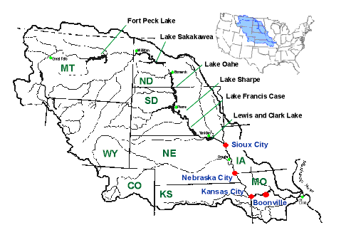 |
The Missouri River drains a
vast watershed that encompasses nearly 1/6 of the continental U.S.
It has been, historically, a shallow river with an ever changing
channel that left its banks frequently to spill out onto the
surrounding floodplain. While humorous, G. Fitch paints an accurate
picture of the historical Missouri. But it is within mankind's
power to reshape the world around them, if there is enough
incentive. |
 |
The Great
Flood
1952
“It started
with snow pack melting under an early spring sun. Raging mountain
streams swollen with snow pack runoff, flowed through tributaries
and into the (Madison), Gallatin and Jefferson Rivers. These three
historical rivers merge at Three Forks, Montana to form the
headwaters of the Missouri River. The Montana snows were deep and
melted quickly. Above normal Spring temperatures promoted massive
snow melt conditions. Runoff washed down through tributaries and on
into the Missouri River. The quickly rising river flooded Pierre,
S.D., ripped through the stockyards at Sioux City, Iowa, and later
blew the lids off sewer manholes in Omaha - The 'Great Flood' was
on its way. There were places where the Missouri River now spread
out 15 miles wide…and all of that water was heading south to
Omaha, Nebraska and Council Bluffs, Iowa.”
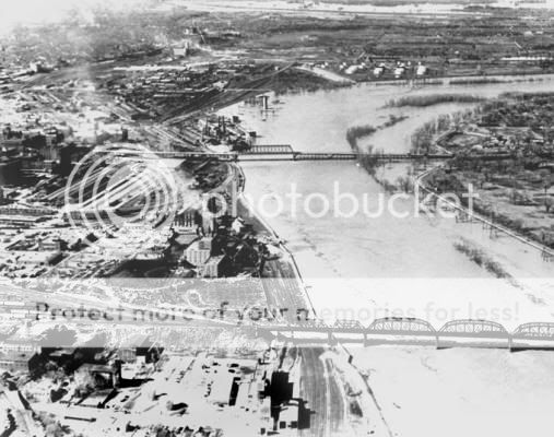 |
"The Missouri River crested in Omaha at 30.25
feet...the highest level in the city's history, and a record never
broken thus far."
"When the flood waters finally had gone back down
the "Muddy Mo" left hundreds of thousands of pounds of sand and
silt on the land."
Although flood mitigation efforts along the Missouri had begun
prior to The Great Flood, efforts were stepped up after
that.
"A federal plan for a massive Missouri River flood control system
collected dust for eight years before the disaster of '52.
President Harry Truman saw the damage to Nebraska, Iowa and his
home state of Missouri...and he got mad. The Garrison Dam and Fort
Randall Dams were completed two years later, Gavin's Point in 1956.
Oahe, in '62, Big Bend a year later."
|
These dams helped to control rising waters by
providing a large reservoir to hold the snow melt and rainfall,
which could later be released in a controlled manner. The rest of
the river, below the dams, would be channelized. Levees to confine
the flow of the river would be built, along with wing dikes to
control bank erosion and reduce meandering. Some of the existing
meandering loops in the river were cut off, straightening the
channel in those areas and leaving oxbow lakes behind. Desoto Bend
was created in this manner. In all, 72 miles of the river had been
cut off by channeling. Dredges would also be used to establish a
navigable main channel.
 |
 |
The Capt. Meriwether Lewis, a dust pan dredge, was
used on this section of the river before being retired and
subsequently turned into the Museum of Missouri River History in
Brownsville Ne. The ship’s final dredging assignment was the
creation of the Florence Boat Bay, which can be seen from the
Mormon Bridge.
“The dikes, revetments, and levees
constructed by the Corps of Engineers as part of the Missouri River
Navigation and Flood Control Project have transformed the once
sprawling and constantly changing river into a narrower, deeper,
fixed channel designed to more easily maintain the 735-mile (1,183
km) navigation channel. The river carries a large amount of silt
and sand, but high water velocity in the navigation channel
normally prevents settling out and sand bar accumulations. As a
result, unlike the Mississippi River, the Missouri River rarely
requires dredging to maintain the navigation channel.
“
The Army Corps of Engineers inspect, maintain and control
these various systems in place along the Missouri River, managing
reservoir levels, navigational needs and environmental concerns.
The Corps follow a Master Water Control Manual that gives the basic
guidelines on how to operate the Missouri River reservoirs to meet
the authorized purposes. An annual operating plan is also created
that considers current water conditions, such as how much water is
in storage and what is expected as runoff.
All of this engineering and
planning does not prevent floods entirely on the Missouri River.
1993 saw major flooding in the U.S. including the Missouri
watershed. High amounts of snowfall runoff and torrential rain over
large sections of the watershed (as much as 20 inches in some
areas) simply overwhelmed the systems, although the six reservoirs
on the upper Missouri helped prevent much more extensive flooding.
In 1997, the largest snow melt runoff in the 106 years records have
been kept by the Corps, there was no flooding because the water was
captured in these reservoirs. It has been estimated that those six
reservoirs have prevented more than $25 billion in damage from
flooding over the years.
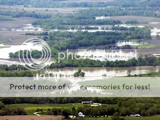
In 2010, areas of the N. P. Dodge Park on the
banks of the Missouri were inundated several times due to
combinations of large amounts of rainfall and increased releases
from the dams to prevent their overflow as capacity was reached.
Damage was extensive, causing the closing of the boat marina for
part of the season and the campgrounds and playgrounds for all of
the season. In addition to cleanup of sand and silts deposited by
the floods, rock riprap to control erosion along the bank was
washed away and will need to be replaced. Many trees have been or
will be lost due to several months of standing water drowning the
root systems.
To log this EarthCache you will be required to
make some observations and answer the following questions in an
email to the EarthCache developer.
These first 2 questions can
be answered from the walking path along John J. Pershing Drive or
from the road as you drive by, do not cross the fence as those
areas are restricted
access.
1. What is the name on the closest building
visible from N. 41° 21.118, W. 095° 57.676
Ques1
2. What organization operates the closest building
visible from N. 41° 21.152, W. 095° 57.680
Ques2
The following requirements
will take place in N. P. Dodge
Park.
3. The 2010 high water level at the gas dock
(N. 41° 21.388, W. 095.079 Final) was roughly 30
inches above the paved surface. Estimate the difference between
that high level and the current level of the river. Also ,
photograph one of the mooring posts at the gas dock. showing both
the water's surface and a complete post as in this sample
photo and post with your log.
|
These photos will give a unique record of
the water level and will help track that through the various
seasons on the river.
This is a required photo. If there are
extenuating circumstances preventing the posting of this photo,
please contact the EarthCache developer prior to
logging.
|
 |
4. Look around the park; do you
see any evidence of recent flooding?
You may or may not see any as time goes by. Describe any evidence
you do find.
You may also post a photo of any flood damage you
find.
Illinois Business Journal,
“River users object to Missouri River flow levels,”
http://www.ibjonline.com/print_reducing_river_flow_levels.html
Wikipedia contributors, "Missouri River," Wikipedia, The Free
Encyclopedia, http://en.wikipedia.org/w/index.php?title=Missouri_River&oldid=377865933
(accessed September 5, 2010).
OmahaRiverFront.com - MISSOURI RIVER HISTORY and FACTS, Published
June 13, 2002
by Randy Neuman http://www.omahariverfront.com/resources/river_floods/mizzrvr_floods.htm
“Flood of the Century,Remembering the Great Midwest Flood of
1993,” By Gloria Bucco, http://www.dnr.state.ne.us/floodplain/PDF_Files/FloodUpdateStory_Rev3.pdf
Archives Record Dredge Lewis, http://www.nebraskahistory.org/lib-arch/research/public/state_finding_aids/dredge_lewis.pdf