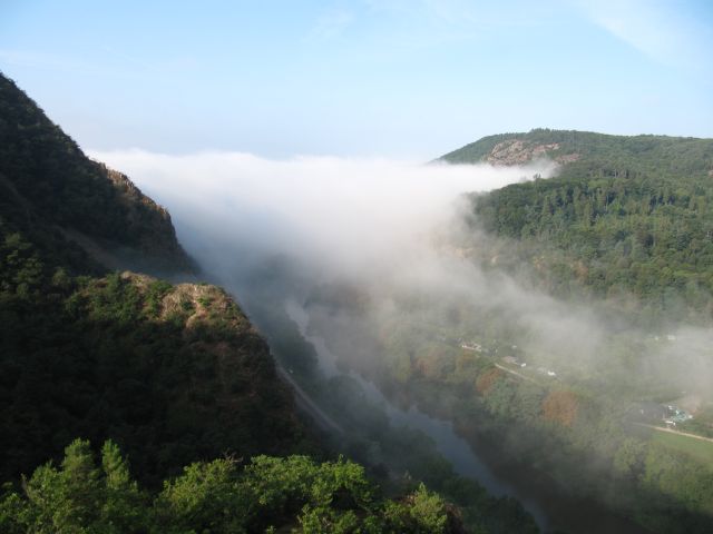
Entstehung des Nahetals in der Eiszeit
Im Tertiär (vor ca. 70 Millionen Jahren) lag dieses Gebiet
wesentlich tiefer, nur die höchsten Kuppen der
Rheingrafenhochfläche ragten als Inseln aus dem Meer, wie
abgelagerte Meersande beweisen. Die Nahe floß über den
Porphyrblock im Untergrund, wie Naheschotter auf dem Rotenfelsplateau
bezeugt.In der Eiszeit, die vor ca. 1 Million jahren begann, hob sich das
Nahe-Hunsrückgebiet durch die mehrfachen Vereisungen
Norddeutschlands in 4 perioden, Höhe ca. 200 m. Höhen heute:
Rotenfels 326 m, Gans 321 m, Nahespiegel im Salinental ABC m. Die
Nahe sägte sich mit dem transportierten Geröll in den Fels während
dieser Hebungen ein, in ca. 1 Million Jahren 200 m – 1/5 mm
pro Jahr. Durch die Härte des Gesteins entstand nur ein schmales
Tal, während im weicheren Gestein unterhalb der Bad Kreuznacher
Talkessel entstand.
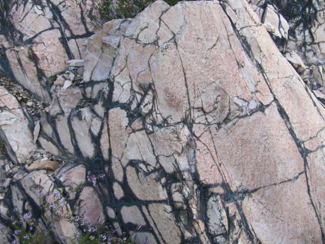
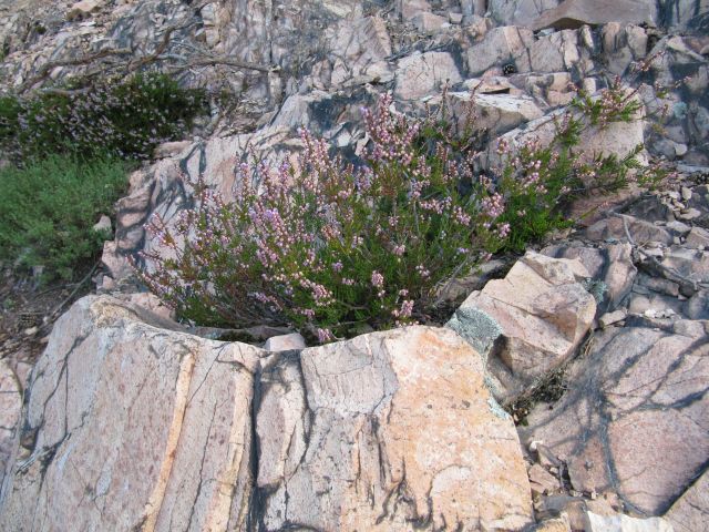
DEFGHIJ: es ist ein vulkanisches Gestein welches vor ca. 200
Millionen Jahren im mittleren Rotliegenden nach oben gepreßt wurde.
Da es, von leichten Erdschichten abgedeckt, langsam erkaltete,
konnten sich mineralische Bestandteile auskristalisieren –
Feldspäte, Quarz u. a. Beim Erkalten und durch Gebirgsdruck ist das
Gestein zersprungen, obenaufliegende Felsstücke dann verwittert.
Durch Auslaugung des roten Gesteins entstand die heutige gelbrosa
Färbung.
Um den Cache zu loggen müsst ihr an den Ort gehen, die Zeichen
A-J suchen und eine Mail an
ABCDEFGHIJ@gmx.net schicken.
Ihr bekommt dann eure Logfreigabe.
Ein Foto in eurem Log wäre nett.

The developement of the Nahe Valley in the Ice Age
In the Tertiary (about 70 million years 0ago) this area was much
lower, only the highest summits of the Rheingrafenhochfläche rose
as islands from the sea, as revealed by sea deposited sand.The
Nahe flowed over the porphyry block in the bedrock, as witnessedin
Ethe Naheschotter on top of the Rotenfelsplateau. In the IceAge
Ethat began about 1 million years ago, the Nahe-Hunsr%C3%BCck arearaised
Eby the repeated glaciations of Northern Germany in fourperiods,
Eheight 200 m approx. Heights today: Rotenfels 326 m, 321 mGans,
ENahespiegel in Salinental %3C ABC m. The Nahe sawed with the
transported debris in the rock during one of these beats, in about
1 million years 200 m - 1 / 5 mm per year. Due to the hardness of
the rock only a narrow valley developed, while in the softer rock
below the basin of Bad Kreuznach Originated.
DEFGHIJy: it is a volcanic rock that was pressed upward by the
middle Rotliegenden about 200 million years ago. Since, covered by
light layers of earth, slowly cooled, the mineral components were
crystalized - feldspar, quartz, etc. While cooling down and by rock
pressure, the rock cracked and the upper layers weathered then. The
today well known yellow pink collor came by leaching of the red
rock.
To log your visit you have to go to the coordinates and find the
missing letters A-J. Send a Mail to
ABCDEFGHIJ@gmx.net
and you will receive your log permision.
It would be nice if you include a
picture into your log.