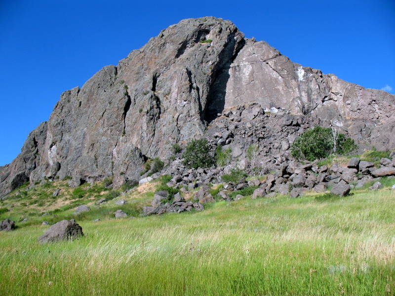
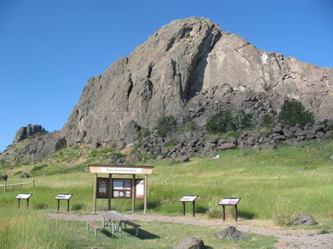
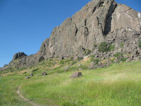
Tower Rock State Park is one of Montana's
newest state parks. The 400-foot high igneous rock formation lies
in a 140-acre site along the stretch of the Missouri River between
Craig, Montana and Pelican Point Fishing Access Site. The public
can park their vehicle in the spacious parking lot, then learn
about the geology and history of the site with five interpretive
panels located at the trail head. The trail to the base of the
saddle is maintained for a quarter-mile. Tower Rock State Park is a
day use only park. Overnight camping is allowed in nearby fishing
access sites.
Before Tower Rock was referenced in the
journals of the Lewis and Clark Expedition, many
Native American tribes used the rock as a landmark when they were
entering and leaving the rich buffalo grounds of today's north
central Montana. Captain Meriwether Lewis noted in
his journal "an Indian road enters the mountain at the same place
with the river on the Stard side and continues along it's border
under the steep clifts." Lewis also wrote in his journal, "At this
place there is a large rock of 400 feet high wich stands
immediately in the gap which the Missouri makes on it's passage
from the mountains... This rock I called the tower. It may be
ascended with some difficulty nearly to it's summit and from it
there is a most pleasing view of the country we are now about to
leave. From it I saw that evening immense herds of buffaloe in the
plains below." Meriwether Lewis, July 16, 1805.
This famous rock became a landmark for native tribes, the Corps
of Discovery, fur trappers and traders and many more that followed
in their footsteps. Now you can follow in their footsteps when you
take in the beauty and nature of Tower Rock State Park.
About the Geology
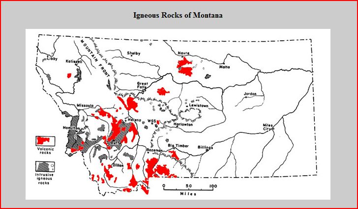
The red and gray areas on the map show where igneous rock can be
found at the surface, or just beneath the soil. Igneous rock is
formed when magma or lava cools. The red areas are where lava
erupted onto the surface and hardened to form a category of igneous
rock that geologists refer to as “volcanic” (a.k.a.
extrusive). The gray areas are where the magma hardened beneath the
surface, making a kind of igneous rock is called
“plutonic” (a.k.a. intrusive). Basalt is the most
common specific type of volcanic rock and granite is the most
common specific type of plutonic rock.
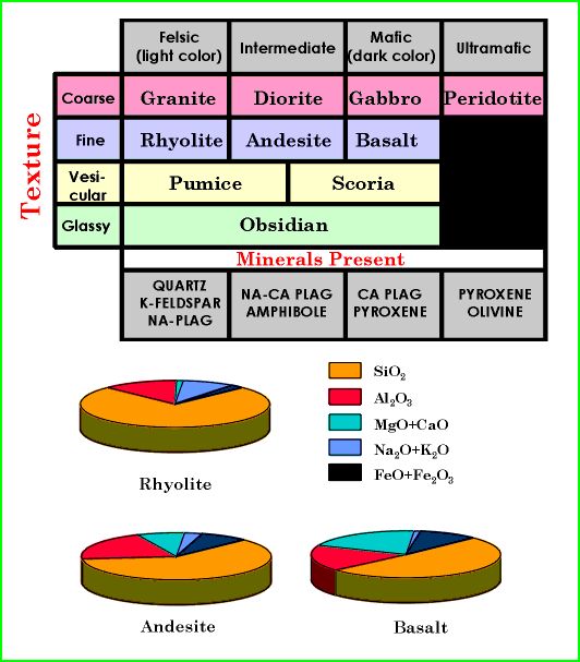
One thing that helps geologists determine whether an igneous
rock is plutonic or volcanic is the size of the crystals, or
grains, that makes up the rock. When lava erupts onto the surface
it tends to cool quickly, whereas magma beneath the surface may
take centuries to harden. As a result the various minerals in lava
have little time to organize themselves into crystals.
Consequently, volcanic rocks tend to be fine-grained and display a
more uniform color than plutonic rocks. On the other hand, as magma
cools slowly beneath the surface, minerals have more time to form
crystals. The crystals eventually run out of space as they grow
into each other, forming interlocking “grains” of
various colors, such as the quartz (white), biotite (black), and
feldspars (pink, gray) that can be seen in a typical granite.
A Little More Info:
IGNEOUS ROCKS
Rocks - Aggregates of minerals
1. Igneous Rocks - Rocks formed by
crystallization from a melt (magma)
2. Extrusive (volcanic) - produced when magma
flows on the earth's surface
3. Intrusive (plutonic) - produced when magma
solidifies at depth beneath the earth.
Classification of Igneous Rocks
Process-oriented. Based on the rate of cooling of the igneous
rocks and their resultant grain size.
Texture - size, shape and arrangement of
mineral grains in a rock.
Coarse grained - Individual mineral grains can
be seen which the naked eye. Rock must have cooled slowly to allow
large crystals to develop.
Fine grained - Mineral grains are present but
are two small to be seem with the eye. Cooled rapidly before
crystals had a chance to grow.
Vesicular - Rock containing vesicles (gas
holes). Always light weight. Example pumice.
Glassy - Not composed of minerals at all but a
true glass. Glasses are not crystalline!
All typical classification schemes rely on a combination of
texture, particularly grain size, and mineralogy. But, keep in mind
they are process-oriented. Coarse grained are plutonic, fine
grained are volcanic. See Figure below that depicts a typical
classification. Stress similar mineralogy of granite vs. rhyolite,
just differ in grain size. Compare granite to gabbro which have the
same grain size, but different mineralogy. Notice from figure how
the three comon fine-grained rocks, rhyolite, andesite and basalt
differ in their chemistry. Rhyolite is very rich in silica while
basalt has less silica, but more iron and magnesium. Andesite is
intermediate.
Logging the Earthcache
To log this Earthcache e-mail the cache owner do not post
answers to these questions:
1. What are the geologic signs of the transition between the
soft rock of the prairie and the erosion resistant igneous rock
that make up the Adel Mountain volcanics?
2. Rock fragments were blasted skyward from violent volcanic
activity, settled and became cemented together with volcanic ash at
this site approximately how many years ago?
3. A recent study of plants in this area revealed many species
of prairie and mountain type plants found nowhere else but along
these habitat edges. How many species were identified?
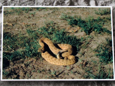
Beware of Rattlesnakes in the Area!