In early times of our country's history, springs were one the
safest sources of water. These natural springs also provided a good
cool drink on a hot summer day and in the winter when creeks and
streams were frozen over, springs could be found oftentimes flowing
freely.
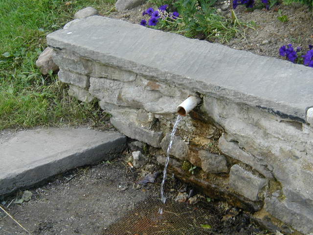
This spring, like many located around areas of growing
population, has been excavated by hand to provide easier access for
the people.
A spring may be the result of karst topography where surface
water has infiltrated the Earth’s surface (recharge area),
becoming part of the area groundwater. The groundwater then travels
though a network of cracks and fissures - openings ranging from
inter-granular spaces to large caves. The water eventually emerges
from below the surface, in the form of a spring. The forcing of the
spring to the surface can be the result of a confined aquifer in
which the recharge area of the spring water table rests at a higher
elevation than that of the outlet. Spring water forced to the
surface by elevated sources are artesian wells. This is possible
even if the outlet is in the form of a 300-foot deep cave. In this
case the cave is used like a hose by the higher elevated recharge
area of groundwater to exit through the lower elevation
opening.
Non-artesian springs may simply flow from a higher elevation
through the earth to a lower elevation and exit in the form of a
spring, using the ground like a drainage pipe. Still other springs
are the result of pressure from an underground source in the earth,
in the form of volcanic activity. The result can be water at
elevated temperature such as a hot spring. The action of the
groundwater continually dissolves permeable bedrock such as
limestone and dolomite creating vast cave systems. Springs are
often classified by the volume of the water they
discharge.
The largest springs are called "first-magnitude," defined as
springs that discharge water at a rate of at least 2800 liters or
100 cubic feet (2.8 m3) of water per second. The scale
for spring flow is as follows:
Magnitude Flow (ft³/s, gal/min, pint/min) Flow (L/s)
1st Magnitude > 100 ft³/s 2800 L/s
2nd Magnitude 10 to 100 ft³/s 280 to 2800 L/s
3rd Magnitude 1 to 10 ft³/s 28 to 280 L/s
4th Magnitude 100 US gal/min to 448 US gal/min 6.3 to 28 L/s
5th Magnitude 10 to 100 gal/min 0.63 to 6.3 L/s
6th Magnitude 1 to 10 gal/min 63 to 630 mL/s
7th Magnitude 1 pint to 1 gal/min 8 to 63 mL/s
8th Magnitude Less than 1 pint/min 8 mL/s
0 Magnitude no flow (sites of past/historic flow)
Artesian well or spring?
a) An artesian well is caused by the pressure of the water in the
underground reservoir forcing itself through a weak spot in the
containing rock and coming to the surface.
b) A spring is the result of an underground reservoir being at a
higher elevation than the outlet from which the water flows.
THIS IS
A DAYLIGHT ONLY CACHE!
To log this cache ...
1 Take a container of known volume and a timer with a second hand.
Time how long it takes to fill the container (flow rate), do the
math and tell me the magnitude.
2 take a thermometer and take the temperature of the water.
3 Do you think this is a spring or artesian well?
Do not include your answers in your log.
Instead, geo-mail them to me within 3 days of your visit.
(Earthcaching rules require me to delete your log if I don't
receive your answers in a reasonable amount of time).