FRENCH
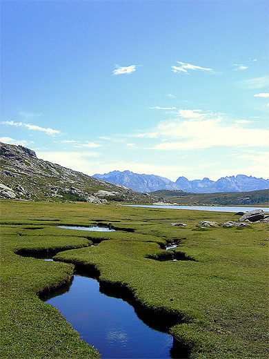
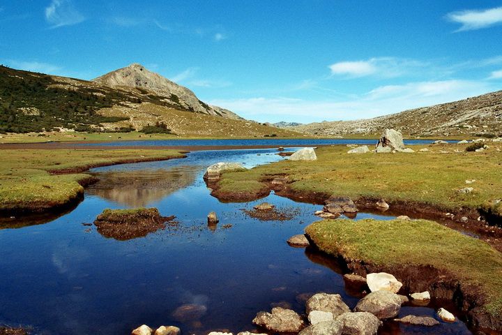
Lac de Nino Le lac de Nino,
source du Tavignano (deuxième fleuve de Corse, tant par sa longueur
que par son débit), est situé sur le plateau du Camputile. Il est
entouré de pozzines, sortes de petits lacs tourbeux.
Géographie Longé par le GR20, il est très visité en
particulier en saison estivale. Le bivouac y est interdit. C'est le
2e plus grand lac de Corse, après le lac du Rotondo, avec une
superficie de 6,5 ha. Accès Depuis la station de ski du col
du Vergio sur la D84 à 10 km d'Evisa. Le sentier du GR20 part dans
la forêt, sans grandes difficultés et accessible à tous marcheurs
moyens. Au bout d'une heure, le sentier commence à grimper une
première fois vers le col de Saint- Pierre (San petru) à 1452
mètres, puis continue pour passer deux crêtes à 1816 m et 1896m,
puis redescend légèrement vers le lac à 1743 m. Environ 700 m de
dénivelé, 15 km aller-retour et 8h de marche. Autre départ,
toujours sur la D84, mais à environ 8 km plus bas que la station,
vers la maison forêstière de Popaghja à 1120 m. La dénivelée est un
peu plus importante que le premier départ.
DEVOIR:
1) Photographie-vous ou de votre unité de GPS
avec le lac et télécharger une photo!
2) Identifier une hauteur du lac
3)Trouvez une profondeur maximale du
lac
4) La réponse Envoyer à mail
gregsi@seznam.cz
ENGLISH
Lake Nino Lake Nino source
Tavignano (second Corsica River, both by its length and its speed),
is located on the plateau Camputile. It is surrounded pozzines,
kinds of peat lakes. Geography Bordered by the GR20, it is
much visited especially in summer. The camp is prohibited. This is
the second largest lake in Corsica, after the lake Rotondo, with an
area of 6.5 ha. Access Since the ski neck Vergio on the D84
at 10 km Evisa. The GR20 trail into the forest, without great
difficulty and accessible to all walkers means. After one hour, the
trail starts to climb first around the neck of St. Peter (San
petru) to 1452 meters, then continued to spend two peaks at 1816m
and 1896m, then drops slightly toward the lake to 1743 Mr. About
700 m altitude, 15 km round trip and 8 hours of walking. Other
departure, still on the D84, but about 8 km below the station to
house forest Popaghja to 1120 m. The climb is a bit larger than the
first heat.
TASK:
1) Photograph yourself or your GPS unit with
the lake and upload picture!
2) Identify the lake level
3) Find a maximum depth of Lake
4)The answer to Send mail
gregsi@seznam.cz
PICTURES / PHOTOS