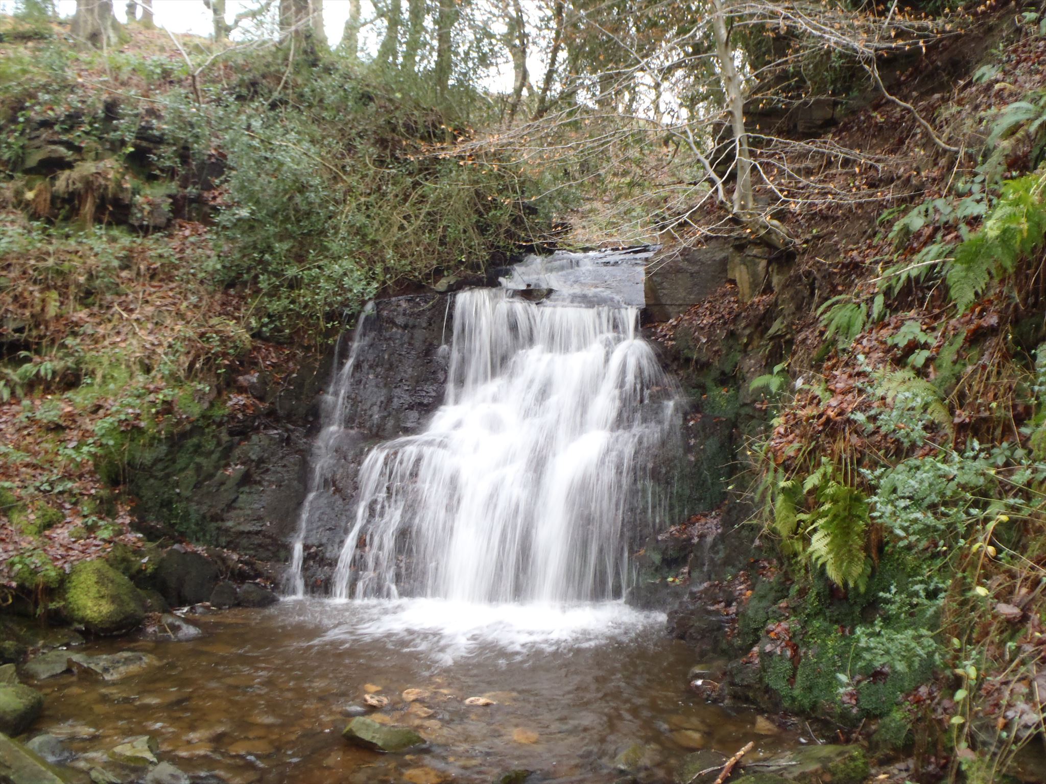
Tigers Clough.
Rivington
This picturesque waterfall is in a little known oasis peace by Rivington. This part of Rivington is less well used than the tourist paths up to the Pigeon Tower and Pike so is relatively free of hustle bustle and litter. Tiger's Clough is found at the base of Winter Hill.
This information is taken from "Winter Hill Scrapbook by D. Lane"
"
"Winter Hill was not always as it appears today. Once it was not even a
hill, nor was it even in the earth’s temperate region as it is today. As a
result of tectonic plate movements, cataclysmic bending and flexing of
the earth’s surface and dramatic changes in climate, slowly but surely
what we now see today has emerged. Without going into too great detail
a brief description of Winter Hills geological
history follows.
When our planet earth was first formed some 4.5 billion years ago, the
earth was in a molten state but slowly started to solidify accompanied by
volcanic activity and a surrounded by an atmosphere that does not
resemble the atmosphere of today. Over billions of years, the earth began
to stabilise and life somehow began on our planet. In the Winter Hill area
no deep borings have been taken so we have no real record of exactly
what lies under our feet at great depth. Closer to the surface however, we
do know something about our more "recent” history over the last few
million years by studying the geology in mining shafts, shallow borings,
quarries etc.
The "upper” portion of Winter Hill consists of a series of layers or seams
of sandstones, shales and coal - often referred to as the Millstone Grit,
Lower, Middle and Upper Coal Measures. The layers include an endless
variety of sediments, coal seams (along with their associated underlying
bands of fireclay or ganister) and are approximately 8.000 feet in
thickness
This area was once part of the great "Upper Carboniferous” delta of the
North of England, a version of some of the more famous world deltas that
we have today such as the Nile, Mississippee and Amazon. Somewhere to
the north of Winter Hill was a huge land mass with a large river entering
the sea (to the South) via a delta. At that stage in the earth’s evolution, the
surface of the "land” was continuously rising and sinking so the areas
near the delta were continuously being raised above sea level, then
dropped beneath that level in a succession of floodings and periods when
plant growth was possible. Over periods of time, the sandbanks and the
muds were overlain with swamps and vegetation only to be innundated
over and over again with the either the river or the nearby seas. Thus,
over a period of time, the rocks (formed as a result of pressure) have
formed in a seemingly endless cycle of marine shales, sandstones,
mudstones and vegetative coal layers.
At some stage in the earths history, the ground underwent tremendous
pressures, and parts of our region were bent and twisted due to great
internal tensions and this in turn was accompanied by dramatic earth
movements where one part of the surface was lifted whilst a neighbouring
portion sunk, thus forming "faults”. There are a number of faults under
Winter Hill. What we now see as the top of Winter Hill was once at sea
level covered in lush tropical forests.
For anyone who wants proof of these earth movements I can tell you that
it is possible to find fossil remains of those tropical forests (leaves, tree
bark and roots, seeds etc) on the very top of Winter Hill ….. they can be
found at various points in shale bands on the sides of the road running up
to the television mast. Honest! ….. but you’ll have to find the sites
yourself …. I don’t want to be held to blame for new "holes” appearing
on the hill top!
There are two main seams of coal under Winter Hill and both have been
exploited in the past. In fact, almost the entire section of one part of the
south facing flanks of Winter Hill are to all intents and purposes hollow,
due to centuries of coal mining, with only pillars of coal being left "in
situ” to support the surface as we know it today.
The layers of rock forming Winter Hill are not horizontal but dip towards
the south at a dip of 1 in *. Due to the shape of the hill and the dip of the
layers, the upper coal seam is at a fairly constant depth below the surface
of the ground despite the fact that the hill is not level!"
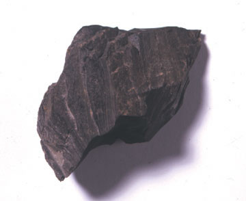
In Tigers Clough itself there are vast cliffs of Shale. Shale is a sedimentary rock which means it was formed in layers of rock, sand and mud beneath the earth. Shale is primarily mud which has solidified to rock after millions of years of compression and heat.
Waterfalls
There are a number of different types waterfalls
-
Block: Water descends from a relatively wide stream or river.
-
Cascade: Water descends a series of rock steps.
-
Cataract: A large, powerful waterfall.
-
Fan: Water spreads horizontally as it descends while remaining in contact with bedrock
-
Horsetail: Descending water maintains some contact with bedrock.
-
Plunge: Water descends vertically, losing contact with the bedrock surface.
-
Punchbowl: Water descends in a constricted form and then spreads out in a wider pool.
-
Segmented: Distinctly separate flows of water form as it descends.
-
Tiered: Water drops in a series of distinct steps or falls.
-
Multi-step: A series of waterfalls one after another of roughly the same size each with its own sunken plunge pool.
In order to claim this Earthcache please carry out the following tasks.
1) Go to the marked waypoint which may mean climbing the slope to the right of the waterfall. You should see some slabs, estimate the width of the largest of these.
2) Visit the waterfall and estimates its height and tell me the type of waterfall this is. The information shown in the listing should help with this.
3) Find the shale cliffs and describe the texture.
Tiger's Clough has Neolithic links to cavemen thousands of years ago.
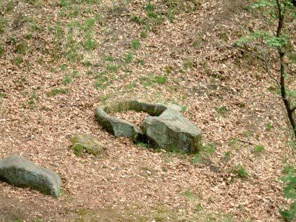
4) Find this rock and estimate the width of the hole and notice how it has been carved out with a chisel.
Optional tasks are to take pictures of you or your GPS at Tiger's Clough.
Please send all answers via my profile. Any logs which are incomplete may be deleted however these will always be accompanied by an email as to why.