Heringerichte Vlootbeek EarthCache
-
Difficulty:
-

-
Terrain:
-
Size:  (not chosen)
Please note Use of geocaching.com services is subject to the terms and conditions
in our disclaimer.
De Vlootbeek is in de Roerdalslenk gelegen. In het noorden wordt deze slenk begrensd door de Peelrandbreuk, in het zuiden door de Feldbiss. Vanaf de grens tot Montfort stroomt de Vlootbeek door een laagte welke vroeger gevormd is door een zijtak van de Roer. De bodem bestaat hier uit oude kleigrond. Ook het traject van de Vlootbeek in de Linnerweerd is gelegen in fluviatiele afzettingen. Hier is het de Maas die klei in het holoceen heeft afgezet. Hiertussen bevindt de Vlootbeek zich in het terras van Sint Joost. Hier heeft aan het eind van de laatste ijstijd duinvorming plaatsgevonden. De vorming van de duinen hield verband met de omstandigheid dat het na smeltwatervloeden van drooggevallen stroombeddingen weggewaaide zand tegen het eind van de laatste ijstijd weer door vegetatie werd vastgehouden. In de kommen die ontstonden door het weggewaaide zand zijn moerassen en broekbossen ontstaan. Deze zijn vooral rond Montfort aan te treffen.
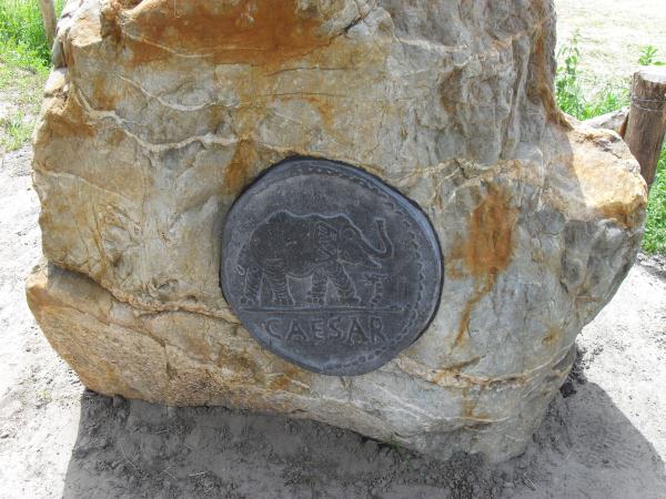
Het Waterschap Roer en Overmaas heeft delen van de Vlootbeek natuurvriendelijk ingericht. In 2009/2010 is de Vlootbeek tussen de wegen Sweeltjesbosweg en de Dijk opnieuw ingericht. Aan een zijde is de oever verflauwd zodat er moerassige zones kunnen ontstaan. Tijdens deze herinrichting hebben archeologen een muntschat gevonden.
Om deze cache te mogen loggen moet je de volgende vragen beantwoorden en mailen naar het e-mail adres via de link van bovenstaand profiel. Dan krijg je toestemming om de cache te loggen.
Voor welke dieren zijn hier poelen aangelegd?
Hoeveel munten zijn er nagemaakt vanaf de parkeerplaats tot aan het infobord?
Maak een foto van jezelf en/of gps bij het informatiebord.
LOGS MET EEN VERKEERDE FOTO OF VAN MENSEN MET EEN FOUT ANTWOORD WORDEN DIRECT VERWIJDERD!!!!
VEEL SUCCES
RESHAPED VLOOTBEEK
The Vlootbeek is situated in the Roer Valley graben. In the North is this graben bordered by the Peelrandbreuk, in the south by the Feldbiss Fault. From the border till Montfort streams the Vlootbeek through a valley which has been shaped by a side-brach of the Roer. The bottom exist here out of old clay ground. Also the track of the Vlootbeek in the Linnerweerd is situated in fluviatic sediments. Here it is the Meuse that sedimented clay in the holoceen. Between this you can find the Vlootbeek in the terrace of St. Joost. At the end of the last ice age have formation of dunes took place. The formation of the dunes was connected by the situation that after the meltwaterflood dry-fallen riverbeds blowed away sand has been hold by vegatation at the end of the last ice age. In the bassins who has been arised by the blowed away sand have swamps and “broekbossen” been arised. These are mainly to see by the village Montfort.
The Office of a dike-reeve Roer and Overmaas have reshaped parts of the Vlootbeek nature friendly. In 2009/2010 is the Vlootbeek between the roads “Sweeltjesbosweg” and “Dijk” reshaped. One side of the bank has been faded so that swamp zones can be arised. During these reshaping, archeologs have found a coin treasure.
To log this cache you must answer the following questions and send them by mail by using my profile and get credit in order to log this cache.
For which animals are the pools made?
How many coins has been imatated from the parkingplace till the infoboard?
Take a picture of you and/or your gps at the infoboard.
LOGS WITH A WRONG PHOTO OR WRONG ANSWERS WILL BE DELETED IMMEDIATELY!!!
GOOD LUCK
Additional Hints
(No hints available.)