Hraunsvatn (northern Iceland) Traditional Geocache
Hraunsvatn (northern Iceland)
-
Difficulty:
-

-
Terrain:
-

Size:  (micro)
Related Web Page
Please note Use of geocaching.com services is subject to the terms and conditions
in our disclaimer.
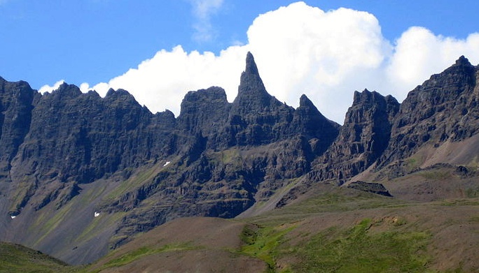
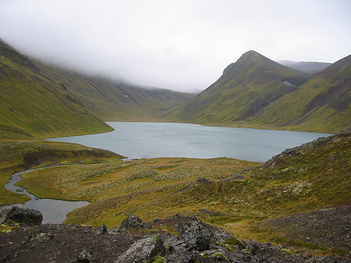
The cache is located by a small lake called Hraunsvatn in a valley
named Öxnadalur. Its around 2,5 km walk (one way) up there. It
takes around one hour, but with a great view of Hraundrangar
(mountains, see picture).
The cache is located just by a small lake that lies at 512 meters
above sea level. The lake is 0,73 km², commonly 10-12 m in depth,
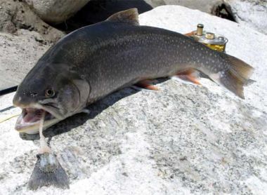
Its possibe to fish for arctic charr (small salmonid, see picture)
in it (you need license). Park your car by farm Háls (see parking
waypoint HP1234). Háls elevation is 257m so its about 255 meters
hike. The trail starts just behind the farm, there is a gate
there.
Click here to go to the wikiloc.com to download
track.

Additional Hints
(Decrypt)
Ybbx sbe syng fgbarf. Vgf haqre bar cnyz fvmrq syng fgbar. Lbh bayl frr gur oyhr pnc jura gur fgbar vf yvsgrq. Gur pbagnvare vf bar bs gurfr ybat pyrne cynfgvp glcr (crg obbgyr) jvgu n fbqn pnc.