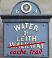
 This cache is placed along
the water of Lieth Walkway, and yet another addition to the Water
of Lieth 'Cache series'. The cache is not at the above
coordinates, but is, as usual, close by
This cache is placed along
the water of Lieth Walkway, and yet another addition to the Water
of Lieth 'Cache series'. The cache is not at the above
coordinates, but is, as usual, close by  . The posted coordinates are for one
end of this old station. See if you can figure out which side the
platform was on...
. The posted coordinates are for one
end of this old station. See if you can figure out which side the
platform was on...
Hailes Platform Station is the first Station of 5 along the
'Balerno Loop' - a loop from Slateford that ran all the way up to
Balerno before re-joining the main line at Ravelrig, and which is
now the Water of Lieth Walkway. The purpose of the Loop was to
serve the Mills that were located beside the Water of Leith and on
Saturday, 1st August 1874, the Balerno branch railway was
eventually opened to all traffic.
This is the 4th cache in the series, and as usual, you have to
solve a puzzle to get the final coordinates. If you have a fair
knowledge of maths , then you may recognise the puzzle
fairly easy..... So, here it is: 
The cache can be found at:
N 55° 54.X’ W 003° 15.Y’ where:
X = 4p + p/2 + p/6 - p/90
Y = 2p + 4p/3 - 2p/45
Note: p =  radians
You can check the answer to this puzzle on
Geochecker.com.
The GPS reception may be a bit bad, so hopefully the clue should
help. Please make sure the cache is put back properly, and please
don't give any hints or tips in your log so that everyone can enjoy
the hunt!
Enjoy!
The caches in the series so far are...
1) GC1G8T1 - Colinton
Station
2) GC1P6GQ - Craiglockhart
Station
3) GC26VF7 - Morningside Road
Station
4) GC28PJ7 - Hailes Platform
Station