Auf den Spuren des Wassers Multi-cache
Auf den Spuren des Wassers
-
Difficulty:
-

-
Terrain:
-
Size:  (small)
Please note Use of geocaching.com services is subject to the terms and conditions
in our disclaimer.
Dieser Multi zeigt euch die Brunnen, die es in der Altstadt von Bad Säckingen zu entdecken gibt. Die Aufgaben (mit Ausnahme des Finals) sind relativ einfach gehalten, damit er auch gut mit Kindern machbar ist.
Er bietet sich für einen Spaziergang an.
Am Wochenende und an Feiertagen, sowie abends während der Sommermonate ist mit erhöhtem Muggelaufkommen zu rechnen.
Hinweis: Station 7 ist im Winterhalbjahr ab Einbruch der Dunkelheit und im Sommerhalbjahr ab 22.00 Uhr nicht mehr zugänglich. |
|
Bitte die Mauer beim Final stehen lassen und nichts zerstören!
English description:
That multi-geocache leads you to the wells of the old town of Bad Säckingen. It is a relative simple one (except for the finale) to make it also suitable for children. Expect many mugglers at weekends, holidays and in the summer evenings. Note: Stage 7 is not accessible during the night (starting from 10 pm. in the summer and at nightfall in the winter).
Stage 1 - N 47° 33.256 E 007° 56.852 :
Search for the cat in the vicinity. How many mice are hiding from the cat? a =
Stage 2: Walk from Stage 1 (Blauer Brunnen) along the runnel to the end of the above-ground stream. What do you see there?
- Half-pipe b = 1
- Bridge fragment b = 4
- City arms b = 7
Stage 3 - N 47° 33.2b4 E 007° 56.9a1 :
How many water leakages on the side does this well have? c =
Stage 4 - N 47° 33.177 E 007° 56.ca7 :
Search for the sundial. Which of the following animals are pictured above the sundial?
- A male cat and a falcon d = 5
- A frog and a cock d = 3
- An owl and a snake d = 1
Stage 5 - N 47° 33.daa E 007° 56.c9a :
What do you see in the well vat?
- Tesserae e = 6
- Pebbles e = 7
- Coins e = 9
Stage 6 - N 47° 33.d23 E 007° 56.ceb :
That well is named after a monk. What is his name?
- Fridolin f = 5
- Gallus f = 7
- Balther f = 9
Stage 7 - N 47° 33.0ea E 007° 56.f30 :
How many roses can you count in the well water? g =
Stage 8 - N 47° 33.ddb E 007° 56.fba:
When did the „Haus zum Falken“ burn down? h = last digit of the year
Stage 9 - N47° 33.da0 E 007° 56.fb2 :
That well symbolises the country (by the symbols air, river, forest and valley at the branches) and the town (heads at the pillar). Count the letters on the sign at the well. Divide the sum by 8 = i .
Stage 10 - N 47° 33.deh E 007° 5e.ffd :
Note: The GPS accuracy is poor at this place!
To which body of water is this well reffering to?
- Rhein k = 0
- Giessenbach k = 2
- Bergsee k = 4
- Schöpfebach k = 6
Stage 11 - N 47° 33.dha E 007° 5e.ffh :
Note: The GPS accuracy is poor at this place!
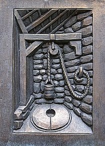
What was used to make water available before the 16th century?
- Saugbrunnen (Suction well) l = 0
- Ziehbrunnen (Draw well) l = 2
- Schöpfbrunnen (Ladle well ) l = 4
- Pumpbrunnen (Pump well) l = 6
Stage 12 - N 47° 33.def E 007° 57.kkg :
Where does the tail of the sculpture point to?
- To the Rhein m = 1
- To the sky m = 3
- To the ground m = 5
Stage 13 - N 47° 3m.lih E 007° 5h.klb :
What does the animal on this well hold in his paws?
- a bough n = 3
- a key n = 5
- a city arms n = 7
Final (Final Location):
Find the cache box at: N 47° 3m.nbl E007° 5h.kfh
Additional Hints
(Decrypt)
Fvrur Fcbvyreovyq