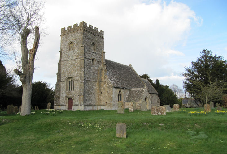
All Saints, Lyddington
This cache is part
of an extension to Sadexploration's immensely far–reaching
Church Micro series. Hopefully, it will attain the high standard
already set and bring some cachers to this little corner of
Wiltshire
The small village of Liddington
is located in rural surroundings in Liddington Parish, within the
Borough of Swindon. The settlement lies south east of Swindon town,
close to the M4 motorway, junction 15 of which is only about 1.5
kilometres away via the B4192 - known as Purley Road where it
passes through Liddington village.
The parish as a whole has been
an area of settlement since the earliest times. The ancient
Ridgeway traverses the parish just north of the village and the
Iron Age hill-fort known as Liddington Castle overlooks the
present-day village. Liddington is recorded in the late Saxon
period, around 940 AD. The Domesday Book of 1086 refers to the
settlement as Ledentone. Records indicate that Liddington was a
fairly prosperous parish in the 14th century. Population of the
parish was 454 in 1841 but gradually declined
thereafter.
Church
Road,
bearing off Purley Road beside a young horse chestnut tree, is a
narrow, un-kerbed lane, sunk below the land either side except at
its south-eastern end where a new property, Church Cottage a
modest, roughcast-rendered, roadside house with gable-end brick
chimneys, now extended to the rear, sits. Church Lane leads to the
Church of All Saints from where there are fine views of Liddington
Castle. At the end of Church Road are the imposing, Grade II listed
Parsonage House and Old Rectory, around which a footpath leads to
the main road.
The most notable stone walls are
to be found close to All Saints Church. Throughout the area large
sarsen stones have been used to mark a boundary or as a makeshift
roadside kerb. This distinctive local stone is often used as a
building material and, for instance, forms the base of the
retaining wall to the churchyard. Use of locally available stone,
in construction of walls, buildings and kerbs, gives the area its
local character distinguishing it as a North Wiltshire
village.
Parking for the cache can be
found at: N51° 31.807 by W001° 42.291
The micro has log book only so
please bring a pen
This is the church car park, so please remember that this will be
heavily used at certain times, especially Sundays!
The cache is a nano, hidden a
short walk from the parking area that, unfortunately, doesn’t
have the best view of the church so please take a few moments to
wander round and have a better look at the Church, this series is
about the destination, not just a smiley!!
If anybody would like to expand to this series please do, I would
just ask that you could let SADEXPLORATION know first so he can
keep track of the Church numbers and names to avoid
duplication.