Ding Dang Dingleberry Traditional Geocache
-
Difficulty:
-

-
Terrain:
-

Size:  (small)
Please note Use of geocaching.com services is subject to the terms and conditions
in our disclaimer.
A tough hike/climb to the summit of a high horn on the main
Organ Ridge.
This cache is tucked away just 10 ft from the summit of Dingleberry
Peak.
You'll spend the better part of a full day getting up and back on
this one.
The climb is VERY steep but there's a non-technical scramble route
to the top.
The views from this peak are some of the best the range has to
offer.
Morning view of the Organs...Dingleberry the high broad peak at
center.
So how do you get up on top of
this huge, complicated massif sitting between Lost Peak and Wildcat
Peak? I'm not real sure I know how myself, and I just got down a
few hours ago. I got extremely lucky to have found a very good
route that got me to the top without any backtracking. I did know
that there is a non-technical route up the SE side (check the web
for Organ Mountain climbs).
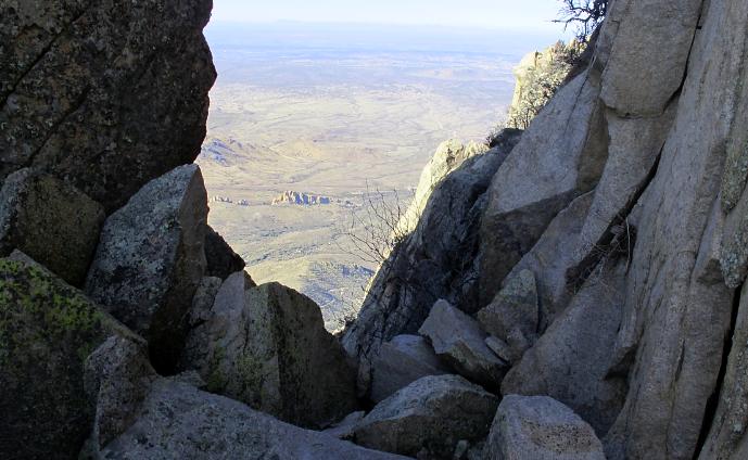
Very top of the top canyon, at the tight saddle on the main
ridge.
I stitched together some unknown (to
me) ascent canyons that one-by-one linked up and lead me right to
the main Organ saddle. High in the upper broad canyon, and near the
main ridge (with Lost Peak up a bit, and to your right) you'll need
to take a sharp climber's left into a tight canyon that ascents
steeply toward the NE. At the top of this short canyon you find a
collection of large blocks. This represents the saddle and the main
Organ Ridge. There is a hole in the blocks you can crawl through to
see the east side...but you don't have to. You'll need to leave the
canyon, ascending steep class III terrain to the left just before
the blocks.
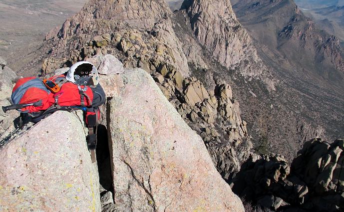
Summit shot...with Wildcat, lesser horns, RE Plateau, Rabbit
Ears, and Baylor behind.
I brought a small rope with me
in case I got in a jam. I ended up making two rappels off the north
side to get to Wildcat Peak for another cache. You can simply
retrace your ascent route to get back down. This hike/climb is
better done with a partner as any little mistake can be serious due
to the terrain and remoteness. However you do it...let someone know
where you're going, make sure you have the off-trail, backcountry
skills necessary, study and bring topo maps along, pick a good
weather day, bring first-aid supplies, be careful, have a lot of
fun, and enjoy the heck out of your time on the summit. I didn't
want to leave... it's that great!
Congrats to tlepinski for the
FTF on this Birddroppings cache!
Additional Hints
(Decrypt)
Pbirerq ol ebpxf arne gur fhzzvg.