When it was decided that the old Woodrow Wilson
bridge needed to be replaced one of the main concerns the engineers
had to address before beginning construction was “bridge
scour” which is one of the three main causes of bridge
failure. It has been estimated that 60% of all bridge failures
result from scour and other hydraulic related causes. Bridge scour
is the removal of sediment such as sand and rocks from around
bridge abutments or piers. Scour, caused by swiftly moving water,
can scoop out scour holes, compromising the integrity of a
bridge.
Stream channel instability resulting in river erosion and changing
angles-of-attack can contribute to bridge scour. Debris can also
have a substantial impact on bridge scour in several ways. A
build-up of material can reduce the size of the waterway under a
bridge causing contraction scour in the channel. A build-up of
debris on the abutment can increase the obstruction area and
increase local scour. Debris can deflect the water flow, changing
the angle of attack, increasing local scour. Debris might also
shift the entire channel around the bridge causing increased water
flow and scour in another location.
To prevent bridge scour from occurring at the new Wilson Bridge
geotechnical engineers conducted extensive analysis of the Potomac
riverbed including an Erodibility Index (measurement of potential
soil loss). This entailed an assessment of riverbed material
properties, hydraulic analysis and scour analysis. Potential scour
depths for the 100-year and 500-year floods were also calculated
for each of the proposed bridge piers.
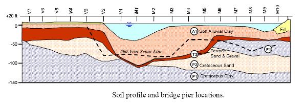
Borehole logs, and shear strength and dilatometer (a
dilatometer measures the stiffness and shear strength of
soil) test results were used to calculate the Erodibility Index of
the riverbed. Boreholes, drilled near all of the proposed bridge
piers, provided soil property information through descriptions and
blow counts (the number of blows required to drive an object into
soil). Soil profiles near piers V1 and M1 through M5 have a thick
layer of very soft to soft gray to brown silty clay, with some sand
and gravel. Below is a layer of Pleistocene era terrace deposits,
which are gray and brown, dense to very dense sand with silt,
gravel and clay lenses. Finally, the Cretaceous period Potomac
group consists of hard gray clay. Soil profiles near piers M6
through M10 and V2 have a thinner layer of soft to very soft
alluvial clay, followed by a thin layer of alluvial deposit that
consists of loose medium dense brown silty sand. The Pleistocene
terrace deposits and Cretaceous Potomac group deposits follow.
Dilatometer test results were used to estimate the undrained shear
strength of the soil and the residual angle of friction. The shear
strength test results were used to confirm the estimates made with
the dilatometer test results.
The available stream power was calculated and
data was collected for approach velocity, depth of flow and energy
slope from a model that was created 5 miles upstream of the
construction site.
This chart shows the results of the Scour Model:
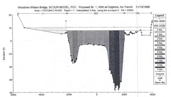
All the information gathered was combined to determine the
absolute safest depth for each individual pier, even in the case of
a 500-year flood.
There is a sonar scour monitoring system
installed on the Wilson Bridge which provides continuous data on
streambed elevations, helping to ensure the safety of the traveling
public.
Validating the EarthCache
find:
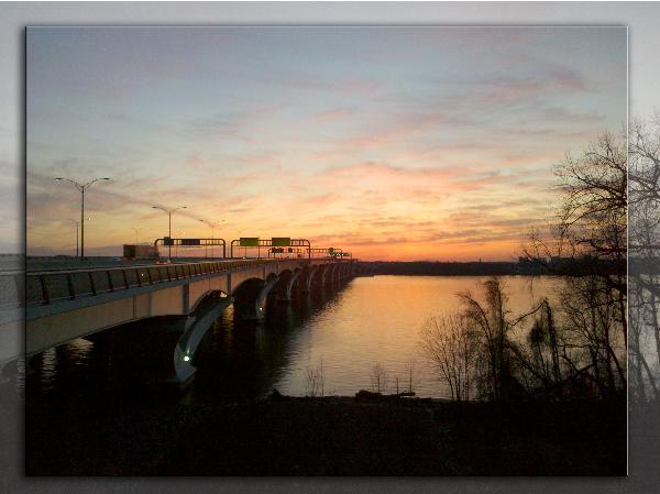
1) Take a picture of yourself with
your gps at the posted coordinates which are at the observation
area in the center of the bridge and include it with your log.
2) On the Maryland side of the bridge
there is an interpretive sign describing the arches used for the
bridge. It reads:
Redefining the arch
The design of the bridge, selected from among seven competing
entries reflects the arch tradition of other Potomac River
crossings without actually using the classic arch. True arches
create large horizontal forces at the foundations – a problem
in the Potomac River where soils are particularly poor. An
innovative system of curved, ?- shaped piers is
used to transfer the load vertically through soft soil to firmer
soils 200 feet below.
Email the letter that represents the shape of the pier as
described on the sign.
3) Describe the current in the river whether it
is fast or slow. Do you think the water flow is doing any damage to
the bridge piers?