Alto de Garajonay EarthCache
-
Difficulty:
-

-
Terrain:
-

Size:  (other)
Please note Use of geocaching.com services is subject to the terms and conditions
in our disclaimer.
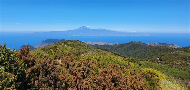
View from Alto de Garajonay towards Teneriffe and Teide
Alto de Garajonay, the summit of Garajonay, is the highest point on La Gomera, 1487 meters. On a clear day, four other Canary Islands can be seen from here: El Hierro, La Palma, Tenerife and Gran Canaria. (Other days you may see only grey mist…)
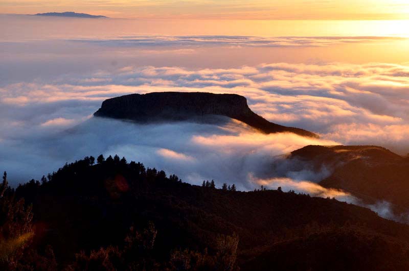
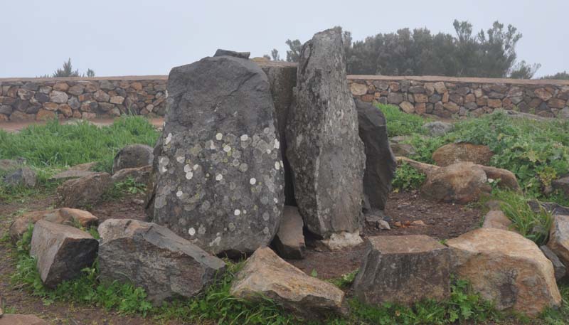
Geologically the Canary Islands were formed by an underlying plate moving slowly eastward over a hot spot in the Earth’s crust, forming volcanic islands. La Gomera is the only island in the group that has not experienced an eruption in last 4 million years. Ash and lava fields have therefore been eroded away leaving a series of steep ravines (barrancos) carved by the winter rainfall The landscape is characterized by volcanic dykes and pillar-like domes (roques) like for example Roque de Agando. The soils are mature red soils formed from the basalt.
Alto de Garajonay lies in the middle of an evergreen misty forest. The area has been a national park since 1981. Since 1986 it has also been protected as a UNESCO World Heritage site.
The laurel forest is a subtropical vegetation of evergreen trees partly covered by epiphytes. It’s an ancient vegetation type that was widely spread in southern Europe and mediterranean region about 10,000 years ago. Today you find remains of it on the Azores, Canary Islands and Madeira between 800 and 1300 meters above sea level where the clouds produces a uniform climate with little temperature variation and high air humidity throughout the year.
Forest ecosystems like this are central to the control of erosion processes and hydrology catchment, specially in mountain regions like this with steep slopes and relatively high rainfall. The misty clouds allow for the growth of wonderful moss and lichen, which bear witness to the clarity of the air.
We recommend a visit at the The National Park Visitors' Centre is in La Palmita, There you will find facts of the traditional culture and the varied landscapes of both the Park and the island. Outside in the botanical gardens you’ll find examples of the flora of the Canaries and many species unique to La Gomera .
The summit is easy accessible, if you don’t pass it on a longer hiking trail you can park your car at N 28 06.940 W 17 14.595. From there it’s an easy 1.5 kilometer trail with no more than 135 meters accent.
To log the cache first you have to perform a few tasks and e-mail me the answers of task 1-3:
 |
1
On this picture you see the view towards one of the islands mountain tops. What’s it name? Pick up your GPS and write down the bearing!
|
 |
2
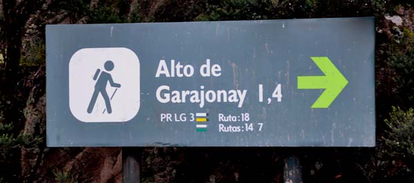
You’ll easily find the green sign on this picture. Write down the two words that’s hidden behind the red screen. Translate it and try to tell me the meaning or use of it |
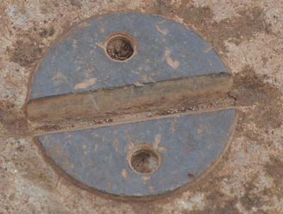 |
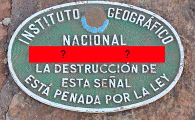
3
On top of the center concrete pole you’ll find a number of these. How many? |
 |
4
(Optional!, no need for logging!)
Finally it would be nice if you upload a picture of yourself and the view at this spot to show us what the weather’s like and as a memory of your visit?!
It would also be nice if you upload a photo of the nature at this spot so we can follow it recovering itself after the terrible fire in august 2012. |
Additional Hints
(No hints available.)