Nederlands:
De Brabantse Wal is een aardkundig monument en uniek in het Nederlandse landschap: een steile overgang van de hoge zandgronden naar het laagliggende zeekleigebied. Vroeger lag hier de grens tussen land en zee. De steilrand zelf is gevormd door de werking van de rivier de Schelde. Het verschil in landschappen langs de Brabantse Wal is opmerkelijk. Het hoge deel is meestal bebost en bebouwd, het lage deel is een open polderlandschap. De rijkdom aan natuur is groot. Dat komt ook door de overgangen van zand naar klei, van droog naar nat en van voedselarm naar voedselrijk gebied. Langs de Brabantse Wal zijn 7 wandelroutes gemarkeerd. Ze voeren door het hoge en lage deel van het landschap en bieden mooie vergezichten.
Mocht u een route willen lopen dan start hier wandeling 7:O.L.V Ter Duinen - Noordpolder Ossendrecht met een lengte van 11km.
Hoe deze Earth Cache te loggen.
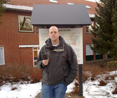
1. Graag willen wij een foto van een teamlid bij het infobord met een GPS in de hand. (optineel)
2. Welke 4 lagen kom je tegen in het zeekleigebied ?
3. Hoe lang geleden zijn de rivierduinen gevormd ?
4. Hoeveel gebieden, representatief voor de ontstaansgeschiedenis van Noord-Brabant, zijn aangewezen als aardkundig waardevol gebied
Deze antwoorden mailen en niet in de log vermelden
LOGS MET DE VERKEEDE ANTWOORDEN OP DE VRAGEN WORDEN DIRECT VERWIJDERD !
English:
The Brabant Wal (= rampart) is a geographical monument and one of a kind in the Dutch landscape: a steep transition from the high sand grounds to the much lower lying clay territory
The boundary between land and sea used to lie here. The steep edge itself was formed by the River Schelde. There is a remarkable difference in landscapes along the Brabant Wal. The higher part mostly wooded and cultivated, the lower part is an open polder landscape.
There is an abundance in scenery variation due to the transitions from sand to clay, from dry to wet and from nutrient poor to nutrient rich areas. Along the Brabant Wal 7 hiking trails have been set out. They lead through the high and low part of the landscape and offer beautiful views.
If you would like to take any of these walks we advise you to do number 7: OLV Ter Duinen - Noordpolder Ossendrecht with a length of 11 km.
How to log this Earth Cache :
1. We would like a picture of a team member with a GPS in hand next to the information sign. (optional)
2. Which 4 types of layers can be found in the "zeekleigebied"?
3. How long ago were the river dunes formed?
4. How many areas, representative of the developmental history of North Brabant, have been designated as "geographically valuable nature areas ' ?
You must mail this answers to me, don't write this in your log
LOGS WITH THE WRONG ANSWERS TO THE QUESTION ARE REMOVED IMMEDIATELY !