[CZ]
Tezba nerostnych surovin v Moravskem
krasu
Tezba nerostnych surovin a jejich zpracovani
patrily k prvnim vyznamnym aktivitam cloveka na uzemi Moravskeho
krasu. Jednalo se zejmena o tezbu zeleznych rud, vapencu a
slevarenskych pisku, ktera ovlivnila budovani huti a slevaren. K
nahodilemu povrchovemu sberu surovin k vyrobe kamennych nastroju,
napr. sber rohovcu z jurskych (druhohornich) pokryvu a ze zvetralin
rudickych vrstev, pozdeji pristoupily i sbery povrchovych vyskytu
limonitickych zeleznych rud, ktere vznikaly diky specifickym
geochemickym podminkam na styku devonskych vapencu a rudickych
vrstev. V dobe slovanske doslo ke znacnemu rozvoji zelezarstvi,
ktere bylo prokazano archeologickymi nalezy starych huti v okoli
Rudice, Olomucan a Habruvky. Jako nerostna surovina zde byla
ouzivana zelezna ruda rudickych vrstev nejen z povrchoveho sberu,
ale i systematicke tezby v nehlubokych dulnich dilech.
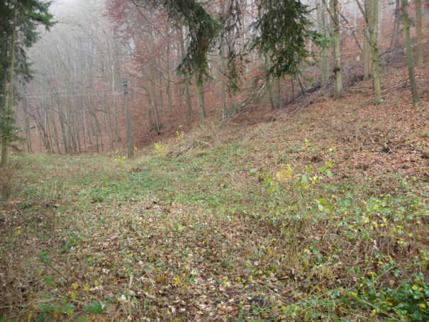
Vapenictvi v Padouchu
Vyznamnou nerostnou surovinou Moravskeho krasu byly a stale jsou
vapence. Predstavuji surovinovou zakladnu pro vyrobu vapna,
stavebniho kamene a uslechtilou kamenickou vyrobu. V minulosti byly
vapence volne sbirany a lamany jako balvany, pozdeji byly tezeny v
malych lomovych provozovnach, kde se misty vyuzivalo i sten
prirozenych krasovych zavrtu. Jednou z vyznamnych tezebnych lokalit
je Wiehlovo udoli, tez zvane Padouch. Udoli
Padouch je ostre zariznuto do lazaneckych vapencu ve spodni casti
Rudicke plosiny. Vyustuje v Olomucanskem zlibku nedaleko jeskyne
Byci skala. Pri archeologickem vyzkumu v udoli Padouch se podarilo
objevit nejen stredovekou hutnickou dilnu, ale i zdroje surovin,
ktere pouzivala. Jsou zde patrne jamy, kde hutnici ziskavali
zeleznou rudu. Kutaci pole se vyznacuje nepravidelne rozlozenymi
nalevkovitymi jamami, ktere se od sebe odlisuji jak hloubkou, tak i
rozlohou. Vzhledem ke geologicke situaci lze predpokladat, ze
rozlehlejsi vnitrni prohlubeniny jsou pozustatkem po tezbe hlinek a
jilu, zatimco vnejsi jsou pozustatkem po tezbe zelezne rudy.
Ukoly nutne pro
zalogovani:
1. K logu prilozte svoje foto s GPS
(samostatnym lovcum staci foto jejich GPS) u informacni
tabule.
2. Na muj email odeslete odpovedi na nasledujici otazky:
a) Jaka je nadmorska vyska udoli u
informacni tabule?
b) Co je limonit?
c) Jaky stupen tvrdosti ma
rohovec?
d) K cemu se v archeologii vyuziva
magnetometrie?
Necekejte na potvrzeni a rovnou se zalogujte. Ozvu se pouze v
pripade chybne odpovedi.
Zdroje informaci: Informacni materialy Spravy CHKO Moravsky
kras.
[EN]
Mineral Resources Mining in Moravian
Karst
Mineral resourses mining and processing counted among the first
important activites of human beings at the territory of Moravian
Karst. In particular, mining of iron ore, limestone and foundry
sands influenced construction of ironworks and iron foundries.
Accidental opencast collecting of raw materials for manufacture of
stone tools, e.g.collecting of hornblendes from Jurassic (Mesozoic)
overlays and slacks of Rudice layers was later followed by
collecting of opencast limonitic iron ore that had originated due
to specific geochemical conditions at the contact of devon
limestones and Rudice layers. In the Slavonic era, iron industry
developped significantly which was proved by archeological
excavations of old steel mills in the surroundings of Rudice,
Olomucany and Habruvka. Iron ore from Rudice layers not only from
opencast collecting but also from systematic mining in shallow pits
was used here as mineral resource.
Lime industry in
Padouch
Limestones have been important mineral resources of Moravian Karst.
They represent raw mineral base for production of lime, building
stones and high-grade stone production. In the past limestones were
freely collected and querried as boulders, later they were mined in
small querries where rock walls of natural karst sink-holes were
utilized here and there. Wiehl´s valley, also called
Padouch, was one of important miniming places. The valley of
Padouch has sank deeply in limestones of Lazanky in the lower part
of Rudice plateau. It leads in Olomucany glen close to Byci skala.
During archeological investigations in the Padouch valley not only
a medieval metallurgical workshop happened to be found but also
sources of raw materials that were used there. Pits, where
metallurgists obtained iron ore, are obvious there. Mining field is
distinguished by irregularly located funnel-shaped holes that
differ by both depth and surface area. With respect to geological
situation it can be assumed that more extensive inner sags are
results of earth and clay mining, while the outer ones are results
of ironstone mining.
The necessary tasks for
logging:
1. Add your photo with a GPS made near the
information board (for alone cachers a photo of their GPS will
do).
2. Send answers to the folowing questions to my e-mail:
a) What is the valley altitude near the
information board?
b) What is limonite?
c) What is the hardness of
hornblende?
d) What is magnetometry used in archeology
for?
Source of information: Information materials of
Administration of the Moravian Karst Protected Landscape
Area.