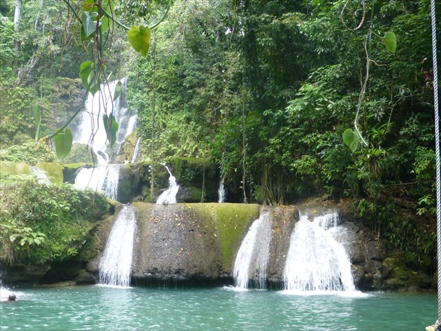
YS Falls is a seven-tiered waterfall in southern Jamaica. Pathways are provided along each of the tiers, and is an easy walk, though not wheelchair-accessible.
The Karst of YS Falls
YS Falls gets its water from the nearby mountains, through passageways buried in layers of limestone. The water inside the mountain is called a karst, and a karst spring is the exit point of the water from inside, creating the river that feed YS Falls.
Rainwater seep into tiny cracks and fissures in limestone and dissolve it. When the water finds an outlet, streams begin to flow underground. As speed and volume grow, water erodes the fissures into larger passages, smashing the tunnel walls with rock debris and smoothing them with abrasive rock particles. This system of underground passages is called a karst, named for an area in former Yugoslavia where these features are common.
On the mountainside, water enters the karst system and tumbles through many passages to a surging outlet. The result is a karst spring which creates streams that will eventually converge to create YS River.
The Y.S. Falls and River has its source in the Nassau mountains near Manchester where it rises and flows west as the border between Manchester and Trelawny, then goes underground to form the karsts. It reappears briefly in several surrounding towns, but reemerges near Balaclava and tumbles down gorges to the plain known as the Savannah, where the YS River flows down YS Falls, then to the main river before emptying into the sea.
The karstic zones in the Nassau mountains are known to contain over 130 caves. These include Mexico Cave and Wallingford River Cave, near Balaclava, which are two associated sections of a major underground river that has its source in south Trelawny, as well as Yardley Chase Caves near the foot of Lovers' Leap, and Peru Cave, near Goshen, which has stalactites and stalagmites. Mineral deposits include bauxite, antimony, white limestone, clay, peat and silica sand which is used to manufacture glass.
To log this cache, email me the answers to the following questions (DO NOT post them in a log):
- YS River is a tributary of what river?
- The water that feeds YS come from the karsts and caves in the nearby hills. Which hills do they come from, and in what vicinity?
- How many litres of water run through the river's banks each second?
- What is the name of the gift shop at the bottom of the falls?
Also, your log must include a picture of yourself with your GPS, with the falls showing in the background.
Please note, the coords are general in that it gets you to the right tourist spot. Once you're at the Falls you'll see a sign that contains the answers to the above questons.
Logging Etiquette: Geocache hiders sometimes go through a great deal of planning to place their caches. As a result, they'd like to hear your feedback on whether you liked or disliked any aspect of the hide, or if you feel that some cache maintenance is required. Single word, acronym, or emoticon logs may be easier when you have a lot of caches to log, but it doesn't tell the hider or other finders anything about your adventure (or lack thereof) in finding the cache. Please keep this in mind when entering your log.

Congratulations to Jamous for FTF!