Limski Fjord - Limskikanal - Limski zaljev
Not to mistake with the Limfjord of the same name in
Denmark!!
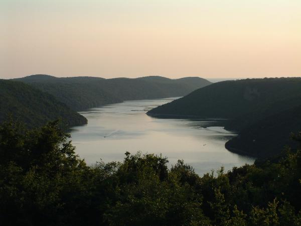
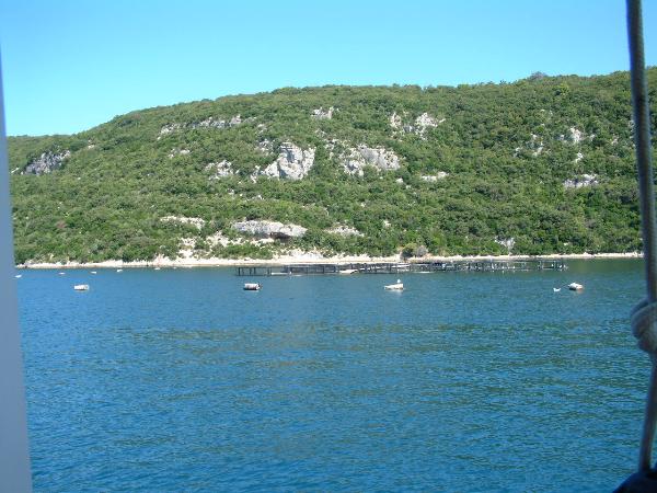
Here on the west coast conveniently between Vrsar and Rovinj it
concerns not really a fjord which a glacier has dug in the rock,
but around a Ria it has cleared away a river on his way over
millions of years. Not only the approx. 35 kilometres long Lim
valley (Limska draga) but also this 10-km-long inlet has dug here,
on her way in Adriatic the river "Pazincica".
Ria is a type of coasts with a narrow and long, deeply penetrating
into the land bay. In contrast to the fjord and promoting Ria was
not formed by glaciers. Rias rather emerge from the river valleys
that were covered by a flooding of continental areas with sea
water, without that previously would have been from a glacier. They
have therefore generally flatter than curves and lower depth
coastal fjords.
Fjords formed by valley glaciers, which flow from its origin, the
Kar, through existing river valleys. The original is here form
overprinting of the glacier by the ice sweeps rock and this further
erodes the bedrock. The original valley becomes wider and deeper,
and thereby obtains its typical U-shaped glaciated valley also
called with very steep slopes. The reason may lie a fjord up to
1000 m below sea level. It is often found in the mouth of the
fjord, a shoal, which is in connection with the flotation of the
glacier tongue. With the retreat of the glaciers at the end of the
Ice Age was the sea to flow into the deep valleys.
Here in the Lim channel is the bedrock of karst rocks. The Karst
(Karst of krš Slovenian and Croatian, which roughly means
"stony and barren ground") The surface forms are well drained and
out of water-soluble rocks (eg limestone, gypsum) are leached by
surface and groundwater. By solving processes) there is
characteristic karst phenomena on the surface (cart, sinkholes and
geologic Uvalas organs). The underground karst features are often
widely branching caves and underground rivers. From the bare karst
is called when it is removed when a lack of both the topsoil and
vegetation cover the bare rock is revealed. If a vegetation exists,
it is called a covered karst. Unless there has greater than the
karst rock weathering or deposition layer formed, the karst
features visible only through Nachrutschen the surface.
Originates from the lower salinity with the mixing with fresh water
and the oxygen salary higher thereby in the water have settled here
several fish and mussel farming. Already the bishop Eufrasius from
Porec has recognised in the year 543 the fish wealth in these
waters and has explained himself to the only proprietor.
By the foundation of the republic Yugoslavia became of the Limski
fjord again publicly accessible and in 1980 one explained the area
to a special marine reserve while swimming is expressly
forbidden.
Howeverby the car about the E751 is accessible of the Limskikanal
(Cache Limski fjord GC5ACE) but the best way to explore these up to
600-metre-wide fjord is the sea way.
At the entrance to the fjord from the land side is "Romualds cave".
It is located 120 meters above sea level. The entrance is small in
scale, so that a constant temperature is in the summer months at 12
° C. The inside of the cave is dry, patchy water drops, this
causing a drip shaped stone formations.
It originated in the well-layered thick limestone layers which vary
in thickness from 0.4 to 1.4 m and are stacked almost
horizontally
Completely at the end of the gulch is, by the way Dvigrad (Cache
Dvigrad Castle GCQCE3) which became deserted ruin town by two great
events (in the first period the smallpox and in the second ones the
plague) almost completely. Then a conflagration gave the rest to
the town and the last survivors founded the nearby city of
Kafanar
To get the log permission for this earthcache you have to answer
the following questions and to do a task:
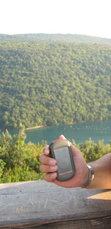
1. Take a picture of yourself with your GPS at the location
and attach it to your log (optional/like this example).
2. What is the complete word/name stated on the observation deck?
(the last 2 letters are .....AC)

3. "The Karst cave 'Romuald's cave' situated near this spot has a
length of ... meters" . (Answer can be found on the sign near the
platform or in internet) and
4. tell me the differences between a ria and a fjord.
Tell me via email your answers. Dont wait for my logpermission, if
the answer or the picture are incorrect i will contact
you!
A lot of fun and "Happy hunting" with Limfjord - Limskikanal -
Limski zaljev wishes you feuerkugelbaron with his 2nd
earthcach
In Cooperation with Volkswagenxfreak © manueL
HTML CODE für Banner