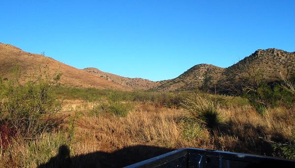
This is a location that I have visited multiple times. It is located at the head of a side canyon that feeds into Jack Wood Canyon, hence the name. The views from the cache site are spectacular, which is why I placed this cache.
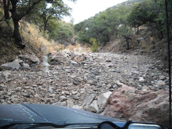
To reach this cache, drive AZ Hwy 80 to "Zent" road, then drive southwest along a dirt road towards Horseshoe Canyon. Horseshoe Canyon requires a high clearance vehicle. At the top, you turn south into Blevins Draw, which is a true 4X4 road. I cannot emphasize strongly enough that Blevins Draw is only for those with experience driving rough 4x4 roads: another option is to go by ATV. I don't recommend hiking in from the east because the mountain is so steep. Please look at the waypoints to guide you.
Once you reach the top of Blevins Draw, head up the canyon until the road ends, then climb the highest peak.
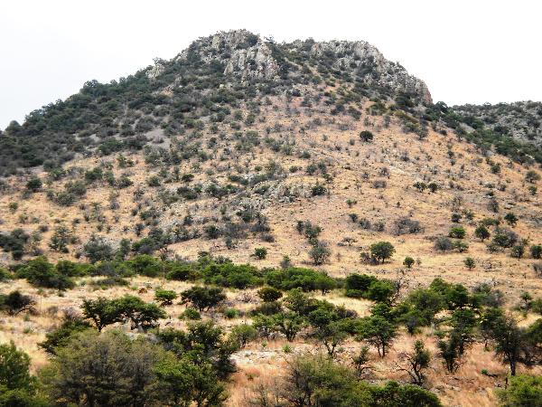
You can go to the top of the canyon to the east saddle, or climb up the west saddle. Both require a steep climb; there is no trail, but with care you can find a game trail. The climb will be 800-1200 feet depending upon your route.
Coordinates are often inaccurate in such places. I recommend that you climb to the absolute highest point, then look for a pinon pine growing out of the rocks.
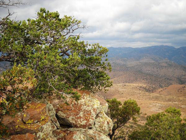
I found an interesting container under this tree, containing a logsheet dated 1996 and a second entry 2001. Obviously this stash predates geocaching, and likely was left by those climbing the peak. The cache itself is within 20 feet of this pine tree .
Because this is a difficult cache to reach, I do not anticipate that kids will be finding it. As a result, I've tried to put better swag in this one than usual. I ask that those who find it place interesting items inside.
FTF may claim a ready to go buffalo cache, which can be used to torture other geocachers by creating either an unimaginative LPC or a frustratingly difficult micro. Because of the cache remoteness, I did not leave any travel bugs. If you want to bring one, I suggest you "dip" it in and out, since the cache may not get alot of traffic
I cannot overemphasize how bad the roads are to this cache! Maps will suggest an alternate route from the south. This road is better, but crosses private land. The landowners have locked the gate and are very unlikely to let you through. The route I have described is entirely on public land, so there shouldn't be any issues with access from the north.
I am not allowed to require that those who find and log this cache upload pictures of themselves at the cache site, but would be very happy if you did!