Each picture identifies an intersection of a rural road in the
general vicinity of the cache and the distance from the street sign
in the photo to the final cache. The more intersections you find,
the more accurate your coordinates will be!
NOTE: It seems that the municipality is spending your hard
earned tax dollars on replacing these perfectly good signs with new
signs that say the same thing, but in different colors. I'm going
to leave the cache pictures as is though as you should be able to
figure out locations from the background images (and the new signs
actually have street addresses on them which takes all the
difficulty out of it). Please give me a shout if you get stuck
though.
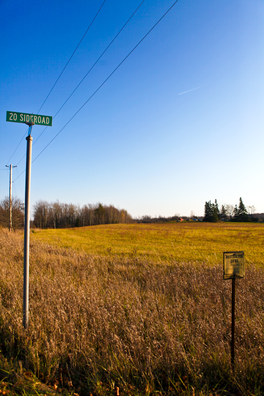
Image1 is 6.444 KMs from the final
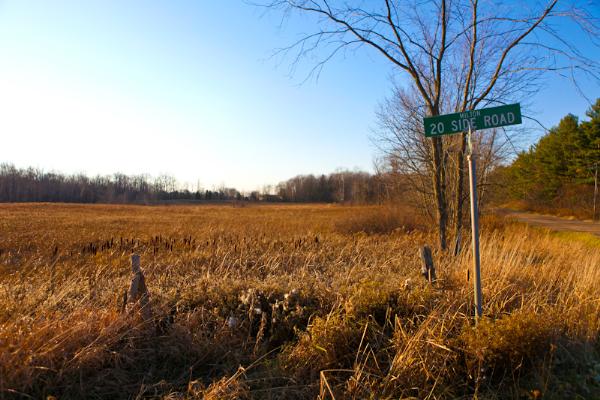
Image2 is 6.639 KMs from the final
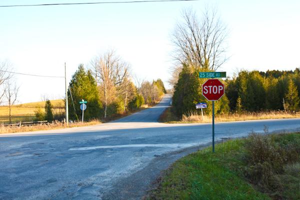
Image3 is 4.582 KMs from the final

Image4 is 3.074 KMs from the final

Image5 is 4.793 KMs from the final