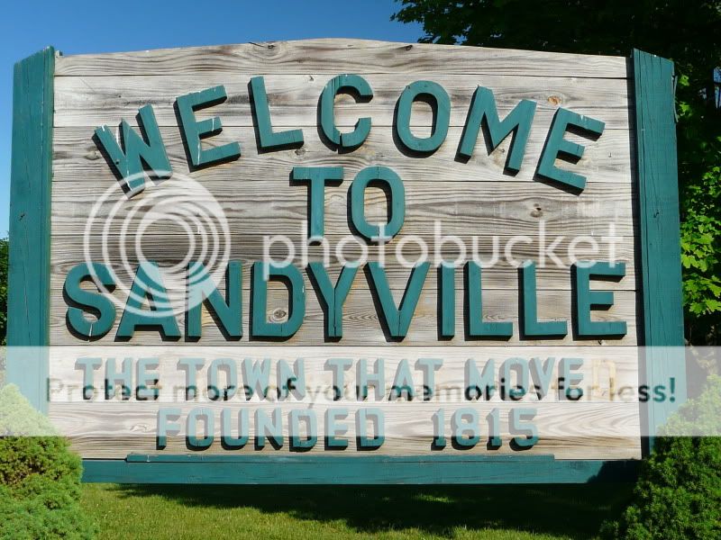
Henry Laffer founded the town of Sandyville beside the Sandy Creek
in 1815, and its history is intimately tied to the geology of the
region.
Sandyville lies in the Muskingum Watershed, which covers nearly
20% of the state of Ohio (8,038 square miles). Most of the
Muskingum Watershed lies in the unglaciated portion of Ohio,
flowing over impermeable rock strata. Sandyville lies at the edge
of the glaciated portion of the state, and for the most part the
Sandy Creek basin lies below the glacial boundary. However, the
floodplain of Sandy Creek and several of its tributaries are
underlain by sand and gravel deposits of glacial outwash origin.
These highly permeable deposits allow ground water to contribute to
well above average dry-weather flow indices in the Sandy Creek. The
deposits also allow water to be absorbed through the streambed into
the surrounding water table if there is excess water in the creek.
But if the ground is frozen or already saturated from extended
precipitation, excess water in the creek cannot be absorbed and
flooding may occur. High run-off exacerbates flooding, especially
in winter and spring, when periods of rainfall may be extended and
runoff is increased due to already wet or frozen ground.
A devastating flood in March 1913 prompted citizens to pledge
more than $2 million to learn how to prevent future disasters. In
1917 the Ohio Conservancy Act was passed. It permitted citizens of
a watershed to organize a Conservancy District to plan, construct,
and administer flood control and conservation projects. The
Muskingum Watershed Conservancy District was created in June 1933.
As a result of its planning, the U.S. Army Corps of Engineers
constructed 14 dams between 1934 and 1938 (two more dams were added
later). This became the nation’s first system of reservoirs
to impound water for flood control.
Part of the conservation and flood control plan called for a dam
to be built in Bolivar, Ohio, which would cause the town of
Sandyville to become subject to flooding. Villagers were given the
choice of abandonment or removal to a new site. In May 1937, many
of Sandyville’s residents had agreed to removal, and by
December 1 most of the town had been moved to the new site ½
mile northeast. The remainder of the town would be protected by a
levee (as it is today). Bolivar Dam was constructed in 1938.
My father, who lived in Sandyville when the homes were moved,
would have been 13 years old at the time. His home was not stable
enough to move, so the family was compensated so they could buy
another home and have it moved, instead. My sister and her family
live in that home today.
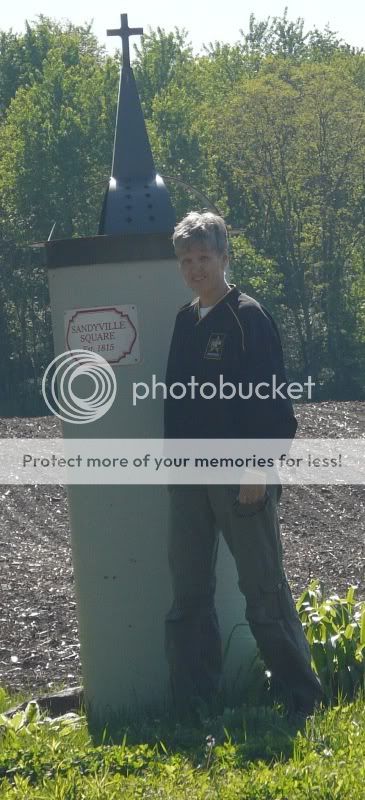
To get credit for this Earthcache, go to the posted Earthcache
coordinates and take a picture with the old town square marker in
the picture, and e-mail me the answers to the following
questions:
1. What geological evidence of flooding do you see at this
site?
2. What is the difference in elevation between the old town
square site and waypoint 40*38.425N 081*22.176W?


I have earned GSA's highest level. Go to earthcache.org to find out
how you can become an EarthCache Master, too.