 |
Wendelstein Cave
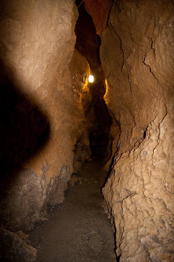
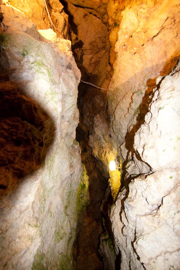
The Wendelsteinhöhle (Wendelstein Cave) is probably the most extraordinary show cave of Germany, just because of its exposed location. It is located inside the summit on an mountain, at a height of more than 1,700m, and thus an alpine cave. It is a so-called fissuer cave, a narrow gorge formed along a vertical fissure in the rock, with impressive erosional forms, but no big chambers and no speleothems. Located in the fossil-rich Triassic Wettersteinkalk, the cave walls show fossils at various locations, which were preparated by erosion.
The Wendelstein summit may be reached in three different ways: by cable car, by rack railroad or by foot. The cave is exceptionally good to reach if one takes one of the inclines, only two minutes walk to the acve entrance. The entrance fee is payed by throwing a coin into the automatically revolving door, then the visitor is free to enter the cave self guided. The natural cave is reached by an entrance tunnel, 82 steps lead down to the level of the main passage.
The natural entrance of the cave is located at the foot of southeastern wall of the summit, but it is not safe due to rockfall. But it is easy to rech the entrance from inside the cave, turning right at the end of the tunnel the path ends after 30m in the entrance hall. With a 17m high cceiling, this chamber is rather impressive, the eye looks up the steep slope to the east looking entrance portal. This place is the deepest point of the cave, cold air flowing into the cave during winter is trapped here. The air keeps cols all the year, even on the hottest days it does not rise above the freezing point. Melting water in spring, which reaches this place, freezes and forms all kind of fantastic sculptures, which stay during most of the summer.
Even more interesting is the other end of the main passage. At first it is wide and about three metres high. This part shows a heavy air circulation and is thus almost as cold as the entrance hall. But the the character changes, th passage becomes narrow and up to 15m high. After 170m the path ends in the dome. Despite its name, this is not a chamber, but the crossing between different passages. The temperature in this part of the cave is 3°C.
The main question in this exceptional karst cave is: how could it be formed on top of a mountain? The answer is simple: it was not, it was formed millions of years ago before this became a mountain. When this area looked like a hillcountry, at the beginning of the Alpine orogeny, the cave was formed by water from an catchment area to the west and south. It drained to the east, about 1,200m above the Inn valley of today. The northern rim of the Alps was uplifted continually for millions of years. At the same time the erosion and the rivers cut into the rocks. The surface was lifted too, mountain ridge formed, but the valleys more or less stayed at the altitude they were before. However, soon after this process had started the cave became dry and cave formation ended.
Your task
Go to the dom (the last "room" in the public area), there you will find a holy cross and a small signboard "Fledermausausgang".
1) Make an optional photo of you, your GPS and that holy cross
2) Send me the estimated height from the "Dom".
3) You can log at once after sending the email with your answers to me
4) If there are any problems with your answers, I will contact you. Your photo is optional, but I would be happy, if you put it to your log.
Wish you a nice walk!
Don't forget, there is an entrance fee of a 2€ coin. |