Fung Wong Shan is the second highest peak in the territory of Hong Kong. It is situated on Lantau Island and overlooks the new Hong Kong Airport – Chek Lap Kok as it is known locally - with a height of 934 m above sea level. It is most famous for the sunrise scenery viewed from the summit. Many people climb the summit to view this magnificent scene, especially in mid-summer. The mountain is actually made up of a pair of peaks, one is known as "Fung Shan" (male phoenix mountain) and the other is "Wong Shan" (female phoenix mountain), together they form "Fung Wong Shan".
There are a number of ways to get to the location of this EarhCache. The ultimate is to take the Cable Car from near Tung Chung Station [Exit B]. Alternatively one can take the Bus [#23] from Tung Chung town centre to the Po Lin Monastery. One can obviously drive to Po Lin if one has a vehicle.
Located near the Lantau Peak is the Po Lin Monastery that is well worth a visit while there. There is no charge whatsoever and the gardens and walks around the area are magnificent. It is recommended that at least 3-4 hours be set aside for a comprehensive visit to the area after doing the Earthcache. It goes without saying that the Po Lin Monastery is a very popular tourist attraction at the same time.
Geologically Lantau Island is made up predominantly of the Lantau Volcanic Group of rocks. These are from the Jurassic Period of volcanic rocks with an age of approximately 147 to 146 million years old. These rocks crop out in the west, south west and south of the island. The rocks are predominantly fine ash vitric tuff and flow-banded rhyolite lava with some coarse ash crystal tuff.
On Lantau Island, the Lantau Volcanic Group comprises mainly porphyritic rhyolite lavas and rhyolitic tuffs, with common tuffaceous sedimentary rocks. In the west, southwest and south of Lantau Island, [where the outcrops are] the group rests unconformably on the Yim Tin Tsai and Shing Mun formations. The group is estimated to be more than 1700 m thick.

In order to log the EarthCache you will need to answer the following questions via an e-mail to the developer, cincolcc(at)gmail.com
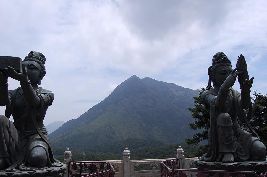
1. At the given co-ordinates, or thereabouts, you will need to take an optional photograph with your GPSr visible and the Fung Wong Shan in the background – looking due East. [See sample picture as an example.] NOTE: For wheelchair cachers I will accept a photograph taken at the base of the steps of yourself with GPSr.
2. Describe briefly the difference between vitric tuff and crystal tuff.
3. Describe briefly what you understand rhyolite lava to be.
4. There are many examples of exposed rock in the vicinity. Is the colour of the rocks light or dark? What do you think is the significance of rock being dark or light in colour?
References consulted:- http://www.cedd.gov.hk/eng/about/organisation/org_geo_pln_map.htm http://en.wikipedia.org/wiki/Lantau_Peak
Hong Kong Geological Survey Section - Senior Geotechnical Engineer: Dr RJ Sewell
FTF goes to = Naesby