
River Vydra originates from junction of creeks Roklansky, Javori, Filipohutsky and Modravsky in altitude of 980 m. It runs through a romantic canyon with number of rapids in nature preserve Povydri from Antygl to Cenkova pila. Modravsky (also known as Luzny) creek is considered as its main spring. It springs in Sumava plains on northwest slope of Lusen (1 373 m) in altitude of 1 210 m. From this spring to junction with river Kremelna by Cenkova pila is the river Vydra 23 km long. Meeting of these rivers creates river Otava.
Vydra creates in its stony channel number of rapids and cascades. Water and sand activity created lot of potholes in stones. Stony seas and balanced boulder are preserved on descents above the river valley.
For the considerable churn-hole (pothole) is the most important geological, geomorphological and hydrological conditions, gradient flow along with the shape of the valley and flow. They have generally circular or elliptical plan and cylindrical, conical or enhanced shape. The fastest form and dissipate in soft cohesive or small rocks, perfect shapes arise from deep igneous rocks and crystalline rocks. Composition of rocks, which form the valley of the Vydra, is quite diverse. If we proceed from upstream Cenkov saw first pass through the territory and Migmatite pararul. Later the southwest approaches to the left bank of massive deep igneous rock formed black mica granite. Right bank of the entire process consists of complex migmatisation rock. The effects of weathering on these occur grossly boulder rubble. Besides the geological setting for the emergence of churn-holes and important momentum flow, which is in the vicinity of Turner's cottage to 55 ‰ (the highest on the Vydra). The otter floating in water in gravel and small pebbles, water vortex which rotates in depressions softer rock or rocks, the Grind and creates little more hollow. It is in this way is growing, perhaps up to very large dimensions. These formations called "churn-holes" and are unusually great underneath a waterfall, and "giant boiler". Churn-holes occur for a longer period of time stationary rocks, near Turner's cottage in the rule, around Halkova cottage in granite.
Churn-hole in the river near Turner's cottage
The shores are here bordered of stone sea and debris fields (talus) which were orignated in cold spells of Post-Tertiary when was colder climate than nowadays. Like talus we designate angulars fragment of rock in the size from nut to the one meter big block which are orignated of weathering and break up of rock massifs which were caused of frost activity. In the Bohemian Forest are stone seas above all in the granites and eastern schists. For the production of stone seas is very important water and frost. Water infiltrates into the cracks which sporadically diffuse in the rock. Water is congeals in them in winter and magnifies here its size for 9%. This is the reason of accretion of cracks. In many repeated freezing and melting, when a crack gets more and more water, is full of excitement of rock and the separation of rock or stone rock block. The stones which are falling off are cumulated under the rock wall and create debris field. If is the rock formation disturbed and blocks remain in the place of the original rock, the formation is called the stone sea.
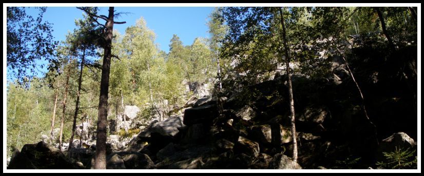 |
Sea stone near Turner cottage.
And now about the way. It is designed so that you see the most beautiful part of river to the conflux with Kremelná. Therefore I‘ll describe the path from Antýgl but you can go of course from Cenkov saw too. The „Vydra“ is fascinating in any season, but you will see it, so do not hesitate and step on one of the most amazing trails of Sumava. Proceed from the starting coordinates of the downward path around the bridge across the river to the first info table No.5 of nature trail Povydrí. Its name is „Viklany“ (rocking stones). Here is your task to make a photo with your GPS and a table. If you look to the left across the river, you see just the tors. On the nice walk we move on to the info table No.4 – „Obrí hrnce“(giant pots). There are several pots in the river in the vicinity of the cottage, so put photo of one of them. Here answer the question A. On Turner cottage is waiting for you food, but there is a little expensive. After a while of the rest go to info table No.3 – „Kamenné more“ (sea stone). Here awaits you the last photo with GPS with table behind you according to spoiler No.2 and the question B - what animal is located in the lower right corner. The animal must also be hidden on your photo! Next stop waiting for you at the info table No.2 – „Reka a lidé“ (river and people). Here turn around and see a large boulder with era - it will be question C, what era is here. The river meanders beautiful and offers beautiful scenery to the table No.1 – „Síla vody“ (the power of water). Here you can find the penultimate question D - how is expressed the geological activity of watercourse. So, after a few hundred meters you will already reach the Cenkova saw, where you‘ll find refreshments. All questions can be found on the information panels during the trip and the last question E, which I have prepared for you, you answer easily too. What is the height difference between the info table 1 and 5 ? The entire route from Antýgl to the Cenkova saw measured 6.5 kilometers but you will be not disappointed.
Insert your photo spoiler
Short clip from river Vydra
If you want to log this cache,you have to complete following tasks:

Vydra, ktera vznika u Modravy ve vysi 980 m soutokem potoku Roklanskym, Javorim, Filipohutskym a Modravskym, proteka v useku od Antyglu po Cenkovu pilu, romantickym kanonem s cetnymi perejemi prirodni rezervace Povydri. Za hlavni pramennou vetev Vydry je povazovan Modravsky potok (nekdy zvany tez Luzny), ktery pramení v sumavskych planich na severozapadnim svahu Luzneho (Lusen, 1.373 m) v nadmorske vysce 1.210 m. Od pramene Modravskeho potoka k soutoku s Kremelnou je Vydra dlouha 23 km.U Cenkovy pily se Vydra steka s Kremelnou a vznika tak reka Otava.
V balvanitém recišti reka tvorí cetné pereje a kaskády. Cinností vody a písku vznikají v balvanech cetné obrí hrnce. Na stáních nad údolím reky se zachovala kamenná more a viklany
Pro vznik výrazných obrích hrncu ( pothole ) jsou nejduležitejší geologické, geomorfologicke a hydrologicke podminky, spád toku spolu s tvarem údolí a prutok. Maji zpravidla kruhovy nebo elipsovity pudorys a valcovity, kuzelovity nebo miskovity tvar. Nejrychleji se tvori a zanikaji v mekkych nebo malo soudrznych horninach, dokonale tvary vznikaji v hlubinnych vyvrelinach a krystalickych bridlicich. Složení hornin, které tvorí údolí Vydry, je pomerne pestré. Pokud postupujeme od Cenkovy pily proti proudu procházíme nejprve územím migmatitu a pararul. Pozdeji se od jihozápadu približuje k levému brehu masiv hlubinných vyvrelin, tvorený biotitickou žulou. Pravý breh v celém prubehu tvorí složité migmatitisované horniny. Pusobením zvetrávání na nich vznikají hrube balvanitá sute. Krome geologických pomeru je pro vznik obrích hrncu duležitý i spád toku, který je v okolí Turnerovy chaty až 55 ‰ (nejvyšší na Vydre). Voda ve Vydre unáší sterk a drobné valounky, jimiž vodní vír otácí v prolákline mekcího balvanu nebo skály, kterou obrušuje a vytvárí stále malou prohluben. Ta se tímto zpusobem neustále zvetšuje, treba až do opravdu velkych rozmeru. Temto útvarum ríkáme "obrí hrnce" a pokud jsou obvzlášt velké napr. pod vodopády, tak "obrí kotle". Obrí hrnce vznikají na delší dobu nepohyblivých kamenech, v okolí Turnerovy chaty v rule, v okolí Hálkovy chaty v zule.
Brehy zde místy lemují kamenná more a sutová pole ( talus ), která vznikla v chladných obdobích ctvrtohor, kdy bylo klima chladnejší než dnes. Jako sut oznacujeme hranate ulomky hornin od velikosti orechu az po metrove bloky vznikle zvetravanim a rozpadem skalnich masivu, které bylo zpusobeno zejména cinností mrazu. Na Šumave jsou kamenná more predevším v žulách a ve svorech. Pro tvorbu kamenných morí je duležitá voda a mráz. Voda vniká do puklin, které horninu místy prostupují. V zime v nich zamrzá a zvetšuje zde svuj objem až o 9%. Tím dochází k zvetšování puklin. Pri mnohonásobne opakovaném zamrznutí a roztátí, kdy se do pukliny dostává stále vetší množství vody dochází k úplnému rozrušení horniny a oddelení balvanu ci skalního bloku. Kameny, které odpadávají se hromadí pod skalní stenou a vytvárí sutové pole. Pokud je skalní útvar rozrušen beze zbytku a kameny zustávají na míste puvodní skály, útvar se nazývá kamenné more.
A nyni k samotne ceste. Je navrzena tak, aby jste poznali co mozna nejkrasnejsi usek reky po stok s Kremelnou. Proto popisu cestu od Antyglu, ale pujde to samozrejme i od Cenkovy pily. Samotna Vydra je uchvatna v jakemkoli rocnim obdobi, ale to uvidite sami, proto nevahejte a vkrocte na jednu z nejuzasnejsich stezek Sumavy. Od výchozích souradnic postupujeme po klesající ceste kolem mustku pres reku až k první info tabuli c.5 naucné stezky POVYDRÍ. Její název je VIKLANY. Zde bude Vaším úkolem porídit vaše foto s GPS a tabulí. Pokud se podíváte nalevo pres reku, spatríte práve tyto tory. Peknou procházkou postupujeme dále až k info tabuli c. 4 – OBRÍ HRNCE. V okoli chaty je jich v rece nekolik, vložte foto nekterého z nich. Zde zodpovezte otázku císlo A. Na Turnerove chate Vás ceká obcerstvení, je zde ale trochu draho. Po chvíli oddechu jdeme až k info c.3 – KAMENNÉ MORE. Zde Vás ceká poslední foto s GPS s tabulí za zády dle spoileru a otázka B – jaké zvíre se nachází v pravém dolním rohu. Na vašem fotu musí být také zakryto ! Další zastávka vás ceká u info c.2 – REKA A LIDÉ. Zde se otocte a uvidíte velký balvan s letopoctem – to bude otázka C, jaký je zde letopocet. Reka se krásne vine a nabízí nádherné scenérie až k tabuli c.1 – SÍLA VODY. Zde na Vás ceká predposlední otázka D – jak se projevuje cinnost vodního toku. Tak,a po pár stech metrech již dojdete na Cenkovu pilu, kde si mužete dát opet obcerstvení. Všechny otázky najdete na informacních panelech behem cesty a poslední E, kterou jsem pro Vás prichystal, dáte také snadno. Jaký je výškový rozdíl mezi informacním panelem c. 1 a 5 ? Cela trasa od Antyglu az na Cenkovu pilu meri 6,5km ale nebudete zklamani.
Vlozte Vase foto dle spoileru
Podminky, za jakych muzete zalogovat tuto kes: