Bluestack Driving Tour #5 - Disert
Graveyard
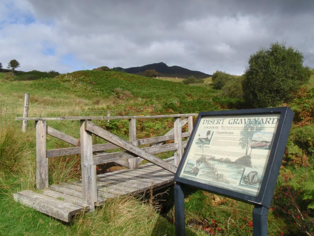
Disert is situated in the Bluestack Mountains approx. 6 miles
NE. of Donegal Town and approx. 2 miles from Drimarone. It can be
accessed from the scenic Bluestack Drive and is featured on the
Ordnance Survey Map, Discovery Series No. 11. Directly beneath
Carnaween Mountain, Disert is the site of an ancient Graveyard and
a Holy Well dating to the times of St Colmcille. The walk, which is
two miles in length, circles this National Monument and utilises
existing roads and tracks. There is a link into the graveyard site
where there is a Mass Rock, Well and Standing Stones (Dolmen) as
well as other artefacts associated with Religion and Folklore. The
walk is suitable for walkers of all levels of ability and there are
many vantagepoints offering magnificent views of the surrounding
Bluestack Mountains and Donegal Bay. Flowing through the site is
the Eany Beg Water and a small tributary of this river that has cut
a gorge into the hillside making a fine waterfall. This short walk
provides plenty to see in this dramatic landscape, which still
remains relatively unspoilt.
Carnaween
Towering over Disert is Carnaween, at 1716ft. the highest mountain
in the parish. The track then descends the hill to the Eanybeg
River. On Heatherberry Sunday Carnaween is still climbed by young
people from the surrounding areas. Unlike other places when
Heatherberry Sunday is on the last Sunday of July or the first
Sunday of August, Carnaween is climbed on the first Sunday of June.
Tradition has it that on this day, all the single men and women
from the Inver and Glenties areas would meet on top of Carnaween
and hopefully would meet and fall in love with someone, and get
married.
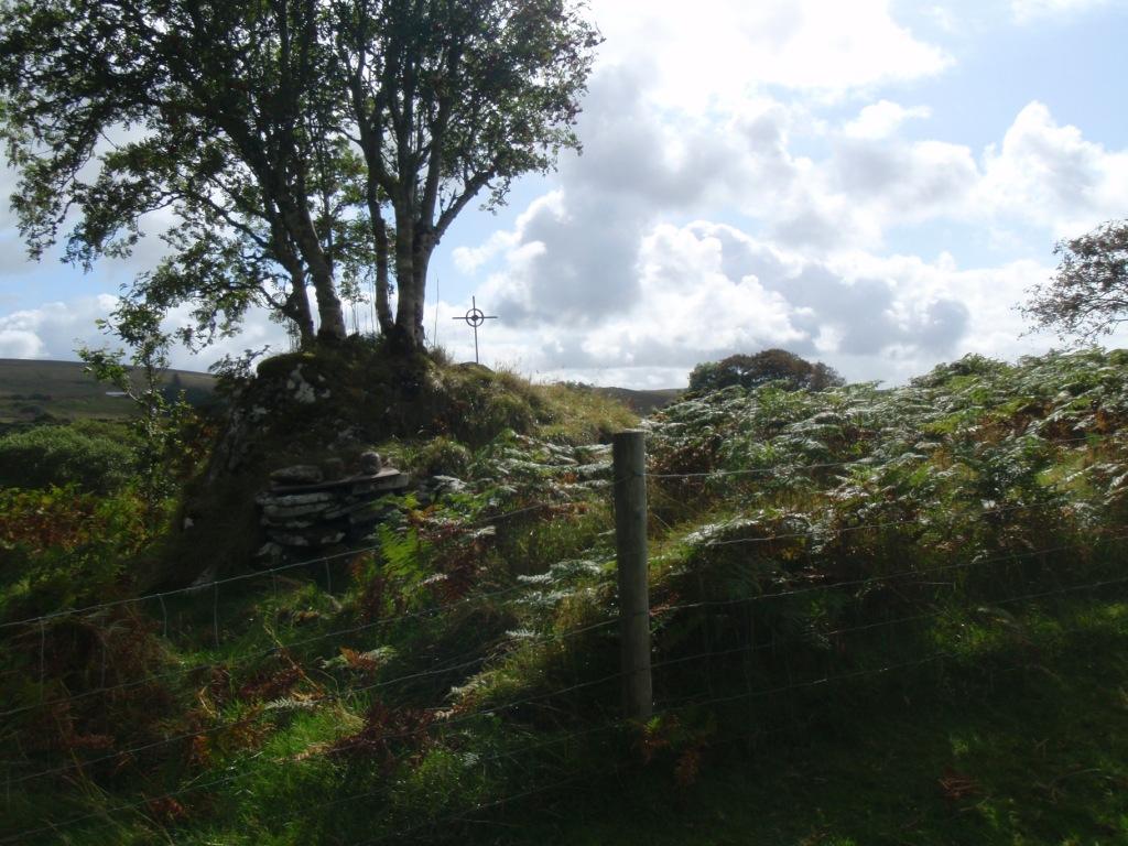
The Alter & Graveyard
According to tradition Mass was celebrated on the Disert altar in
penal times. The priest was said to travel up and down the river
Eany between the Alt in Ardaghey saying mass in each on alternate
Sundays. The bullaun stones were said to have been used as candle
holders. Fr. Dominic Cannon was parish priest of Inver from the
1770"s until his death in 1801. He is said to have been the last to
celebrate Mass in Disert. The Catholics continued to use one side
of the graveyard for burying their dead until the new graveyard
opened in Frosses in 1841. From then on no priest would officiate
at funerals in Disert and the graveyard fell into disuse. The
graveyard at Disert continued to be used for the burial of
unbaptised infants until the 1930s. Stories were told of mysterious
happenings in the graveyard. Once when the people were fixing up
the crosses on gravemarkers a horse came through the graveyard and
knocked them all down. However, the following morning they were all
standing in their places as they had been. On another occasion the
candles were maliciously taken from the altar and thrown down the
Eany River. Next morning the candles were back where they had been
on the altar.
Disert Clay
Like other Columban sites in Donegal, such as Gartan and Tory, the
clay at Disert is said to banish rats. The clay must be lifted from
the right hand side of the altar and in former times great stress
was laid on it being asked for and received with great reverence.
Newspaper reports have suggested that uranium in the clay caused it
to banish rats but these reports haven"t lessened the belief in its
power. Until recently Disert clay was often put in the foundation
when houses were being built. Michael John Blake, N.T, mentions the
clay in a local poem. "Roundup in Disert". Which tells of an
incident during the Civil War in the autumn of 1922. Four
Republicans-natives of Co. Cork- who were on the run were
sheltering in Disert. The Free State soldiers came to arrest them
and a shoot out took place. The last verse tells how it all ended.
"The Disert clay had won the day By slopes of Carnaween The Staters
fled next day was said And never since was seen. The rebels cleared
when the dawn appeared They were loath to leave the ground But they
choose to go and fight their foe Far away from Shanveen Town".
Download a Guide to this
series
here and a Mapsource Route
here.
Total Distance: 112Km
No. Of Caches: 10
Approx Duration: 2 ½ - 3 hrs
Road Type: Mainly 3rd class roads. Please keep
speed down and be prepared for the unexpected, such as children,
livestock, walkers, cyclists, agriculture vehicles etc.
If you want to explore the history and the scenery of the
Bluestack Mountains without the effort, then this series is for
you. The route will take you through the heart of the Bluestacks,
with each cache telling a story of a particular aspect of the
mountains, from history to geology of the mountains.
Whilst it can be completed in a couple of hours, we recommend
bringing a picnic and spending the day here exploring this magical
place.
To reach the graveyard, park at the above co-ords and follow the
signs which will lead you through a field. After heavy or prolonged
rain, wellies or stout boots will be required as it can get very
boggy even on a dry day. Please close all gates and bring no dogs
etc.
The Cache is a large cliplock container. Please take care to
rehide properly to avoid detection.

Visit the Geocaching Ireland discussion
forum HERE