The Great Lakes comprise the largest inland lake system on Earth. They were formed during the Ice Age, during which the layers of snow built up into ice sheets, or glaciers, which were up to10,000 feet thick.
As these glaciers moved southward they scoured severely into the earth's crust, dislodging and bulldozing billions of tons of soil and rock. The glaciers advanced to the area that is now just north of Cincinnati, Ohio. As the earth's temperature progressively began to rise, the glaciers began to retreat northward. The water from the melting ice filled in the basins created by glacial erosion, forming the Great Lakes.
Because the underlying limestone bedrock of western Lake Erie is harder than the soft shale to the east, the glaciers eroded these rock more slowly. Therefore, the western end of Lake Erie is shallower, with about two dozen islands. The largest of these is Pelee Island in Ontario, Canada. The Marblehead Peninsula is composed primarily of limestone, which is actively mined at the Marblehead Quarry, a few miles to the southwest of this site. Marblehead Quarry produces approximately 4,000,000 tons of crushed limestone per year.
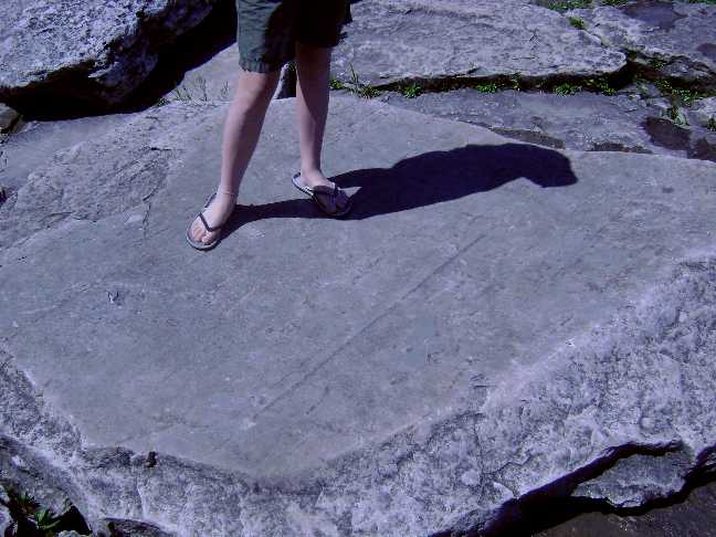
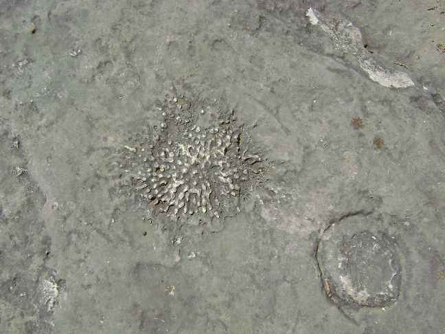
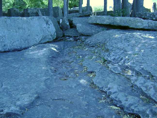
Although not nearly as pronounced as those on nearby Kelly's Island, the grooves seen in the rocks next to Marblehead Lighthouse were created by glacial movement. Like the Kelly's Island grooves, these grooves were probably formed during the Wisconsin Glacier. The ice, which was possibly thousands of feet thick, flowed from the north and formed what is now the Lake Erie Basin. Large numbers of rocks, stones, and gravel were dragged along the ground by the glacier, scouring grooves and scratches into the limestone bedrock beneath, which contains numerous marine fossils.
There are several small grooves in the general vicinity of the lighthouse.
To log this Earthcache, please complete the following:
1. Find one of the grooves at the posted coordinates. Email an estimate the length and depth of the groove to the owner of this cache.
2. Research online information regarding the formation of glacial grooves. Email at least 2-3 sentences describing interesting facts you found, along with the URL of the website(s) where you found the information.
3. OPTIONAL Take a photo of the groove used for #1, and post it with your log.