End Moraine / Endmoräne Judenburg EarthCache
End Moraine / Endmoräne Judenburg
-
Difficulty:
-

-
Terrain:
-

Size:  (not chosen)
Please note Use of geocaching.com services is subject to the terms and conditions
in our disclaimer.
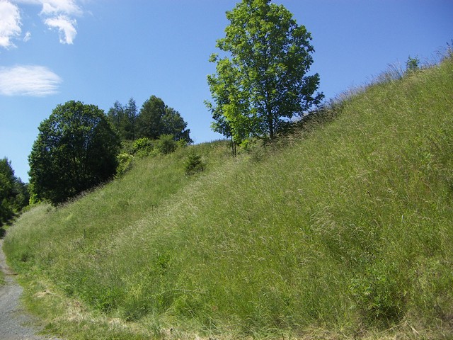
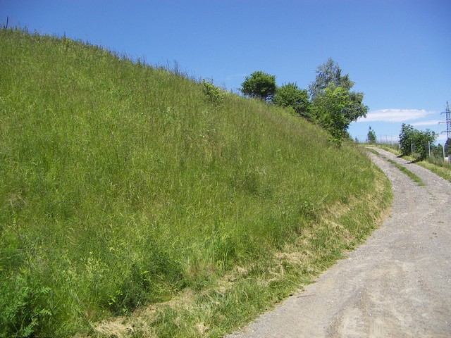
Eine Endmoräne ist die wallartige Aufschüttung von
Gesteinsmaterial am Ende des Gletschers.
A terminal moraine (also called an end moraine), is a pile of
debris that forms at the end (or snout) of the glacier.
Der Murgletscher war für die Oberflächengestaltung Judenburgs
ausschlaggebend. Sein Nährgebiet war der gesamte Lungau und das
Murtal selbst bis über die Katschmündung hinab. Das gesamte
Eiszeitalter brachte eine grosse Talvertiefung. Vom Ende des
Gletschers an wurde der Talboden wieder mit
Schmelzwasserablagerungen erfüllt, die eine markante
Terrassenlandschaft ergaben.
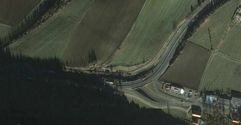
Die Endmoräne stammt von einem Würmgletscher und befindet sich 3 km
westlich des Ortskernes von Judenburg. Vorwürmzeitliche Endmöränen,
die aber nur mehr in sehr kleinen Resten vorhanden sind, finden
sich etwa 6 km vor dem Ende des Würmgletschers bei Maria Buch.
Diese stammen wahrscheinlich aus der Risseiszeit.
Vor der Würmendmoräne liegt das Zungenbecken des Gletschers. Das
ziemlich schmale Sohlental der Mur, dessen Breite in der Regel
einen km nicht übersteigt.
Um den Cache loggen zu dürfen erfülle folgende Aufgaben und
schick mir die Antworten via Mail:
1) Mach ein Foto von dir an den Headerkoordinaten und poste es
beim Log.
2) Wie hoch schätzt du die Endmoräne vom Strassenniveau aus?
3) Wann endete die Würmeiszeit?
The Murglacier played a decisive role in the formation of the
Judenburg area. At one time, the glacier covered the entire Lungau
and the Murtal as far as the Katschoutfall. As the glacier receded
toward the end of the ice age, it left a large valley which
eventually filled with melt water. As the melt water evaporated, it
resulted in the distinctive terraced landscape you see today.
The end moraine, located 3 km west of the city center of Judenburg
was formed during the “Würm” glacial period. Some smaller pre-Würm
moraines can be found close to Maria Buch. These probably date from
the Riss-ice age.
At the base of the Würm moraine, the enclosed basin of the glacier
can be found. The width of the valley generally less than 0.8
miles.
Please send me the answers of the following questions via email
to obtain the log-permission:
1) Post a photo of yourself at the header-coordinates and post it
along with your log.
2) How high do you believe that the moraine is above street
level?
3) When was the end of the Würm glacial period?
Additional Hints
(No hints available.)