The Devil's Elbow EarthCache
-
Difficulty:
-

-
Terrain:
-

Size:  (not chosen)
Please note Use of geocaching.com services is subject to the terms and conditions
in our disclaimer.
The Devil's Elbow is also an unincorporated
community in Pulaski County on historic U.S. Highway 66. It is
situated on the Big Piney River. It is about five miles (8 km) east
of St. Robert, MO. and a few miles from I-44.
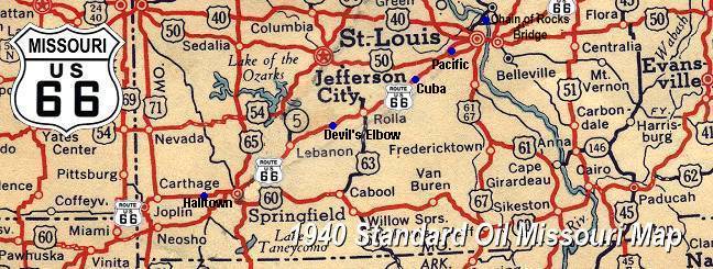
An Old Map Of The Area
This EarthCache is dedicated to our son Captain Robert
R. Burress of the U.S. Army. We were at Fort Leonard Wood to
witness his graduation from the Captain’s Career Military
Police School. While we visited the area, we found this lovely spot
and thought it was appropriate to dedicate this EarthCache to
Robert. Best of luck and God’s speed to Captain Robert and
his service to our Country.
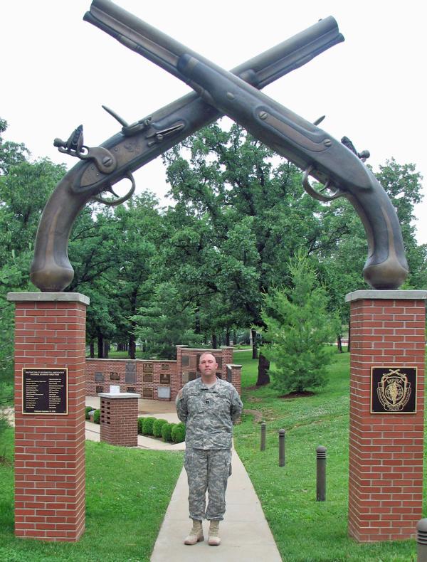
Captain Robert R. Burress
Beside the dolomite/sandstone cliffs which rise above the
Big Piney river, there is a huge dolomite/sandstone boulder which
fell and resides in the bend (meander) of the River. Historically,
this boulder often was the cause of major log jams as local
lumberjacks attempted to float their logs down the Big Piney to
nearby mills. No matter what they did, the boulder always seemed to
win……..LOG JAM! Over the years and a whole lot of
cussing later, this area became known as the “Elbow of the
Devil”. After a short period of time the name the Devil's
Elbow stuck.
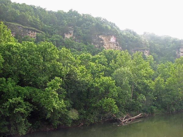
The Cliffs Above the Elbow
"The view of the tall bluffs of Gasconade dolomite visible
from the bridge was once described as being one of the "seven
scenic wonders of Missouri" in literature from the Missouri
Planning Commission. The town of Devil's Elbow is considered
to be one of the highlights of a tour on Missouri Route 66. The
area is home to the Big Piney River and the scenic Devil's
Elbow bluffs, Sheldon’s Market which doubles as the
Devils Elbow Post Office, The Elbow Inn Bar And Grill which
originally opened in 1929, and last but not least, an old steel
truss bridge across the river." It is from this bridge that you
view the EarthCache. Parking is just before arriving at the bridge
(see coordinates). The bridge is seldom used and is wide enough but
watch for stray vehicles.
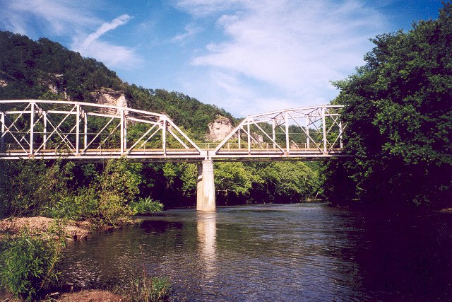
The Bridge
A brief description of the
area’s geology
The Devil’s Elbow of the Big Piney is a
meander that was preserved when the Ozarks Mountains were uplifted
and the river was rejuvenated. Prior to the uplift, the Mountains
had been eroded down to a flat plain, which is common to old
erosional settings. As with the Mississippi and other ancient
rivers, the river had slowed and was curving across a wide
floodplain. When the region was once again uplifted, the river was
downcut from its existing position, thus preserving the meandering
course. Such entrenched meanders or curves are common to rivers
throughout the Ozarks.
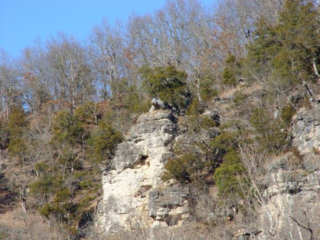
The oldest geological formation that outcrops is the
Canadian Series Ordovician-age Gasconade dolomite. The dolomite
underlies the Big Piney River as well as being exposed as the bluff
along the River. The pre-erosion thickness of the Gasconade
dolomite is thought to be between 200 and 300 feet. The Roubidoux
formation overlies the Gasconade dolomite. It varies from dolomite
to cherty dolomite to sandy dolomite to sandstone. The contact of
the Roubidoux and Gasconade Formations is present at the top of the
bluffs overlooking Devil's Elbow. Due to the resistance of
the Roubidoux formation, several small overhanging ledges of
Roubidoux sandstone are present along the bluffs at Devil's
Elbow and others along the Big Piney. One rock protrusion of
sandstone above Devil's Elbow is called the "Devil's Tongue"
by older generations and "Lizard Rock" by those who are younger.
There are other names, which refer to certain other body parts of
the devil, but discretion prevents printing them on this
page.
The Devil's What??
NOTE: In order for you to claim a find on this
EarthCache you must complete the following: 1. Post a photo
of your GPS pointing to the Devil's Elbow cliffs. (Optional!) While
it would be nice, it is not necessary to show your face in the
photo. 2. Email answers to the following questions:
(A). Estimate the height of the cliffs, (B). What is
your GPS elevation reading at this spot? (C). Describe the
most unusual outcrop from the cliffs. (keep it clean). Be sure to
answer via email only. Please don’t post the
answers.
Please enjoy the EarthCache and take a lot of pictures. A
good zoom lens will help. In the nearby town of Waynesville is a
wonderful EC called Roubidoux Spring. Drive the short distance and
marvel at the flow of the spring and the unusual rocks found on its
banks.
This Earthcache was approved by the
Geological Society of America
| We have earned GSA's highest level: |
 |
Additional Hints
(Decrypt)
Vs lbh zbir dhvpxyl, gur Qrivy znl abg rira xabj lbh jrer gurer!