Skocjan Doline EarthCache
-
Difficulty:
-

-
Terrain:
-

Size:  (other)
Please note Use of geocaching.com services is subject to the terms and conditions
in our disclaimer.
The Skocjan doline was basically formed by the river Reka (in slowenian a river is called reka, so the river is called River).The reka river springs at Sneznik SO in Ilirska Bistarca. It is themain water-source from the northern part of Birkini.
Description
A doline is a closed depression draining underground in karst areas. It can be cylindrical, conical, bowl- or dish-shaped. The diametre ranges from a few to many hundreds of metres.
The name doline comes from dolina, the Slovenian word meaning valley. So this was originally a colloquial Slovenian word which was used by the geologists to describe a geologic feature.
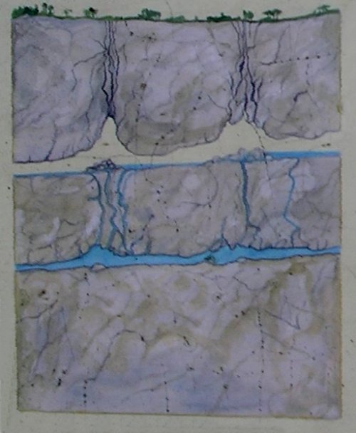
There are two different mechanisms for the forming of dolines:
* solution
The corrosive solution of limestone by rainwater is very high in the area of crack, allowing the water to run into the rock. This normally forms the bowlshaped type of dolines.
* collapse
When a cave grows, there may be a point where the roof of a cavern is not stable enough. This results in (several) collapses that shape the roof like a dome. This process runs out, when the shape is able to hold the weight of overlying rocks.
If the impact of this collapse reaches the surface, if the overlying layers are too thin. The ceiling collapses and a doline is formed. The doline is often a natural entrance to the cave.
Karst Development Phases
1. Inital phase
Limestone reaches the surface and gets subject to weathering.
2. Youth phase
Ground water starts with the solution of limestone and forms first caves. A lower drainage system around the limestone area is necessary for the second stage: the rivers and lakes leave the surface, drainage of the whole area is underground. This is the "typical" stage of a karst area, which we know well from moderate climate zones.
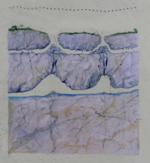
3. Mature phase
The limestone caves get bigger and bigger and start to collapse. Cave systems are marked at the surface by daisy chains of dolines. Dolines merge and form poljes.
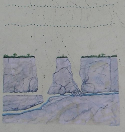
4. Aging phase
The cave systems are more or less collapsed. The former poljes grew and grew until they are all connected and again form a net of subaerial valles draining the area. The former limestone plateau is cut into isolated limestone islands.
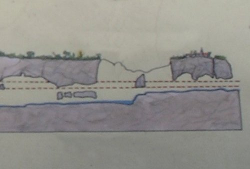
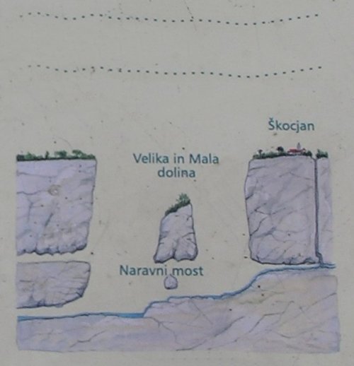
The making of the Skocjan doline:
The river flows under the surface and relieve material
It becomes a subterranean grotto.
Because of the karst-surface water from the surface gets in the earth and relieve a lot more material. At any time, the ceilling collapsed and the doline was born.
To log this earthcache you have to answer the following questions:
1. What is the depth of the doline?
2. What is the approx. distance from the viewpoint to Skocjan?
Please verify your answers here in the geochecker:

Please upload a picture with your and/or your GPS in front of Skocjan.
Additional Hints
(No hints available.)