Saqqara EarthCache
-
Difficulty:
-

-
Terrain:
-

Size:  (not chosen)
Please note Use of geocaching.com services is subject to the terms and conditions
in our disclaimer.
Geophysical and topographical surveys in Saqqara


|
|
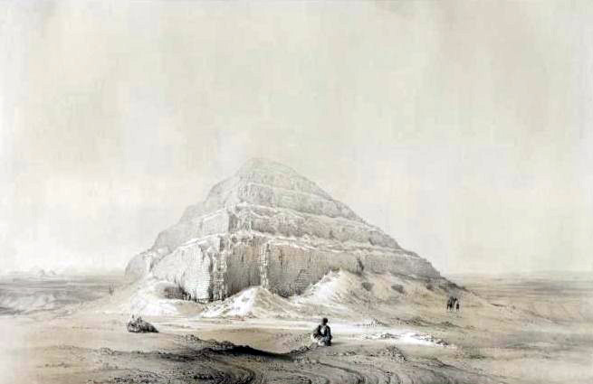
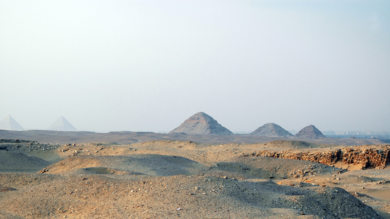
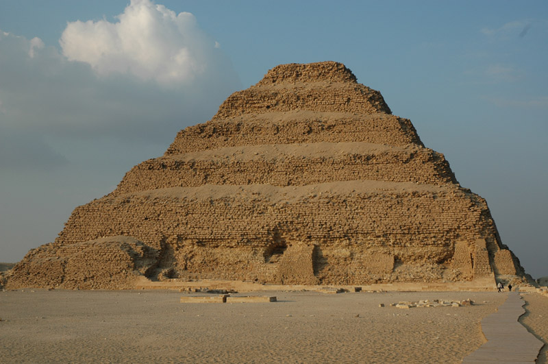
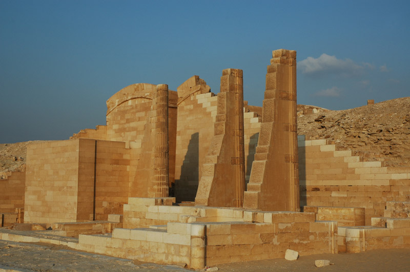
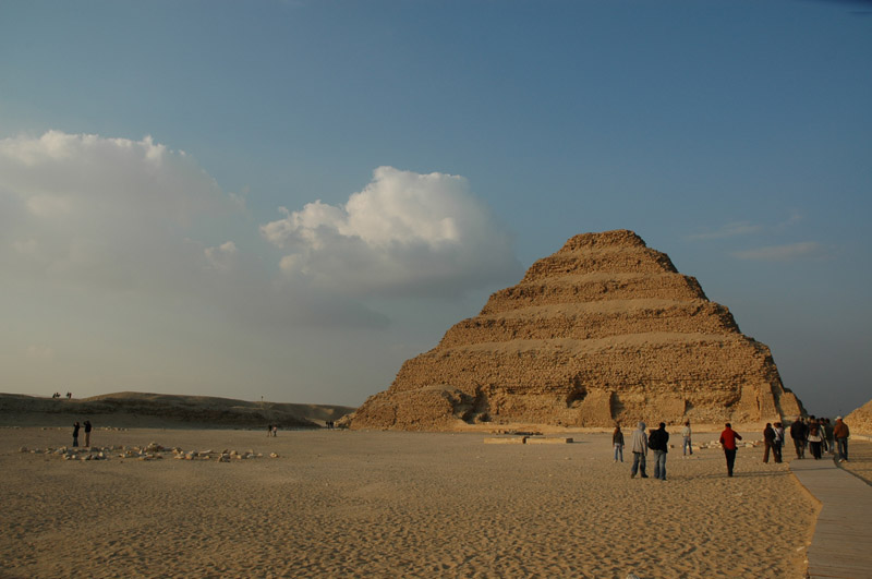
Saqqara, Sakkara or Saqqarah is a vast, ancient burial ground in Egypt, serving as the necropolis for the Ancient Egyptian capital, Memphis. Saqqara features numerous pyramids, including the world's oldest standing step pyramid, as well as a number of mastabas. Located some 30 km south of modern-day Cairo, Saqqara covers an area of around 7 km by 1.5 km. |
|
|
Geology
Topographically, Saqqara area is a relatively low relief with altitudes varying from 30 to 80 m above sea level. Geomorphologically, it comprises of flood plain, flood plain fringes, the pediment plain which extends between Saqqara plateaus and the Nile flood plain and the plateau, where Saqqara pyramids are found. Lithostratigraphically, the shallow geologic section of Saqqara area composed of Quaternary deposits which comprises of river terraces of sands and gravel with a thickness varying between 30 to 180 m. These were underlined by gravel units (10 m) of Pleistocene, which underlined by Pliocene formations. Pliocene rocks are varying in composition from limestone to marl and sandstone with total thickness about 23 m. This unit overlaps the Eocene formations with angular unconformity. Eocene rocks are represented by a sandy to marly yellow limestone. These rocks uncomformably lie over the Cretaceous limestone rocks.
Geophysical and topographical surveys
Recent discoveries confirmed the value and accuracy of the geophysical and topographical surveys. The use of the gradiometer to delineate sub-surface features has been amply proved by the small-scale sondage trenches (sondage is a sounding trench which allows the depth to be judged) which were excavated in 2001, 2002 and 2003 to test the anomalies, which are differences in readings showing that a structure or geological feature is causing the data increase or decrease, in this case most probably mudbrick tombs, temples or chapels. In all cases, the accuracy of the topographic survey has allowed the research team to open the sondage exactly over the anomaly shown by the geophysical data. The saving of labour time, and the ability to keep excavation to strict limits, means the environmental damage is controlled and the archaeological interpretation of the site enhanced.
Seeing Beneath the Sand - The Geophysics
The project uses the techniques of modern science to explore the remains of ancient Egypt hidden beneath the sand. The methods used are either active (touching or probing the ground), or passive (not touching the ground).
Resistivity
An active method where the probes are pushed into the ground. An electric current is passed through them and measured. Some materials allow electricity to pass easily but others are very resistant. Looking at how these measurements vary over an area makes it possible to locate objects buried beneath the sand. This method is excellent for finding walls and large stone structures up to 10 to 15 metres below the surface.
Conductivity
A passive method of measuring the electrical properties of underground materials. A 4 metre long plastic pole has a transmitter at one end and a receiver at the other. The difference in the electrical properties of the material below the pole can then be measured. The survey is made at walking speed, so large areas can be covered quickly and depths of up to 4 metres can be penetrated. This gives a good general picture of the area.
Ground Penetration Radar
An active method where a transmitter and receiver are pulled along the surface. Radio waves are sent through the ground. They continue to travel until they meet an object, which reflects them. The radio waves bounce back to the surface and the time taken to travel the distance can be measured. The results produce a picture of what is under the ground to a depth of 3 to 4 metres. This method is very useful for locating individual graves and tombs.
Magnetic Gradiometer
A passive method that measures the magnetic field of the earth and compares this with the magnetic fields produced by the materials beneath the instrument. When plotted, this builds up a very good picture of what lies 3 to 5 metres below the ground. This method is excellent for picking up mud-brick structures. The computer picture looks just like an aerial photograph of surface ruins, when they are actually buried deep beneath the sand.
New discoveries applying the method
In 2002 and 2003, the Saqqara team did extensive geophysical surveys of the area and discovered many tomb structures and a complicated area of structures which could be large tombs subdivided by smaller burials, workshops or living quarters. The team decided to extend the survey to the east and south, covering areas of disturbed ground where excavations during 1850 to 1960 had uncovered many structures without accurately surveying or recording them. The structures were now covered by windblown sand and lost to records. In 2004, a number of finds were recorded. In addition to several large mastabas (rectangular brick or stone tombs) and smaller structures, the major find of the season was the re-discovery of the Serapeum Way which Mariette had excavated in 1852. Mariette had found 135 sphinxes lining the ceremonial route from the Pyramid of Teti to the Serapeum along which the Apis bulls were taken for burial in the underground galleries of the Serapeum. Further excavations by Mariette uncovered the dromos entrance (dromos means ceremonial approach to the Serapeum), the galleries and the temples to Serapis and Apis, as well as a semicircle of statues to the Greek philosophers and poets. Most of the sphinx statues are in the Cairo Museum and in the Louvre, and the whole area - with the exception of the philosopher's statues - is again buried under many metres of sand. |
|
|
The EarthCache of Saqqara
To succeed in this Earthcache, you will have to email me the answers to the following questions :
1- Take a picture with you, your GPS and the Djoser pyramid
2- What is the best method for picking up mud brick structure?
3- What is the average altitude of Saqqara ?
4- Where is Auguste Mariette buried ?
|
Additional Hints
(No hints available.)