From Hwy #400 N take the S. Gibson Lake Road
(District Road #33) to the end where you may park. From here
a brief walk along the ATV trails will take you to the entrance to
the Five Winds Trail that connects Georgian Bay to the wilderness
along the Gibson River and many Kilometers further
East.
The
Hike
On May 2, 2009 we placed 3 caches in the
area. All three can be reached by hiking along the "Five
Winds Trail" with the final cache at Long Falls on the Gibson
River. The full hike to Long Falls is about 7K from the
parking area and although the trail is well marked with yellow
flags there are times that they disappear altogether. Water
hazards created by a beaver dam must be hiked through as the trail
goes right through the wetland and the elevation changes are
constant. Phew, hard work just thinking about it.
NOTE: Never hike the
wilderness alone. This cache and the others we placed in here
require a challenging hike through hard terrain, Be
prepared!
"Five Winds
Summit"
The "Five Winds Summit" cache is about 2/3 of
the way to "Long Falls" and it is placed to mark the correct trail
route to take as you are at a junction here and you must continue
past the cairn on the left trail and not to the right on the Lone
Lake Trail. This is about the highest point on the hike but
is a little misleading to call it a summit. Someone has gone
to a lot of effort here to build an amazing cairn of rocks to mark
the trail.
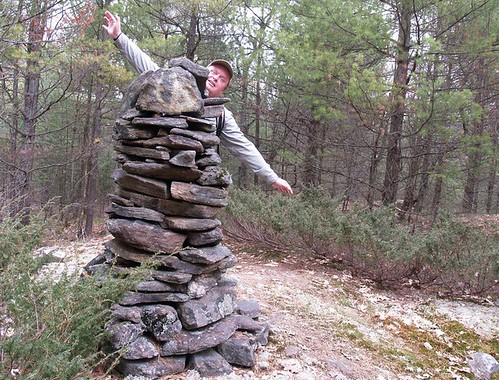
Above: Watch which
way you go.
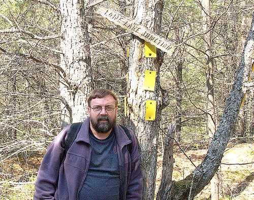
Above: Permakay
holds up a tree at Lone Lake Junction.
The cache is a 35mm
film container attached by string to a tree near the cairn.
NOT IN THE CAIRN!!! I know, micros in the wilderness, but this one
was placed to draw attention to the trail direction and not to be
an awesome cache. Besides its still an awesome spot.