La cache a
été déplacé pour cause de travaux The hiding place been moved because of
jobs
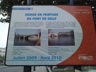 HISTOIRE
 Reliant les IVe
et Ve arrondissements dans l’axe du boulevard Henri-IV pour
arriver boulevard Saint-Germain, il s’agit en fait en deux
ponts distincts, chacun prenant appui sur l’extrémité amont
de l’île Saint-Louis. Le pont vers la rive droite débute quai
Henri-IV pour finir quai d'Anjou, et celui vers la rive gauche
commence quai de Béthune pour déboucher sur les quais Saint-Bernard
et de la Tournelle. Au XIXe siècle, les deux parties distinctes de
ce pont étaient appelées Passerelle Damiette côté rive droite et
Passerelle de Constantine côté rive gauche. Il s'agissait de deux
passerelles suspendues construites par Surville. La première sera
détruite pendant la révolution de 1848, l'autre (construite entre
1636 à 1638) s'écroulera suite à la corrosion des ses cables en
1872. Le pont actuel fut construit en 1876, dans le contexte des
grands travaux du baron Haussmann, et inauguré le 25 août 1877. Son
nom honore Maximilien de Béthune, duc de Sully (1560-1641),
ministre d'Henri IV. Ce double ouvrage est l'œuvre des
ingénieurs Paul Vaudrey et Gustave Brosselin. (M) Ce site est
desservi par la station de métro : Sully - Morland. HISTORY Linking
up IVth century and Ve arrondissements in the axle of the boulevard
Henry-IV to arrive boulevard Saint-German, it is in fact in two
distinct bridges, each taking support on end upper reaches of the
island Saint-Louis. The bridge towards the Right Bank starts quay
Henry-IV to finish quay of Anjou,and that towards the Left Bank
begins quay of Béthune to unblock Saint Bernard on quays and of
Tournelle. In XIXth century, both parties distinct from this bridge
were called Footbridge Damiette side Right Bank and Constantine's
Footbridge side Left Bank. It was about two hanging footbridges
constructed by Surville. The first one will be destroyed during the
revolution of 1848, other one (constructed between 1636 in 1638)
will collapse further to corrosion of its cables in 1872. The
actual bridge was constructed in 1876, in the context of big jobs
du baron Haussmann, and was inaugurated on August 25th, 1877. His
name honours Maximilian de Béthune, duke of Sully
(1560-1641),minister of Henri IV. This double work is the work of
the engineers Paul Vaudrey and Gustave Brosselin. (Metro) This site
is served by the tube station: Sully - Morland.
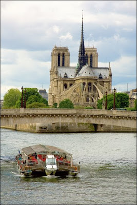 (Photo by encrier)