MILFORD SOUND – PIOPIOTAHI
Maori name meaning "a single thrush" from a legend which told that when Maui lost the treasure of immortality to the Goddess of Death, Hine-nui-te-Po, a thrush flew to this place to sorrow for the death of its mate.
Milford Sound, is the most northerly of the 14 fiords spanning the 215km south-western coastline of Fiordland National Park. Fiordland is New Zealands largest national park and a UNESCO World Heritage Site. It was first discovered in 1823 by a Welsh Sealer, John Grono, who named it after his birthplace, Milford Haven.
Sounds or Fiords?
A true "Sound" is a river valley that has been drowned due to the land sinking below sea level. Fiords are created by glacial action that produces u-shaped valleys with steep cliffs, and are also characterised by shallow entrances that slope quickly seaward to deep water. Although the famous Sounds continue with the misname, the region was renamed Fiordland to recognise this error.
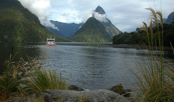
The Milford Fiord occupies the trunk portion of a formerly glaciated valley stem cut deeply below the surrounding mountains. From its head, the Sound follows an irregular course for 16 km, out to the Tasman Sea, and has an average depth ranging between 100-450m. Mitre Peak dominates the skyline at 1692 metres, a pinnacle of rock that forms the world's highest sea cliff.
Marine Environment
Milford Sound is one of the wettest places on earth, with an average annual rainfall of 7.5m. Where it rains or snows on average, 182 days a year. During heavy rainfall, thousands of temporary waterfalls cascade down the steep mountain sides into the fiord below. This massive volume of rain creates a permanent fresh water layer above the seawater within the fiord.
The marine environment of Fiordland is as unique as its landscape. The fresh water layer is stained by tannins and humic acid leached out of decaying vegetation, This yellowy brown fresh water, being less dense, then forms a 3-4 metre layer of low salinity on the surface of the saltwater, which cuts down the amount of light and restricts almost all marine life to the top 40m of water depth. This 40m band is calm, very clear and relatively warm – home to sponges, corals and fish of sub-tropical, cool water and deep water varieties.
The fiords support the worlds largest population of black corals ~7 million colonies, some of them up to 200 years old. They are home also to brachiopods, primitive clam-like animals that have been by-passed by evolution, remaining unchanged in over 300 million years. Bottlenose Dolphins, New Zealand Fur Seals, Fiordland Crested Penguins and little penguins are also resident in the fiords.
|
Logging requirements
In order to log a valid 'find' on this earthcache, you will need to:
1. Go to the posted coordinates, on the ground near the Green Navigation light, you will find a bronze plaque. How many words on the third line. What is the four character code listed?
2. From your personal observation at the posted coordinates. Describe the colour of the water within Milford Sound. What causes this discolouration?
3. Describe in your own words, your theory on why seaweed doesn't grow on the inter-tidal zone rocks within Milford Sound? For bonus points (optional): There is one species of shellfish capable of living on these rocks, name it.
4a. At the published co-ordinates, take a photo of your gps clearly shown and yourself (if you so wish) with Mitre Peak and navigaton lights at the point, in the background. Please post this photo online.
4b. NOTE: On extremely wet days, there is no need to take a photo at the published co-ordinates, a photo of you and your gps clearly shown, taken from the boardwalk outside the visitor centre with the cruise boats in the background will suffice. NOTE: you still need to answer all the questions.
Please email your answers and wait for confirmation prior to logging online. Please DON'T post your answers online, even encrypted. Failure to comply with logging requirements, may result in your online log being deleted.
|
Some things you might see while doing this Earthcache (click on the images to expand) :-
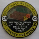 |
We chose the Milford Sound Earthcache as a our 25th hide, and have released a "25 Hides Geo-Achievement Coin" to mark the occasion.
If you wish to discover it, please indicate this with your emailed answers, and we will forward you the tracking code. Thanks for visiting our earthcache.
|

First to Visit honours goes to doheng.
|