
GLACIAR PERITO MORENO - PATAGONIA
English Version:
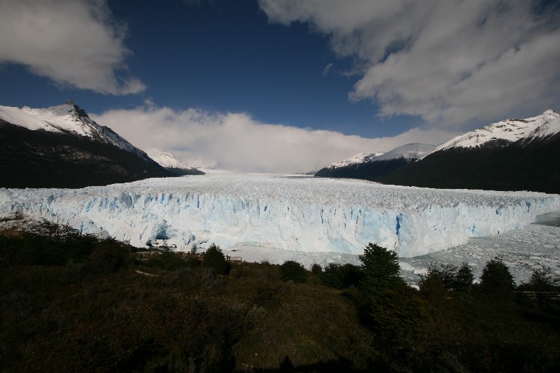
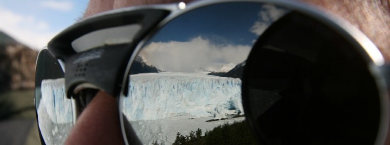
The Perito Moreno Glacier is a glacier located in the Los Glaciares National Park in the south west of Santa Cruz province, Argentina. It is one of the most important tourist attractions in the Argentine Patagonia. The 250 km2 (97 sq mi) ice formation, and 30 km (19 mi) in length, is one of 48 glaciers fed by the Southern Patagonian Ice Field located in the Andes system shared with Chile. This icefield is the world's third largest reserve of fresh water.
The Perito Moreno Glacier is one of only three Patagonian glaciers that are not retreating. Periodically the glacier advances over the L-shaped "Lago Argentino" ("Argentine Lake") forming a natural dam which separates the two halves of the lake when it reaches the opposite shore. With no escape route, the water-level on the Brazo Rico side of the lake can rise by up to 30 meters above the level of the main lake. The enormous pressure produced by this mass of waters finally breaks the ice barrier holding it back, in a spectacular rupture event. This dam/rupture cycle is not regular and it naturally recurs at any frequency between once a year to less than once a decade.
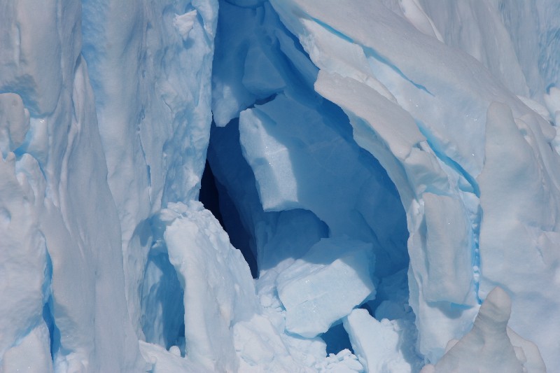
The terminus of the Perito Moreno Glacier is 5 kilometres (3 mi) wide, with an average height of 60 m (197 ft) above the surface of the water, with a total ice depth of 170 metres (558 ft). It advances at a speed of up to 2 metres (6.56 ft) per day (around 700 metres (2,297 ft) per year), although it loses mass at approximately the same rate, meaning that aside from small variations, its terminus has not advanced or receded in the past 90 years. At its deepest part, the glacier has a depth of approximately 700 metres (2,297 ft).
The glacier first ruptured in 1917, taking with it an ancient forest of arrayán (Luma apiculata) trees. The last rupture occurred in July 2008, and previously in 2006, 2004, 1988, 1984, 1980, 1977, 1975, 1972, 1970, 1966, 1963, 1960, 1956, 1953, 1952, 1947, 1940, 1934 and 1917. It ruptures, on average, about every four to five years.
The Perito Moreno glacier, located 78 kilometres (48 mi) from El Calafate, was named after the explorer Francisco Moreno, a pioneer who studied the region in the 19th century and played a major role in defending the territory of Argentina in the conflict surrounding the international border dispute with Chile.
To log this Earthcache answers the following questions by mail:
1. Estimates: How much meter is the distance between the terminus of the glacier and the headland of the peninsula, on the day at which you went to the glacier.
2. Exactly at the coordinates you find a national symbol. What you can see?
3. Upload a photo with you and your GPS in the hand in front of the glacier.
All other logs will be deleted.
Deutsche Version:
Der Perito Moreno-Gletscher befindet sich im Los Glaciares Nationalpark im Südwesten der Provinz Santa Cruz in Argentinien. Er ist einer der wichtigsten Touristenziele im Argentinischen Patagonien. Die 250 km2 große Eisformation, mit einer Länge von 30 km , ist einer von 48 Gletschern, des Patagonischen Inlandeises. Dieses Eisfeld ist die drittgrößte Süßwasserreserve der Welt.
Der Perito Moreno Gletscher ist einer von nur drei Patagonischen Gletschern, die sich nicht zurückziehen. Periodisch kommt der Gletscher über den L-förmigen Lago Argentino voran und bildet eine Talsperre. Er trennt die zwei Hälften des Sees ab, wenn er das entgegengesetzte Ufer erreicht. Der Zufluß der südlichen Brazo Rico Seite kann nicht mehr in Lago Argentino abfließen und staut sich bis zu 30 Meter über das Niveau des nördlichen Hauptsees. Der enorme, von dieser Masse von Wasser erzeugte Druck bricht schließlich die Eisbarriere mit einem spektakulären Durchbruchereignis. Dieser Durchbruchzyklus wiederholt sich zwischen einmal pro Jahr bis zu einmal pro Jahrzehnt.
Die Gletscherzunge des Perito Moreno Gletschers ist 5 Kilometer breit, mit einer durchschnittlichen Höhe von 60 m über der Wasseroberfläche und einer totalen Eistiefe von 170 Metern. Der Gletscher wächst mit einer Geschwindigkeit von 1 bis 2 Metern pro Tag an (um 700 Meter pro Jahr). An seinem tiefsten Punkt hat der Gletscher eine Tiefe von ungefähr 700 Metern.
Der Gletscher brach 1917 erstmals durch und nahm einen uralten Wald von Myrte Bäumen (Luma-Apiculata) mit sich. Der letzte Durchbruch geschah im Juli 2008 und vorher 2006, 2004, 1988, 1984, 1980, 1977, 1975, 1972, 1970, 1966, 1963, 1960, 1956, 1953, 1952, 1947, 1940, 1934 und 1917. Er bricht etwa alle vier bis 5 Jahre durch.
Der Perito Moreno-Gletscher, befindendet sich 78 Kilometer von El Calafate entfernt und wurde nach dem Forscher Francisco Moreno benannt. Im 19. Jahrhundert erforschte er die Region und spielte eine große Rolle bei der Verteidigung des Argentinischen Territoriums im internationalen Grenzkonflikt mit Chile.
Zum Loggen dieses Earthcaches beantworte folgende Fragen per Mail:
1. Schätze: Wieviel Meter beträgt die Entfernung zwischen Gletscherzunge und der Spitze der Halbinsel, an dem Tag, an dem du den Gletscher besucht hast.
2. Genau an den Koordinaten findest du ein Nationalsymbol. Was kannst du hier sehen?
3. Lade ein Foto mit dir und deinem GPS in der Hand vor dem Gletscher hoch.
Alle anderen Logs werden gelöscht.