Reading the Rocks
The mountains around you are part of the "Crystalline Core" of the North Cascades. From the west, you enter the Core at Marblemount, where SR 20 crosses the Straight Creek Fault. From the east, you enter this geologic zone near the mouth of Panther Creek, where the highway crosses the Ross Lake Fault.
The hard metamorphic rock of the Crystalline Core — also called the Metamorphic Core Domain — is composed primarily of Skagit gneiss (pronounced "nice"). Metamorphic rock is created when igneous (volcanic) and/or sedimentary (seafloor) rocks are transformed, or "morphed," into other rock types by tremendous heat and pressure inside the earth. Skagit gneiss is a coarse-grained rock created from a complex mosaic of seafloors, volcanic eruptions, and continental crust. The process began 220 million years ago, when volcanic islands of basalt and andesite rose from an ocean floor of sandstone and shale. Around 90 million years ago, tectonic forces shoved the crustal block containing the igneous and sedimentary rocks 100,000 feet below the surface, where heat and pressure metamorphosed them, melting and recrystallizing the minerals into gneiss over the millennia.
To see the result of this tumultuous change up close, look at the road cut across the highway. It exposes rocks once buried 15 miles below ground. Notice the tilted and warped bands of dark-gray gneiss, and the veins (or dikes) of lighter-colored rock that infiltrated the gneiss some 40 million years ago.
(My companion earthcache, Whose Fault Is the Terrane?, at Ross Lake Overlook lets you compare the rugged metamorphic mountains of the North Cascades with the pastoral, sedimentary landforms of the Pasayten Wilderness.)
Shaping the Land
The mountains of the North Cascades are still in motion — rising, shifting, and eroding, dramatically altering the landscape over time. You can see clear evidence of this from the overlook by tracing the course of the Thunder Lake Fault, which formed 40 million years ago. Using the interpretive sign for reference, start on the left above the Thunder Arm of Diablo Lake and follow the fault across the ridges and valleys, under the lake, and up the east side over Sourdough Ridge. Along the way, notice its contribution to landslides, creek formation, and erosional features.

The landscape of the North Cascades has been further shaped by glaciation. During the last major Ice Age (the Pleistocene, 1.8 million to 10,000 years ago), the Cordilleran ice sheet extended down from Canada and buried the valley in ice more than a mile thick. The ice rasped away at the rock, rounding many of the landforms. The deep gorge of Diablo Lake was eroded by voluminous meltwaters from the Cordilleran ice as it repeatedly advanced and retreated.
The erosional effects of glaciation continue today on a smaller scale, as glaciers slowly grind away at the gneiss in the Cascades. In fact, the Thunder Creek watershed to your left has the largest concentration of glaciers (10%) in the lower 48 states. Look to the southwest, and you may catch a glimpse of the glaciers on Colonial, Snowfield, and Pyramid peaks.
Logging Requirements
To claim a find for this earthcache, message me the correct answers to the following questions. (The plaques at the posted coordinates may prove helpful.) Finds posted without the answers being sent simultaneously, or with incorrect answers, will be deleted per earthcache requirements.
- In the road cut, what color are the intrusive dikes? What two minerals are they made of?
- On the right side of the road cut, you can see a different kind of streak. What color is it, and how was it created?
- Name three geological forces still altering the landscape in the North Cascades.
- How much have the North Cascades glaciers shrunk in size since the end of the Little Ice Age?
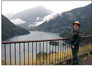
We'd also love to see a photo of you at the viewpoint with Diablo Lake in the background. (No spoiler photos of the rocks, please!)
Winter Access
The North Cascades Highway (SR 20) closes each winter after the first major snows, usually from early December until late April. However, this cache is outside the closure area on the west side (before the gate at milepost 134), so it is available year-round. You can check the status of SR20 here.
Sources
Ranger Cindy Bjorklund, Interpretive Specialist, North Cascades National Park Service Complex.
Geology of the North Cascades: A Mountain Mosaic by R.W. Tabor and Ralph Haugerud (Mountaineers Books, 1999).
To learn more about the geology of the North Cascades, visit Natural Features & Ecosystems on the park's website.
Note: This earthcache was suggested and approved by the Interpretive Specialist at the North Cascades National Park Service Complex, with the support of the Superintendent and the Chief of Interpretation and Education, who also gave permission for use of their logo.