Zámecký vrch - Hausberg
Mansion hill
[CZ] Na vrcholu Zámeckého vrchu se nachází skála, na které dríve stával kraslický hrad, zvaný Neuhaus - Nový hrad. První zmínka o nem pochází z 13. století. Dríve zde stálo hradište, které strežilo obchodní cestu z Prahy do Plavna a Erfurtu. V 15. století sloužil hrad loupežným rytírum. V 16. století hrad již nikdo neobýval.
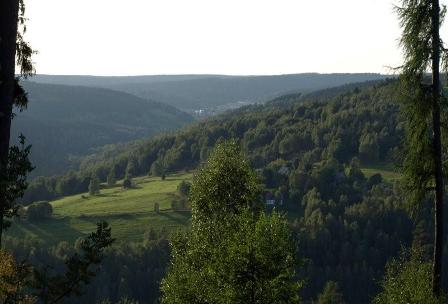
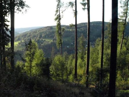
Uvodni souradnice vás zavedou na Zámecký vrch - Hausberg, který je prístupný na "Naucné stezce stopami horníku". Nejlepe je dostupná z Kraslic po modré turistické znacce, pred cihlovou vilkou modrou znacku opustite a zahnete prudce doprava . Keš je umístena cca 280 m od výchozího stanovište na Zámeckém vrchu.
Pro získání cílových souradnic stací na výchozím míste zjistit rok ( R ), kdy byla skalní jsekyne obnovena spolkem prátel mesta Kraslice .
Cilove souradnice jsou pak :
N50° 20.A E12° 30.B ,
kde A = 2422-R a B = 2927-R R .. rok rekonstrukce jeskyne
R.. letopocet na ceduli nad jeskyni
[DE] Die Einleitungskoordinanten fuehren sie zum Hausberg, der ist aus dem "Lernweg nach den Spuren den Hauern" zuganglich. Sie koennen dort nach der blauen Wanderwegmarkierung gehen, vor der Ziegelvilla biegen sie rechts ab. Cache befindet sich zirka 280 m von den Einganskoordinanten auf dem Hausberg. Fuer die Zielkoordinanten reicht nur auf dem Ausgangspunkt den Jahr (R) festzustellen, wann wurde die Hoelle von dem Graslitzverein rekonstruiert.
Die Zielkoordinanten sind:
N50° 20.A E12° 30.B ,
wo A = 2422-R und B = 2927-R
R.. das Jahr auf dem Schilder ueber dem Eingang in die Hoelle.
Auf dem Gipfel des Hausbergs befindet sich ein Felsen, wo frueher die Graslitzer Burg stand, gennant Neuhaus oder auch Neue Burg. Die erste Erwaehnung darueber kommt aus dem 13. Jahrhundert. Frueher stand hier Burgstaette, die bewachtete den Geschaeftsweg aus Prag nacch Plauen und Erfurt. Im 15. Jahrhundert diente die Burg den Raubrittern. Im 16. Jahrhundert hat schon niemand die Burg bewohnt.
[EN] [EN] Theere is a rock on the top of the Mansion hill, where the Castle of Kraslice stood, hight Neuhaus or New castle. First mention of the burg comes from 13th century. Before there were fortress, which watched over the merchant trail from Prague to Plauen and Erfurt. In 15th century the castle was owned by the robbing knigts. In 16th century the castle was uninhabitable.
The initiative coordinates will lead you to Mansion hill, whitch is accessible from the educational trail "Through the footsteps of miners". It is accessible from Kraslice along the blue tourist mark. In front of the brick house turn to the right. Cache is situated around 280 m from initial point. To acces the target coordinates, you have to find the year (R) on the initial point, in which was the cave reconstructed by the Kraslice - association.
Target coordinates are:
N50° 20.A E12° 30.B ,
where A = 2422-R and B = 2927-R
R is the year writen on the desk abowe the cave