Kostolík na Kalvárii
Kalvária
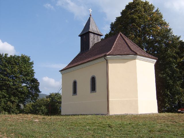
Na úpätí vrchu teraz nazývaného Kalvária, bola vybudovaná Krížovácesta ukoncená kostolom sv. Kríža s kapacitou 150 ludí. Prvýpísomný doklad o existencii Kalvárie je zaznamenaný v Kronike Františkánov v r. 1729.
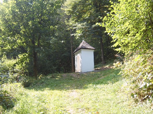
Pôvodne Krížová cesta z r. 1741 pozostávala zo siedmich kaplniek,(každá predstavovala 2 zastavenia Krížovej cesty). Postupne boli dostavené dalšie kaplnky na pocet 12 koncom 19. storocia.
V r. 1993 sa zacalo so záchranou tejto cirkevno-umeleckohistorickej pamiatky, s postupnou obnovou kaplniek Krížovej cesty,kostolíka aj "serpentínnej cesty" vedúca popri kaplnkách kukostolu. V roku 2006 sa zahájila dostavba kaplniek na celkovýpôvodný pocet, takže Krížová cesta je od jej vzniku po prvý razúplná s poctom 14 kaplniek. Kostol sv. Kríža má pôvodný vzhladokrem interiéru, z ktorého sa nezachovala dokumentácia. Kaplnky boli realizované v pôvodnom prevedení.
Zdroj: http://www.kremnica.sk/

Skrýša
Keška sa nachádza na uvedených súradniciach, na kopci Kalvária, nad Kremnicou. Je to kontajner velkosti 3, hnedej farby.

Jedna z kaplniek na Kalvárii
Dlžka trasy je cca 1400m a prevýšenie od centra mesta cca 170m.Jedná sa o lesný chodník, široký asi 1.5m. Pre zdatných cyklistov je zvládnutelný na horskom bycikli po celej trase.
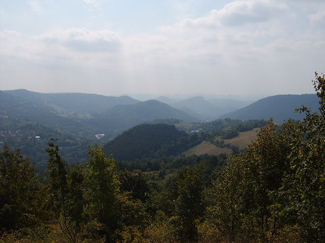
Z vyhliadky (VIEW1) budete odmenený výhladom na kopce Gróbna, Štós,Jarabica v okolí mesta. Smerom na juh sú to Štiavnické Vrchy,smerom na sever uvidíte Kostolík v Strede Európy (keška GCKET4 - Heart of Europe ) a kopec Trnovník (keška GC1BHC3 - Nad Kremnickymi Banami ).
Odlov odporúcam spojit s keškou GC1G20Q - Prepadlisko Šturec.
Prístup ku Keške
Pešo z centra Kremnice
Parkovanie je možné na neplatenom parkovisku v centre mesta(PARK1), odporúcaný zaciatok je od (START). Chodník Vás dovedie nadalšie miesto, kde je možné parkovat (PARK2), na koniec uliceRumunskej Armády. Tu zacína "serpentínna cesta". Popri obnovených kaplnkách sa dostanete až na vrchol kopca Kalvária (VIEW1).
Pešo, parkovanie na ulici Rumunskej Armády
Po príchode do mesta odbocte z hlavnej cesty smerom do kopca(TURN1). Prejdite cez most a držte sa smerovvej tabule na ulicuRumunskej Armády, kde na jej konci (PARK2) môžte nechat auto. Je tam miesto pre 4 autá. Dalej inštrukcie pre peší prístup.
Drive-In alebo pešo bez nárocného stúpania
Pri rekonštrukcii kostolíka bola obnovená polná cesta (foto:Kalvária - Pohlad z dialky, takže Drive-in je možné absolvovat ajosobným autom (Škoda Favorit na foto: Kalvária - Pohlad na Kostolík).
Po príchode do mesta odbocte z hlavnej cesty smerom do kopca(TURN1). Prejdite cez most a držte sa smerovej tabule na BanskúCestu. Pokracujte až na jej úplný koniec až sa dostanete odbocku napolnú cestu (TURN2), kde prípadne môžete nechat auto. Prístup kucache je bez nárocného stúpania. Po polnej ceste pokracujte stálerovno a po 1 km sa dostanete až ku kostolu na vrchole kopcaKalvária. Na polnej ceste v bode (TURN3) je odbocka ku keške GC1G20Q - Prepadlisko Šturec.

Cache
The cache is located on the above coordinates, on the Kalvaria Hill above Kremnica. The container is size 3, brown colour.

Výhlad na juh
The track length is 1400m from the point (START) and elevation isapproximately 170m from the city centre. The width of a wood pathleading to the cache is approximately 1.5m. It is suitable for advanced bikers on the mountain bikes.
You can enjoy the view on the Grobna hill, Stos hill, Jarabica hillfrom the view point (VIEW1). You can see the Stiavnicke Vrchy onthe south and The Church in the Heart of Europe (Cache GCKET4 - Heart of Europe ) and Trnovnik Hill ( GC1BHC3 - Nad Kremnickymi Banami) in the north direction from the view point (VIEW1).
I recommend to do this cache together with cache GC1G20Q - Prepadlisko Šturec.
The access to the cache
From the city centre of Kremnica by foot
The free parking is available in the town centre (PARK1), it isrecommended to start from the spot (START). The path will lead youto the another possible parking place (PARK2), to the end of theRumuskej armady street. The serpentine road starts here. The pathalong the renewed little churches will lead you to the top of the Kalvaria Hill (VIEW1).
Access on foot, parking at the Rumuskej armady street
When you get to the town, turn from the main road to the hill(TURN1). Cross the bridge and follow the sign for the RumuskejArmady street, at the end of this street you can park (PARK2).There is parking for 4 cars available there. Follow the instruction for the access by foot.
Drive-in access or access to avoid steep hill
The field road was renewed together with little church renovations(picture: Kalvária - Pohlad z dialky), so Drive-in is possible todo by a car as well (car Škoda Favorit on the picture: Kalvária - Pohlad na Kostolík).
After you get to the town, turn up the hill (TURN1). Cross thebridge and follow the sign for the Banska Cesta. Follow the road tothe end until you reach the turn for the field road (TURN2), whereyou can park if wanted. The access to the cache is easy, you willavoid steep hill. Go ahead on the the field road, after 1km youwill reach the top of the Kalvaria hill. There is a spot on thefield road (TURN3), where you need to take turn in order to get tothe cache GC1G20Q - Prepadlisko Šturec.