Geologisch monument Typelocatie Zand van
Waterval.
Gedurende een deel van het Tertiair (circa 35 tot 30 miljoen
jaar geleden) werd geheel Zuid-Limburg overstroomd door de
Middenoligocene Zee. In deze zee werden drie zand- en kleipakketten
afgezet, die samen gerekend worden tot de Formatie van Rupel. Het
middelste pakket is genoemd naar deze oude verlaten groeve. Deze
groeve is de ‘typelocatie’ voor het Zand van Waterval
in Nederland.
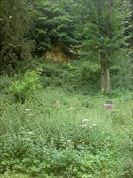
Makkelijk te bereiken, het info-bord wordt in de zomer helaas
vaak overwoekerd door brandnetels!
Parkeren kan op N50 53.533 E005 46.643
Formaties in Limburg
In het Krijt, toen de Thetische zee het gebied had overstroomd,
werden eerst de mariene Formaties van Aken (zandige klei) en Vaals
(zand) afgezet en daarna volgden de dikke kalkpakketten van Gulpen
en Maastricht.
In het Tertiair trok de zee zich langzaam terug en is sprake van
een afwisseling van mariene en continentale afzettingen. Uit deze
periode stammen de kleiige zanden en kleien van de Formaties van
Rupel en Tongeren (Oligoceen) en de fijne zanden van de Formaties
van Breda en Heksenberg (Mioceen).
In het Plioceen kreeg de Maas door de terugtrekkende zee de kans
rivierafzettingen te deponeren in een breed gebied waarbij de
rivier niet diep insneed (Kiezeloöliet Formatie). Uit het Midden en
Onder Pleistoceen stammen rivierafzettingen die in het gehele
gebied zijn terug te vinden (Formaties van Tegelen, Kedichem,
Sterksel, Veghel, Kreftenheye).
In het Boven Pleistoceen werden deze grind- en zandlagen in
Zuid-Limburg gedeeltelijk bedekt met de Formaties van Twente en
Eindhoven, de zogenaamde löss. Löss is een aanduiding voor eolische
(=wind-) afzettingen met een korrelgrootte van ongeveer 16-50 µm.
In de Roerdalslenk is op de Pleistocene sedimenten de Nuenen
Formatie afgezet. Door overstromingen is lokaal rivierklei
gesedimenteerd (Betuwe Formatie).
Geological monument Type location “Sand of
Waterval”.
During one part of the Tertiary (approximately 35 to 30 million
years ago) South-Limburg was entirely overflowed by the
Middleoligocene sea. In this sea three sand and clay parcels were
disposed, which are together counted to the Formation of Rupel. The
middle range is named after these old abandoned quarry. This quarry
is the typelocatie 'for the Sand of Waterfall in the
Netherlands.
Easy to reach, the info-board in the summer unfortunately often
overgrown by nettles!
Parking is a N50 53.533 E005 46.643
Formations in Limburg
In the Cretaceous, when the Thetic Sea the area had flooded,
were the first marine Formation of Aachen (sandy clay) and Vaals
(sand) disposed and afterwards followed the thick lime parcels of
Gulpen and Maastricht.
In the Tertiary the sea pulled back slowly and there is a variety
of marine and continental deposits. From this period the tribes
clay sand and clay of the Formation of Rupel and Tongeren
(Oligocene) and the fine sands of the Formation of Breda and
Heksenberg (Miocene) descend.
In the Pliocene the Meuse got the chance by the retreating sea to
deposit in a wide area where the river was not deep (Kiezeloöliet
Formation).
In the middle and under Pleistoceen came the river dispostits which
can be found in the whole area (Formaties of Tegelen, Kedichem,
Sterksel, Veghel, Kreftenheye).
In the Upper Pleistocene were gravel and sands in South Limburg
partially covered with the Formation of Twente and Eindhoven, known
as löss. Löss is a name for aeolian (wind =) deposits with a grain
size of about 16-50 µ m. In the Roerdalslenk the Nuenen Formation
diposits on the Pleistocene sediments. By floods room river clay
disposed localy (Betuwe Formation).
Om te loggen doe je de volgende dingen:
1) Maak een foto van jezelf+gps voor het bord en plaats deze bij de
log.
2) Mail het antwoord op de vraag: Hoe heet de onderste laag van de
formatie van Rupel?
Let op! We krijgen veel foute antwoorden, dus lees de vraag
goed!
Logs zonder foto of juist antwoord worden natuurlijk
verwijderd!
To log do the following things:
1) Take a picture of yourself + gps in front of the sign and place
it in the log.
2) Mail the answer to this question: What the name of the bottom
layer of the Formation of Rupel?
Logs without photo or correct answer will be removed!