"He who knows the most, he who knows...the ground, the waters, the plants, the heavens, and how to come at these enchantments, is the rich and royal man." - Ralph Waldo Emerson
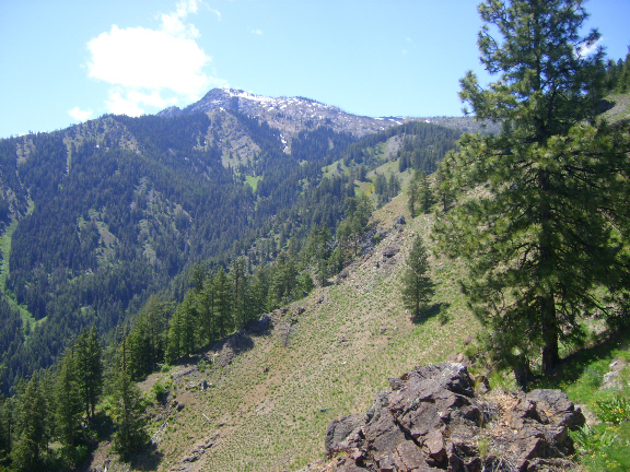
When hiking in the foothills near Wenatchee and Cashmere, if you look to the west you can see the Enchantment Peaks in the distance, but only the higher elevations of the craggy peaks. The reason is that there is a 6200-6800 foot high ridge that runs in a North-South direction, which blocks most of the view. That ridge would be Wedge Mountain. This hike takes you up the east face to the top of Wedge Mountain for an unobstructed view of the Enchantments and Snow Lakes.
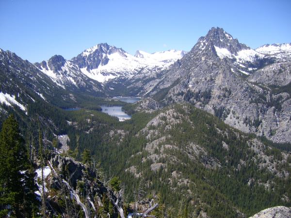
Wedge Mountain is a ridge just south of Leavenworth with steep slopes on the east and west sides. The hike is exceptional for stunning views into the Alpine Lakes Wilderness. Located just outside the eastern boundary of the wilderness, Wedge Mountain offers a superb view of the entire Enchantments, a group of lakes in rock basins and one of the most famous places in the Cascade mountains. The cache is located at the 6200 foot elevation near a saddle between two of Wedge Mountains several peaks. To the south of the cache is the False Summit (6600 ft). Further to the south is the true summit of Wedge Mountain at the 6885-foot peak. There is really no need to climb to the summit for a better view. The saddle where the cache is located offers the same view.
The hike distance (round trip) was 3-1/2 miles with 1700 foot elevation gain. From Wedge Mountain where I took the above photo, you can see McClellan Peak (8364 ft), Little Annapurna (8405 ft) and The Temple (8242 ft). These cathedral-like masses of granite spires are awe inspiring. The lakes you see down below are the Snow Lakes at 5400 ft elevation. Further to the North is Nada Lake.
WEDGE MOUNTAIN
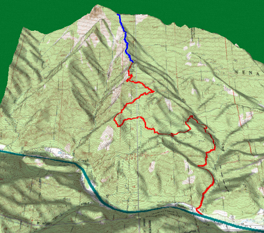
The map above shows the route to the top of Wedge Mountain. The green line represents Hiway 97. Turn west off Hwy 97 onto Mountain Home road, approximately 4 miles south of Hwy 2 near Peshastin. Head west on Mountain Home road for about 3 miles, then turn left onto FS Road 7305. Stay on Road 7305 for about 4 miles where it ends at the Wedge Mountain trailhead. The road is a little rough in places and high clearance is recommended. The blue line represents the trail to the top.
I rated the terrain difficulty at 4 due to the steep hike (1700 feet in 1.75 miles) and because there are several downed trees across the trail. The hike appears to be do-able for grade-school age children. On the way down I met a church group of about 20 people heading up to the top. Besides the adults, several of them were youth in their early teens, and one young girl I would guess was about age 7.
Note: I wanted to be sure that the cache was located outside of the wilderness boundary, so I hid it on the east side of the summit, about 100 feet from the top. Be sure to continue up past the cache to see the view. Enjoy the hike, and don't forget to bring your binoculars and camera.