Landunter - Ebbe, Flut und Watt
| Die ausgedeichte Fläche ist der täglichen Tide ausgesetzt. Die Tide bezeichnet das Auflaufen (Flut) und Ablaufen (Ebbe) des Wassers. Je nach Höhe des Hochwassers wird eine entsprechende Fläche des Gebietes überflutet. Durch die Tide kann sich ein naturnahes Fließgewässer entwickeln. Die regelmäßigen Überflutungen bewirken die Entstehung von Süßwasserwatten, die bei Ebbe frei liegen und Wattvögel als Möglichkeit zur Nahrungsaufnahme dienen. Der nicht täglich überflutete Bereich entwickelt sich zu einer natürlichen Auenlandschaft und dient als Lebensraum für viele Tiere und Pflanzen. |
|
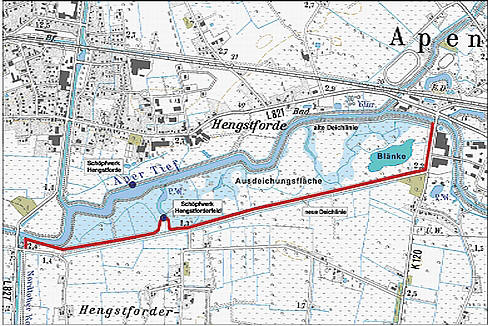
Map of the area flooding
|
Das Wasser kommt durch Ebbe und Flut vom Meer her, der Wasserberg (Flut) wird in dem Fluss hier ist es die Ems hoch bis ins Binnenland gedrückt und schiebt das Süßwasser bis ins Aper Tief wo es die Flächen bei Flut überschwemmt und bei Ebbe liegt die Fläche wieder trocken, das geschieht etwa alle 12 Stunden. In diese eingedeichte Flächen siedeln sich viele verschiedene Wasservögel Arten an.
Dieses Süßwasser Watt ist hier einmalig, weil es an der Küste nur Salzwasser Watt gibt. Süßwasser (Also hier kein Salzwasser) wie schon gesagt weil es Flusswasser ist, welches durch die Gezeiten, (der Anziehungskraft der Sonne und Mondes) für 6 Stunden aufgestaut wird, dann fließt es wieder ab.
|
|
Vorort findet ihr eine Schautafel mit sehr viel Information an den ihr die Antworten zu den Fragen finden könnt.
Logbedingung:
Um diesen Earthcache loggen zu können beantwortet mir bitte zwei Fragen, und macht als Beweis angegebenen Koordinaten ein Foto und stellt das Foto mit in den Logeintrag, es werden nur Logeinträge mit eurem Beweisbild anerkannt.
Die Antworten sendet ihr per Email an baumsucher(ät)gmail.com, und log mit einem Fotobeweis.
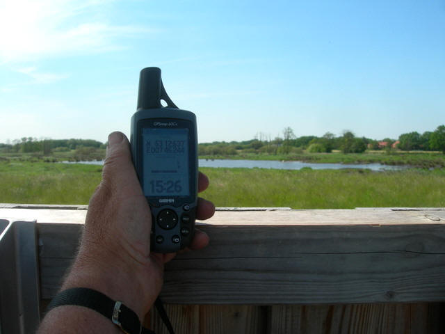
View from the lookout tower on the flooding area |
Zu den Fragen:
- Wie hoch ist das mittlere Tidehochwasser?
- Wie groß ist die Ausdeichung in m³?
- Fotobeweis
|
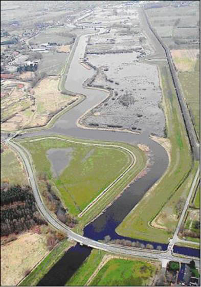
LuftbiAerial view of internal Watt
|
English
Land under - ebb, flood and Watt in Apen.
The area with a dike surrounding is the daily tide suspended.
The Tide means :
The water comes through ebb and flow of the sea, the mountain water (flood) in the river here it is the high Ems to the inland down and pushes the fresh water to the Aper deep where the flooded areas at high tide and low tide, the Dry land again, that happens about every 12 hours. In these areas eingedeichte settled many different waterfowl species.
This freshwater Watt is unique because it's only salt water coast watts. Freshwater (Also there is no salt water) as we have said because it is river water, which by the tides (the attraction of the sun and moon) for 6 hours aufgestaut, then it goes again.
The leak (flood) and drain (low tide) of the water. Two times a day
Its be flooded.
Ebb-tide and flood comes from the sea, the water mountain in the river here the Ems highly in the inland is pressed and pushes the fresh water in the Aper low where it the surfaces with flood inundated and at ebb-tide lies the surface again drying, happens about every 12 hours. This fresh water Watt is actually unique, because there is seawater Watt at the coast only. Fresh water (thus here no seawater) like already said because it river waters is, which by tides, (that Attraction of the sun and moon is together pushed)
Depending upon height of the flood an appropriate surface of the area becomes flooded.
By the Tide a nature running waters can develop. Regular floodings cause the emergence of fresh water cotton wool.
Depending upon height of the flood finalspeaking surface is flooded. The expansion area works it as reservoir for floods, is Part the flood protection of the region. The area is protected an a part of biotope system and becomes scientific Supervised.
At ebb-tide freely Land provide Watt birds a intake serve for food them.
Is There not a daily flooded range develops to a natural Humid area and serves as habitat for many animals and plants. Suburb you can observe rare birds and sea animals
At the Location you find a diagram and all information you need.
To Log this cache please answer me tow questions and send it to me.
Make with you and your GPS a photo on the position of the coodinates
And adress it to the Log. After all you will get a log permission from me!
- How high is the middel highwater ?
2. How big is the dike area in m³ ?