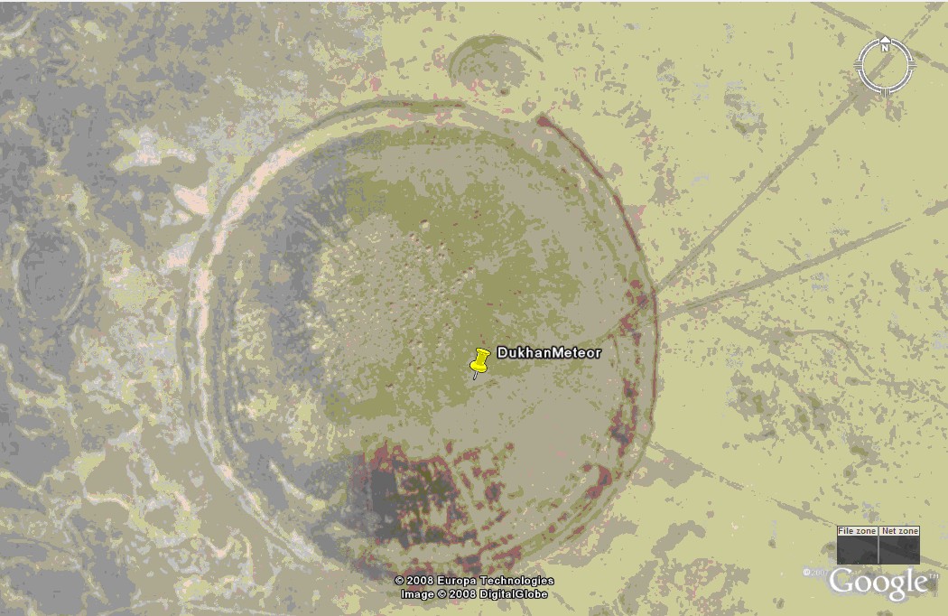
There are a number craters of an unusual shape and character. It is believed that these craters are as a result of a meteorite impact in the 1940’s that was witnessed by numerous Bedouin tribesmen at the time. The craters were discovered recently as a result of a search initiated by stories by some aged Bedouins. A piece of meteorite discovered in the area in 1989 also gave credence to the impact. Three years of expedition has lead to the confirmation of the crater sites. Samples from the sites have been analysed for radioactivity and chemical composition for additional confirmation.
The craters have an upward curve rather than a depression as in normal craters. The softness of the earth at the crater accounts for this unusual shape. The pillar like structures in the centre of the craters indicate that they were formed very quickly rather over a period of time. The extremely high temperature at the time of the impact, which could have caused the sand, mixed with the surrounding salt and water, to “boil”. The area was marshy until the oil production started in the 1950’s that has lead to a partial draining of the area. It is estimated that the largest meteorite was in the region of 10kg when it impacted the earth. There are stories of camels being sucked into the ground at the time of the impact! Urban legend perhaps! There are some 5 distinct and identified craters covering an relatively straight line over a distance of approximately 30km.
There is one fairly large crater north of this earthcache that also can be seen at waypoint N25°24.521' E050° 50.671' Although there may be an easier route to the site, that road will take you through a restricted area that requires access permits. Please use the route indicated by these waypoints to avoid any possible problems with security personnel.
The road is easily passable with a saloon car, except for the last 2km which WILL require a 4x4 vehicle. The sand is very soft and could be muddy depending on season.
WAYPOINTS TO USE
Exit ramp at Zikreet N25° 26.458’ E050° 52.103’ Double back along paved road, passed shops, to N25° 27.109’ E050° 53.025’
Entry point to unpaved roads N25° 26.671’ E050° 53.454’
Point where saloon cars will have to park N25° 23.672’ E050° 51.497’
PLEASE DO NOT POST ANY PHOTOGRAPHS OF THE IMPACT SITE AS THIS WILL COMPROMISE THE ANSWERS TO THE QUESTIONS BELOW.
In order to substantiate your visit and be able to claim this Earthcache, a number of questions need to be answered and submitted to the cache developer via e-mail at cincolcc(at)gmail.com
1. What is the altitude of the crater - as indicated on your GPSr?
2. Describe in your own words what the centre of the crater looks like – DO NOT POST A PHOTO.
3. What is the colour of the sand in the middle of the crater as opposed to the surrounding area?
4. How many walking paces across is the centre part of the crater? The part that you described in point 2 above.
NOTE: You may log your visit prior to approval, but e-mail submissions that do not meet the above criteria will be deleted.
FTF goes to kurinsky