In the 1920s, the Strongsville Heights Allotment in northern Medina
County was subdivided to make cottage lots. These lots turned out
to be very difficult to build on, as the sandstone bedrock is very
near the surface. While many parcels of land were given away as
prizes at movie theaters and never developed, the Medina County
Parks district had a different use in mind for the area. Piece by
piece, they began to acquire the land now known as the Princess
Ledges Nature Preserve.

The posted coordinates will take you to the parking area at
Princess Ledges. From Pearl Road, look for a small park sign on
Spruce Avenue, just south of Mapleside Farms, to help you find your
way to the park. Once there, you will follow the yellow Ledges
Trail to discover Princess Ledges. Please stay on the trail and
observe all Medina County Parks rules during your visit. Remember
to bring your camera and a tape measure! You will need them to
claim a find at this earthcache.
Princess Ledges are made of sandstone, a clastic sedimentary
rock. Sedimentary rocks are formed when small particles, or
sediments, are cemented together. Clastic sedimentary rocks form
from particles that come from the breaking down and weathering of
other rocks. Sandstone forms from sand that was once on a beach or
a sea floor, but even before that, the sand was a particle that may
have broken or worn off a mountaintop. From there, wind or water
carried the particle, and millions of others like it, to the shore.
Sedimentary rocks for in layers as years and years worth of
particles pile on top of each other. The layers of sediment get
compacted and cemented together into rock through a process called
lithification. Because of the weight of the sediments, high
pressures at the bottom of the pile squeeze out air and water and
compact the solid particles together. Minerals then cement or glue
the particles together, and rock is formed.
The nearby Whipps Ledges, located in Hinckley Township, a few
miles to the east, are composed of a sandstone called Sharon
sandstone or Sharon conglomerate. This type of sandstone dates to
the early Pennsylvanian age, about 318 million years ago. Sharon
sandstone often contains large pebbles of quartzite cemented in
with the normal-sized sand grains. This formation is especially
noticeable at Thompson Ledges in Geauga County. A different kind of
sandstone makes up the bedrock at Princess Ledges and west to
Berea, Amherst, and Berlin Heights in the middle of Erie County.
Known as Berea Sandstone, it dates to the late Devonian age, about
360 million years ago. During this geologic age, this part of Ohio
was covered by an ocean that was home to armored fishes like
Dunkleosteus, as well as to trilobites and brachiopods. Relative to
Sharon sandstone, Berea sandstone has more regular grains and is
less crumbly. Because of these qualities, this is a commonly
quarried stone. It gets its name from the city of Berea, Ohio,
where especially high-quality stone was first quarried in the
1840s. The stone is used for grindstones, paving blocks, and
building material.
LOGGING REQUIREMENTS: According to Earthcache rules, in
order to claim the find, you must perform an educational task. So,
I ask that you take some measurements at Princess Ledges.
At waypoint #1, you are near the smaller of the two sets of
ledges. Here you can see the horizontal layering of sediments up
close and notice where the sandstone has cracked along these
layers. Find a nice-looking example, take out your tape measure and
camera, and take a photo of your measurement (like
this). Post this photo with your log.
At waypoint #2, you are at the larger of the two sets of ledges.
You will see a tall tree near the middle of the ledges. Between the
base of the tree and the base of the ledges you will see a large,
horizontal block of sandstone.
Click here to see it. How long is it? (Hint: It's more than 6
feet long. I have been here in the winter, and you can still find
this block with snow on the ground because it is somewhat sheltered
by the ledges. You know, barring anything nicknamed "the storm of
the century".)
Beyond this, at the far side of the ledges, along the trail, is
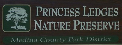
a small Medina County Parks sign. What does the sign say?
Post your photos with your online log, and email me with your
measurements and the words on the sign.
Logs not accompanied by email and photo within a reasonable
amount of time will be deleted per Earthcache rules. Please don't
make me have to do that!
References:
Camp, Mark J. 2006 Roadside Geology of Ohio. Missoula,
Montana: Mountain Press Publishing Company
http://en.wikipedia.org/wiki/Sedimentary_rock
Marshak, Stephen. 2001. Earth: Portrait of a Planet. New
York, NY: W.W. Norton & Company, Inc.
Medina County Parks website and educational programs. (Thanks to
the Medina Parks and Shelley Tender for allowing this
earthcache!)