Lomnicky stit EarthCache
-
Difficulty:
-

-
Terrain:
-

Size:  (not chosen)
Related Web Page
Please note Use of geocaching.com services is subject to the terms and conditions
in our disclaimer.
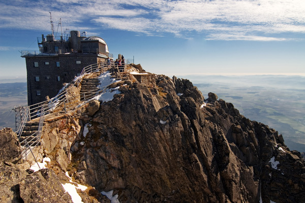
Lomnický
štít (Lomnický peak)
is one of the highest and most visited mountain
peaks
in the High Tatras mountains, in Slovakia.
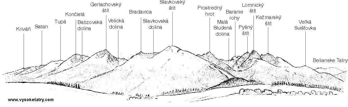
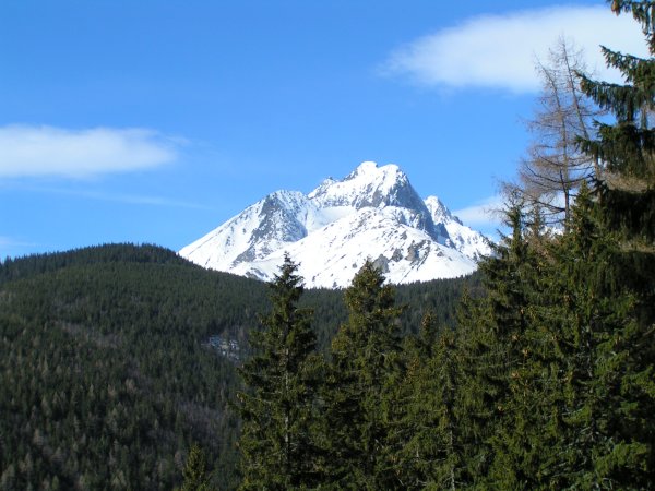
The most popular and most famous peak of the High
Tatras is the
Lomnický Peak (2634
m).
The triangular top of the peak (high above the
surrounding land) is connected to three ridges.
The north-western ridge joins the
main ridge of the High Tatras passing Pyšný and Baranie
Saddle.
In the north-east direction it is followed by a crotch passing the
Kežmarský and Malý (Small) Kežmarský
Peak.
The third ridge - Lomnický Ridge, passes Lomnické Saddle
in the south, south-east of the Lomnický Peak.
In past it was called "Granddad" and seemed to be the highest
one.
Geologic
Structure high
Tater. Crystallic kernel is formed from granite and slate. Deposits
mesozoic era contain calcify, dolomite, quartize, slate, different
sorts of conglomerates and sandstone. Kernel arose in Palaeozoic
(Carbon). Sea retreated in Mesozoic era and started erosion. In
Trias sea again rised and shake down sediments (calcite). Tatry
Mountains be part of land at the end period Cetraceous Period.
Major formation was "alpine creasing". End for modelling
were to be major effect glacier. They flowed inside of ice
age on northern parts mountains as far as 14 Km.

In the 18-th century malachyte and silver were mined on its
northern slopes by four generations of the Fábry family in
hope that they would find gold. Jakub Fábry found a path from
Medené Lávky up to the top of the peak (in 1760 -1790)
and the members of his family found a path from the top through the
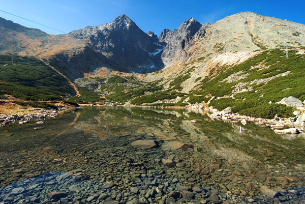
Lomnické Saddle down to the Skalnatá dolina (Rocky
Valley). The southern slopes were well known among the local
hunters. The first tourist ascent was done by the English traveller
Robert Townson from Malá Studená Dolina (Small Cold
Valley) in 1793. He measured almost the precise height of the
Lomnický Peak (2633 m). Winter ascent was done in 1891. The
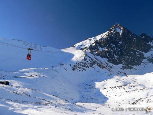
peak has been accessible by a cable car from Tatranská Lomnica
since 1940. Thus it became the most visited peak of the High
Tatras. The cable car station on the top of the peak is connected
to the highest situated Astronomical and Meteorological Observatory
in Slovakia. At the summit, the TV transmission station was built
in 1957 and electric power line was brought in from Skalnatá
dolina (Rocky Valley) in 1965.
- What is the exact geological
term for the rock (phonolite) forming the hill?
- How did the name Lomnicky stit
come to be?¨
- What is the elevation of the
hill above the surrounding landscape?
- In what geological era was the
hill formed?
- Which process had the biggest
influence on the final shape of the hill?
 Furthermore, add your photograph of yourself
at
Furthermore, add your photograph of yourself
at
the peak yourself with GPS in background rocky
mountain lake to the log. Send your answers to:
jan.zdich@seznam.cz
with the subject „Tatry“.


CZECH
* Jaký je presný název pro kámen (znelec)
formující tuto horu?
* Jak vzniklo jméno Lomnicky stit?
* Jaký je prevýšení od okolní krajiny
(zvolte libovolný bod v okolí)?
* V jaké historicky geologické ére byl
utvoren?
* Který proces mìl nejvìtší vliv na
konecný tvar?
Vaše foto u Skalnatého plesa (musí být videt v
pozadí) a foto kde je videt vrchol nebo sedlo a v pozadí
Lomnický štít. Obojí se souradnicemi.
Pro nesrovnalosti mne informujte na email.
Additional Hints
(No hints available.)