The Sibayak volcano is a stratovolcano with a rather easy access to
the crater, where some volcanic activities can be seen, like
gas/steam blowers and yellow sulfur spots.
Down in the valley there are a geothermic energy plant and hot
springs containing sulfur.
Stratovolcanos, are formed by eruptions of viscous lava, which
cools and hardens before spreading very far. Therefore, the slopes
are usually rather steep, as can be seen during the hike, too.
Stratovolcanos are often formed along tectonic plates where oceanic
crust is subsumed under continental crust. That is the case here as
well. The Sibayak volcano is one of the many geological phenomena
in this region. These phenomena are caused by the Australian
tectonic plate, which moves north where it meets the Asian one. In
the whole region of Indonesia phenomena like volcanic eruptions,
earthquakes and tsunamis occur frequently.
The last eruption of the Sibayak volcano was in 1881. Ashes and
lava tracks of this eruption are still visible at the spot.
Nowadays, the Sibayak shows a continuous activity in the form of
escaping hot water, gas and steam. These phenomena are the result
of a geothermal reservoir, which appears to be confined to
sedimentary pre-Tertiary to Tertiary (65 till 2,5 million years
old) formations about 1 km below the surface. The Sibayak
vulcano on top of these formations is less then 100,000 years old.
The thermal features consist of fumaroles (gas/steam blowers) and
solfataras (blowers containing sulfurous gases) at high elevations
and hot springs at lower elevations. These blowers can be
approached very closely, but be careful, because sometimes the
blowers eject stones or other materials. So, keep yourself out of
that direction.
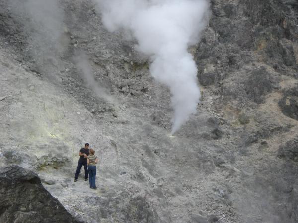
A blower.
The presence of sulfur can be concluded from the yellow spots in
the environment of the cache location and the typical bad smell,
like a rotten egg, that is present not only at the same location,
but also vaguely in a wider environment of a few kilometers.
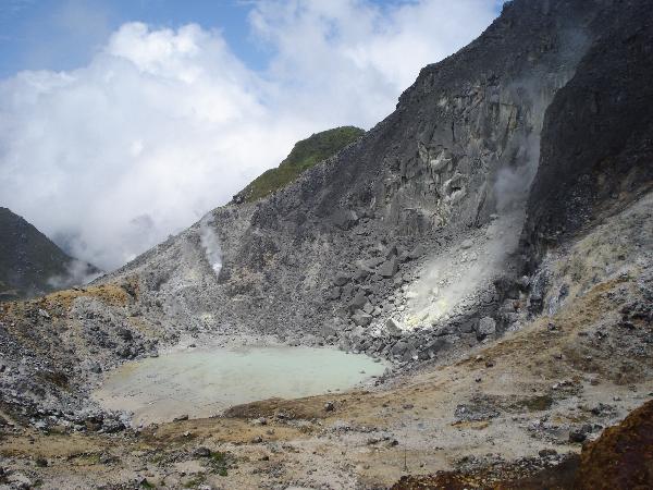
Crater lake and sulfur spot.
The energy from the geothermal reservoir is used already in a
2 MW power plant and further use of the energy is under
investigation.
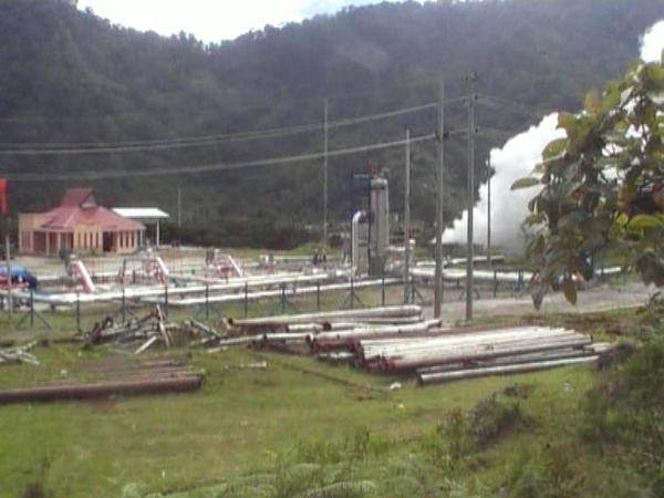
Geothermic power plant.
The hike
The hike needs good preparation. The visit to the volcano will
take a major part of the day. The cache location is at about 2000 m
above sea level, which is more than 500 meters above the start of
the hike. De length of the hike is between 5 and 10 kilometers,
depending on where you start and where you end. Therefore, it is
recommended to stay the night before in a hotel and to start early.
We have good experience with the Sibayak Multinational hotel at
N03° 12.563' E098° 30.199', which is for Indonesian standards a
good hotel, where you will also find people to guide you to find
your way. If you don't want to use a guide, we can send you track
information of the paths we used to be uploaded in your GPS.
The path through the jungle is heavy, due to the steep slope,
and a visit to the hot springs is recommended to recover and to
relax. The hot springs are at N03° 13.361' E098° 30.829'. From the
hot springs there is still a nice view to the volcano with its
clouds of steam.
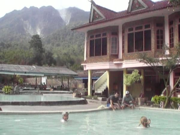
Hot springs.
If the path through the jungle is used, and you are lucky, you
might see gibbons.
The geothermic energy plant is located close to the hot
springs.
How to log the cache
When logging your visit to geocaching.com, add a photo of you
and your GPS with in the background one of the steam/gas
blowers.
Further send us an e-mail in which you answer the following
question:
What causes the bubbles in the northern part of the crater
lake?
- Boiling water, or
- Gas escaping from the earth below and going through the
water
Explain in your email how you found the answer to this question.
If you log your visit, but within one week no answer to the
question is received, or no appropriate photo is added to the log,
we have to delete the log.
More information can be found in Wikipedia about stratovolcanos in
general and specifically the Sibayak volcano. The
following document has more information about the Sibayak
geothermal field.