Grindgroeve Bissen
NEDERLANDS:
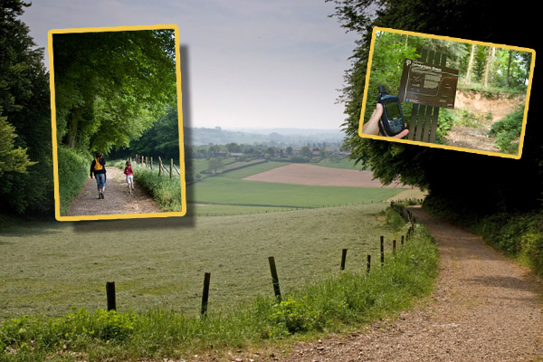
Je kunt je auto parkeren op: N 50° 47.302 en E 005° 54.240 Van
daaruit is het nog een klein stukje lopen via een goed wandelpad
(pittige klim!) naar de grindgroeve. Bij deze grindgroeve heb je
een prachtig uitzicht naar het zuiden toe; één van onze favoriete
plekjes in Zuid-Limburg! Op het bankje kun je genieten van de rust
en het uitzicht.
In de oude groeve zijn de oudste afzettingen van de Maas
ontsloten. Gedurende het jongste deel van het Tertiair tot in het
Kwartair (van circa 2,2 tot 1,7 miljoen jaar geleden) stroomde de
Maas in een dal dat zich uitstrekte vanaf Luik in de richting van
Eijsden. Vanaf hier boog de Maas naar het oosten in de richting van
Noorbeek – Epen – Bocholtz en Kerkrade om bij Düren in
de Rijn uit te monden.
Aan de noordkant van het dal strekte zich een heuvelrug uit die
liep vanaf Halambaye via Banholterheide en de Hut bij Margraten
naar Ubachsberg. Aan de zuidkant werd het dal begrensd door de
Tertiaire schiervlakte van de Ardennen die aan de noordkant werd
begrensd door de lijn Luik – De Plank – het Bovenste
Bosch bij Epen en de noordrand van de Vijlenderbossen. Op het
infobord staat een plattegrond waarop dit traject duidelijk is
weergegeven.
Het in deze groeve ontsloten mengsel van zand, grind en stenen
is vanuit het zuiden door de Maas aangevoerd. Overal waar dit grind
dicht onder het oppervlak voorkomt, heeft men dit in het verleden
afgegraven. Deze groeve is een voorbeeld van een dergelijke
afgraving. Onder het grindpakket komt een dik pakket
verwerkingsleem voor dat is ontstaan door oplossing van het
onderliggende kalksteenpakket.
Voorwaarden om deze cache te kunnen loggen:
Beantwoord deze vragen via het profiel en plaats je log met een
foto van jezelf bij het informatiebord voor de ‘Grindgroeve
Bissen’
1. Wat was de specifieke naam van de rivier waardoor het mengsel
van zand, grind en stenen is aangevoerd?
2. Waar kwam dit mengsel precies vandaan?
3. Waarvoor werd het afgegraven grind gebruikt?
LOGS MET EEN VERKEERDE FOTO OF VAN MENSEN MET EEN FOUT
ANTWOORD WORDEN VERWIJDERD!
ENGLISH:
You can park your car at: N 50° 47.302 and E 005° 54.240 From
there you can walk to the ‘grindgroeve Bissen’.
In this old (grit) pit we can see the oldest deposit of the
river ‘Maas’. During the youngest part of the tertiary
til the quaternary (2,2 up to 1,7 million years ago), the river
Maas was flowing in a wide valley from ‘Luik’ in the
direction of ‘Eijsden’. From there the river Maas made
a turn towards the east in the direction of Noorbeek – Epen
– Bocholtz and Kerkrade and then (at Düren) poured in the
Rhine.
On the North side of the valley a hillock back from that ran as
from Halambaye by means of Banholterheide and the hut stretched
itself at Margraten to Ubachsberg. On the south side the valley was
limited by the tertiary peneplain of the ardennen which were
limited on the North side by the line shutter - the beam - it upper
bosch at Epen and the North edge of the file of the bunches. On the
infobord a plan stands on which this route has been reflected
clearly.
In this pit we see a mixture of sand, grit and stones which were
taken by the river Maas from the south. Everywhere where this grit
was coming to the surface it was excavated. This pit is a beautiful
example of such a dig off.
Questions:
1. What was the specific name of the river which took the mixture
of sand, grit and stones to this place?
2. Where was this mixture exactly coming from?
3. Where did they use the excavated grit for?
Send your answer via the profile and after confirmation you can add
your log with a picture of yourself and the informationpanel in
front of the Grindgroeve Bissen.
LOGS WITH A WRONG PICTURE OR FROM PEOPLE WITH A WRONG ANSWER
ARE REMOVED IMMEDIATELY!
An Earthcache is an educational form of a virtual cache. The
reward for these caches is learning more about the planet on which
we live - its landscapes, its geology or the minerals and fossils
that are found there. Earthcaches are developed in association with
the Geological Society of America. For more information go to
(www.earthcache.org)
Met dank ook aan pielewiele 22! Deze plek is ook een punt (WP)
waar je langs komt tijdens één van zijn (prachtige) caches. Hij
vond het geen probleem om dit punt voor deze earthcache te
gebruiken.