The Limestone Manifold EarthCache
-
Difficulty:
-

-
Terrain:
-

Size:  (other)
Please note Use of geocaching.com services is subject to the terms and conditions
in our disclaimer.
Yahoo! This earthcache is an award winner!
Thanks to all the CenTex geocachers who worked on the awards program and who voted for this earthcache. It is a real honor. 

For this earthcache, you are going to visit a beautiful place. A place with underground springs. While there, you will learn about aquifers and how they work. You will perform a measurement, and also document that activity, as all good geologists must do. You may choose to get wet, or you may not. That is up to you, but the opportunity is certainly there.
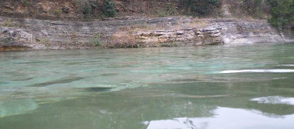
Welcome to Barton Springs! This spot is one of the crown jewels of Austin.
The posted coordinates lead you to the entrance of the Barton Springs natural area. From I-35 or downtown Austin, head west on 1st Street to Congress Avenue. Head south on Congress to Barton Springs Road. Then head west on Barton Springs Road until you enter the Zilker Metropolitan Park area. The Barton Springs access will be on the south side of Barton Springs Road.
Once you enter the Barton Springs area, you will find ample parking. Depending on the time of year that you visit, and also how old you are, there may be a small admission fee. The possible fee ranges from zero to three dollars.
Barton Springs is the fourth largest natural springs in the state of Texas. It was created millions of years ago, as a result of a landshift that created the Balcones Fault.
Barton Springs is the main discharge point for the Barton Springs segment of the Edwards Aquifer. The Edwards Aquifer is a well known karst aquifer.
The aquifer is composed of limestone from the Cretaceous period, and it is about 100 million years old. The limestone is full of caves and conduits, and fissures and fractures. Over time, these voids in the limestone have grown and enlarged due to forces such as faulting and the dissolution and erosion of the limestone by water. This results in a karst aquifer made up of limestone with large void spaces.
Then, water that originates from rainfall enters the aquifer through various entry points, and flows through the chambers and caves, and fills the voids. Hydraulic pressure forces are at work here, and the pressure differences are what drives the water flow throughout the aquifer, and eventually out through exit locations, such as Barton Springs.
That is pretty much how it all works. Now, on to the tasks that you must complete. First, make sure you are prepared...
Gear:
You will need to take some special gear with you to complete this earthcache. You will need a camera and a temperature measuring device, also known as a thermometer. There are many different types of thermometers. Use whichever type you wish, as long as it is capable of measuring liquid temperatures between 40°F and 100°F. An optional piece of gear is a swimsuit. If you decide to get into the water, and I hope you do, you'll need the swimsuit.
Oh no! Did you forget your thermometer?! Don't worry, Moosiegirl has you covered. A mere 0.2 mile away, she hid a geocache named Thermometer (GC17YBW), which contains the tool you need. Go find it and use it if you need it. Just make sure you return it to the cache. Thanks Moosiegirl for making that cache. Great idea! 
LOGGING REQUIREMENTS:
In order to claim this earthcache as a find, you must complete the following tasks.
Task #1 - Photo By The Marker (Optional): Go to N30 15.845 W097 46.248. There you will find a Texas Historical Marker. With your find log, please post a photo of yourself standing in front of the marker, with the marker in the background. I don't care about your GPSr. The photo should show your face and the marker. Click here to see an example of the type of picture I want to see.
Tasks #2 and #3 - Photo While Making Water Temperature Measurement and Measurement Result: You need to measure the temperature of the water in the pool. For extra fun, you can immerse yourself in the pool while making the measurement. If you prefer, you can stay dry and do it from the edge. Either way, you will need to take a photo of this process. Why the photo? You see, although the temperature will vary somewhat depending on current conditions, since the water is being fed from the aquifer down below where the temperature is constant, it is pretty widely known about what temperature the water is going to be at all times. It is not going to vary by a large amount. Therefore, it is kind of easy to cheat on this measurement. Now wait, hold on... Understand that I trust you guys, well most of you, but you are going to have the camera with you anyway. Earthcaches are special and it is important that prescribed tasks are performed. That is a fundamental element of the earthcache principles. Do you think that scientists and geologists go perform their research and then not document the things they do? No they don't. Of course, they document their research. Frequently by images. So you are going to perform a field task and document it. Simple as that. Therefore, a photo of the process of measuring the water temperature is required. With your find log, you need to post a photo showing measurement of the temperature of the water in the pool. The photo needs to clearly show the device that you are using to measure the water temperature. In your email to me, you need to identify the temperature that you measured.
Task #4 - Learn About The Aquifer: Back up top next to the historical marker, you will find three information boards. The board on the right provides an excellent description of the geology of the Edwards Aquifer. I am not going to ask you to just fill in a blank from a sentence on the board. I am asking you to read the entire board and establish an understanding of how the aquifer works. Then I pose this question to you, phrased differently than anything that you will see on the board. Here is the question:
The aquifer can be thought of as a holding tank, or perhaps as a huge manifold, where rainwater is captured and redistributed. The water enters the aquifer through entry points, and then it is eventually forced out through separate exit points (the spring that feeds the pool area is an exit point). A place where water enters the aquifer has a specific terminology. It is a certain type of feature. What type of feature is it? I am looking for a single word here.
In your email to me, you need to identify that single word.
Logs not accompanied by email within a reasonable amount of time will be deleted per earthcache rules. I don't like doing that. So please be careful to get done what you need to get done.
Also, I don't really care to see emails that say something like "we didn't know this was an earthcache at the time, but we were there, at the spot, but we didn't a camera with us, so we logged it." Anyone can "be at the spot". But the earthcache is not about just "being at the spot". You need to complete the requirements. They are easy. If you don't complete them, then you don't complete it. Sorry, but that's the way it is.
Remember Your Four Tasks:
Photo #1 (by the marker) (optional),
Photo #2 (measuring the temperature),
Email (measured temperature value), and
Email (type of features that are entry points).
I hope you learn something. I hope you decide to get wet. And I hope you have fun.
Reference:
Spearing, Darwin 1991 Roadside Geology of Texas. Missoula, Montana: Mountain Press Publishing Company
Thanks to la bandita boatchick for poking me and making sure I knew this spot was here.
Additional Hints
(No hints available.)