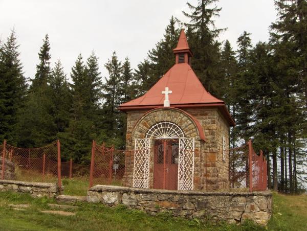
Vrchol se nachazi nad obci Horni Lomna, je soucasti hranicniho hrebene (hranice mezi CHKO Beskydy a CHKO Kysuce) v nadmorske vysce 940 metru nad morem. Vrchol se nachazi v evropskem rozvodi Odra - Dunaj.
Je zde krizovatka turistickych cest - cervena hrebenovka na Velky Polom (1,5 km), Skalku (5 km), Girovou (14 km), jizne na Bily Kriz (12 km), zluta z Horni Lomne. Severne, smerem na Horni Lomnou se nachazi Lyzarsky areal Horni Lomna - Prelac.
Tato kes je venovana parte ŽAVES, ktera mela dlouhe roky v blizke osade chalupu. Vzdy, kdyz jsme zdolali "Blbec" kopec (pokud pujdete z Horni Lomne po zlute, pochopite), si dospeli u Kaplicky davali panaka a my deti jsme vedeli, ze ted uz se pujde z kopce.
Tip: pokud se vydate po cervene smerem na Bily Kriz, muzete Pod malym polomem odbocit po modre na Horni Lomnou a zhruba po 300 metrech se napojit na cervenou na Slavic (5,5 km), kde je dalsi pekna keska (GCWGW6). :-)
[EN]
Chapel on the Murinkovy Hill was built in 1910.
The peak is located above Horni Lomna village and is a part of the border mountainside (border between Beskydy Protected Landscape Area and Kysuce Protected Landscape Area), 940 m above sea level. The peak is situated inside the European watershed of Odra and Danube rivers.
There is a crossroads of tourist tracks – red mountain edge track to Velky Polom (1,5 km), to Skalka (5 km), Girova (14 km), southward to Bily Kriz (12 km), yellow tourist sign from Horni Lomna. Northward, in the direction of Horni Lomna, there is a Ski Area Horni Lomna – Prelac.
This cache is dedicated to the ZAVES team who used to have a cottage in a nearby village for many years. Always, when we got to the top of the "idiot" hill (if you follow the yellow tourist sign you will understand), the adults would have a shot of something strong by the Chapel and us, kids, we knew that then we would only walk down the hill.
Tip: if you take the red sign track in the direction of Bily Kriz, you can turn Pod malym polomem to the blue sign to Horni Lomna and after 300 metres to connect to the red sign track to Slavic, where the next nice cache is located (GCWGW6) :-)